Published on · Updated on
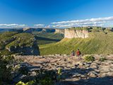
The main towns and villages in the Chapada Diamantina region, in the heart of Bahia, serve as bases for exploring the Chapada Diamantina National Park, which protects some 152,000 hectares of waterfalls, caves, archaeological sites and spectacular geological features. Each has its own distinct character: some are historic towns listed by IPHAN, whilst others are mountain villages, mining towns or ecotourism destinations.

The region is vast, and the distances between attractions are considerable too. The official territory comprises 24 municipalities and covers around 32,700 km², according to SEI-BA; under broader definitions, it extends to around 38,000 km² and 58 municipalities. That is why choosing the right base makes all the difference. This guide presents nine destinations, with information updated in October 2026, and outlines what each one has to offer. See also the Chapada Diamantina Tourist Guide.
Video about the most important towns and villages in the Chapada Diamantina
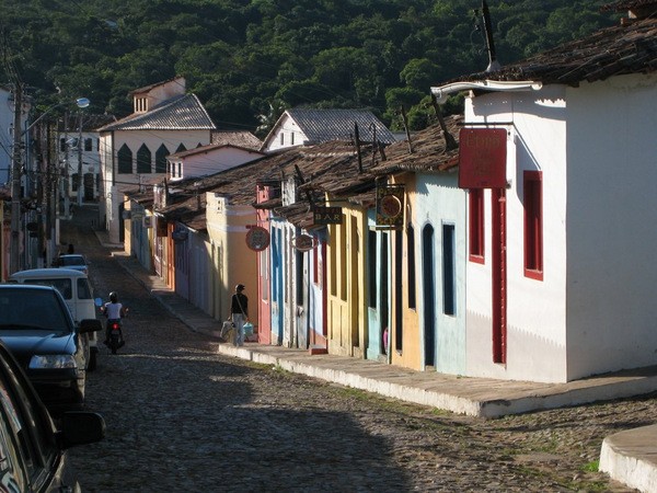
Lençóis e Região na Chapada Diamantina

Cachoeiras e Trilhas do Vale do Capão ou Caeté-Açu13:32

Guia de Turismo de Andaraí na Chapada Diamantina

Ibicoara na Chapada Diamantina04:14

Igatu a “Machu Picchu” brasileira - Reportagem30:17

Andaraí e Mucugê09:42

Morro do Chapéu - 5 passeios turísticos10:33

Vila do Ventura na Chapada Diamantina08:10

Rio de Contas - Guia Turístico07:48
Main towns and villages in the Chapada Diamantina region
These are the main towns and villages in the Chapada Diamantina, each with its own distinctive characteristics and history:
- Lençóis: the tourist ‘capital’, with houses listed by IPHAN, good facilities and access to walking trails and waterfalls.
- Vale do Capão (Palmeiras): a mountain village with a strong focus on ecotourism, art and alternative lifestyles, and a gateway to the Cachoeira da Fumaça waterfall and the Vale do Pati valley.
- Andaraí: a historic town in the central part of the Park, featuring high waterfalls, the Marimbus and the River Roncador.
- Ibicoara: a base for visiting Buracão Waterfall and Fumacinha Waterfall, in the south of the park.
- Igatu: a stone village in the district of Andaraí, built on the ruins of an old gold-mining settlement.
- Mucugê: a listed historic site, comprising the Santa Isabel Cemetery (the ‘Byzantine’ cemetery) and the Sempre-Viva Project.
- Morro do Chapéu: to the north, with waterfalls, caves, archaeological sites and a mild climate.
- Vila do Ventura: a historic diamond-mining settlement in the municipality of Morro do Chapéu, featuring stone buildings and rock paintings.
- Rio de Contas: a town from the gold rush era, with a listed historic quarter and access to Pico das Almas.
Together, these towns and villages combine historical heritage with natural beauty and welcome visitors from all over Brazil and abroad. See the map of Chapada Diamantina National Park
Towns and villages in the Chapada Diamantina: the figures
| Destination | Population (2022 Census) | Approximate distance from Salvador | Featured |
|---|---|---|---|
| Bed sheets | 10.774 | around 420 km | Park Gate, listed buildings |
| Palmeiras (Vale do Capão) | 10,339 (municipality) | 440 a 460 km | Smoke, Father Inácio, footpaths |
| Andaraí | 13.080 | 420 a 460 km | Waterfalls, Marimbus, Igatu |
| Ibicoara | 20.785 | around 458 km | Buracão and Fumacinha |
| Mucugê | 12.137 | around 450 km | Listed complex, Sempre-Viva |
| Morro do Chapéu | 33.594 | around 390 km | Ferro Doido, Brejões |
| Rio de Contas | 13.184 | around 650 km | Listed complex, Pico das Almas |
Distances vary depending on the route and the source; please check before travelling. Igatu has around 380 residents, according to IPHAN, whilst Vila do Ventura has no official population figure.
Guide to the main towns and villages of the Chapada Diamantina
1. Lençóis in the Chapada Diamantina
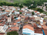
Listed by the National Institute of Historic and Artistic Heritage (IPHAN) in 1973, with 570 properties, Lençóis is regarded as the gateway to the Chapada Diamantina. The town has an extensive network of guesthouses, hotels and restaurants, as well as regular flights: in 2026, Azul will operate flights from Lençóis to Salvador and Confins twice a week, according to reports in August.

The main attractions are the 19th-century houses, the history of gold mining (read about the history of Lençóis), the Serra do Sincorá and the easily accessible natural attractions in the surrounding area.
In 2019, Lençóis came first in the Best Destinations Awards, in the category for Brazil’s best destination, with a score of 9.10 and over 25,000 voters. In July 2026, the Ministry of Tourism included the town amongst the seven Brazilian towns competing for the UN World Tourism Organisation’s ‘World’s Best Tourist Towns’ seal; the result is due to be announced in December 2026.
The calendar includes the São João festival, the Lençóis Festival (the 27th edition took place from 4 to 6 September 2026) and the Festa de Senhor Bom Jesus dos Passos, which IPHAN recognised as part of Brazil’s Cultural Heritage in March 2026. Lençóis has a population of 10,774 (2022 Census) and is situated approximately 420 km from Salvador. See the guide to Lençóis and the history of settlement in the Chapada Diamantina.
2. Vale do Capão
Vale do Capão is a district of Palmeiras, some 19 km from the town centre via the BA-849 – which was paved in 2025 – and has a population of around 3,000, according to a report in *A Tarde*. Its unspoilt natural surroundings attracted visitors who ended up staying, and today the village is home to artists, therapists, guesthouses and restaurants offering vegetarian and vegan options.

Trails lead out from Capão to some of the most famous spots in the Chapada. The Cachoeira da Fumaça is around 380 m high, according to ICMBio (other measurements put it at 340 m); the trail is around 5 km long, takes about 2 hours to complete and starts in the village of Campos.
The journey through the Vale do Pati from Capão takes you through the village of Bomba, the Serra da Moitinha and the Gerais do Rio Preto; the quickest route is via Guiné, in Mucugê, taking around 3 hours. The Capão Jazz Festival, which is free to attend, held its 13th edition on 18 and 19 September 2026 at the Circo do Capão.
The Capão Valley is 440 to 460 km from Salvador. See the complete guide to the Capão Valley.
Update: On 29 December 2025, the Palmeiras Town Council approved a tourism levy for the Vale do Capão (up to R$53.28 per week in high season); I have not confirmed whether this has been officially enacted or when collection will begin, so please check with the town hall. As for access to Morro do Pai Inácio, it has cost R$ 20 (full price) and R$ 10 (concession) since 6 April 2026, by municipal decree.
3. Andaraí
Andaraí is one of the six municipalities within the National Park (alongside Ibicoara, Itaetê, Lençóis, Mucugê and Palmeiras) and has a population of 13,080.
The historic centre features well-preserved 19th-century houses. The municipality has many watercourses and some of the highest waterfalls in the region. Guidebooks mention Cristais (110 m), Herculano and Samuel (100 m each) and Ramalho (90 m); these are estimates from guidebooks, with no official measurements. See the highest waterfalls in the Chapada Diamantina.

The location is ideal for anyone wishing to explore Mucugê, Ibicoara, Nova Redenção and Itaetê. Within the municipality lie the village of Igatu, the Pantanal do Marimbus and the natural pools of the River Roncador. The Poço Azul (in Nova Redenção) and the Poço Encantado (in Itaetê) are about 45 km from Andaraí, but do not belong to the municipality. Andaraí is 420 to 460 km from Salvador.
4. Ibicoara
Ibicoara is one of the municipalities within the National Park; it lies at an altitude of around 1,000 m and has a population of 20,785. It was separated from Mucugê in 1962 (Act of 20 July; established in April 1963). The Espalhado Municipal Nature Reserve, established in 2005 and situated about 30 km from the municipal centre, is home to the Buracão Waterfall, which is about 85 m high and can be reached via a trail of about 3 km through the canyon.

The Fumacinha Waterfall is situated in Ibicoara, in the Julião Canyon, and is around 210 metres high, according to the Giant Waterfalls Project. It is not in Mucugê, as previously stated in this guide. For those who enjoy adventure, the municipality also boasts the Licuri and Rio Preto waterfalls, which are mentioned in local guidebooks.
The region is renowned for its coffee: Café Boa Nova, from Ibicoara, won Abic’s ‘Best Coffee in Brazil’ award in 2018, and coffee from Chapada Diamantina has held a Designation of Origin recognised by the INPI since October 2024. Ibicoara is about 458 km from Salvador.
5. Igatu
As mentioned above, the village of Igatu deserves a special mention. The village, part of the district of Andaraí, stands on a rocky hillside overlooking the Paraguaçu River valley. IPHAN listed the site in 2000 (comprising around 200 properties, including stone ruins, the Church of São Sebastião and the São Sebastião Cemetery). Today, around 380 people live there, although at the height of the gold rush the population exceeded 10,000.

It can be reached via a dirt track, about 25 km from Andaraí, according to the Igatu guide on bahia.ws; check the current condition of the track before setting off.
ICMBio highlights Igatu as one of the best places in the North-East for climbing, particularly bouldering, in the Serra Alta and Califórnia sectors. Guides also mention six nearby waterfalls. The calendar includes the São João festival and the Igatu Festival (the 16th edition took place in August 2026).
The preservation of listed houses is supported by the ConViver Programme (IPHAN and UFBA), which has already assisted 30 homes. See the Igatu guide and read about the architecture of the Chapada Diamantina.
6. Mucugê
The townscape of Mucugê, with its colonial houses and buildings that blend into the rock face, has been listed by IPHAN since 1980. The town is situated in the Serra do Sincorá, some 450 km from Salvador. It has a population of 12,137 and enjoys a mild climate, with an average temperature of around 19 °C, according to tourist guides.

One of the best-known attractions is the Santa Isabel Cemetery, known as the ‘Byzantine’ cemetery: it dates from the 19th century (not the mid-18th century, as previously stated), with white tombs featuring arches and neo-Gothic-inspired pinnacles.
Sources differ on the date: IPHAN refers to building work carried out between 1854 and 1886, whilst one researcher cites a decision by the City Council in October 1855, during the cholera epidemic. The walking trail from the centre is about 600 metres long.
Mucugê Municipal Park was established between 1996 and 1999, and the Sempre-Viva Project has been in existence since 1993, with the aim of protecting the endemic flower (read about the Sempre-Viva flower). The Mucugê guide describes a living museum of gold mining in a former prospectors’ cave.
Events include the São João festival, the Mucugê Literary Fair (Fligê, 13–16 August 2026), the ‘Vozes na Chapada’ Choir Festival, the Chapada Forró Festival and the Chapada Diamantina Ultra Trail.
7. Morro do Chapéu
Morro do Chapéu is situated to the north of the Chapada, at an altitude of around 1,011 m and approximately 390 km from Salvador. It has a population of 33,594 and is the largest municipality in this guide (5,745 km²). The climate is mild: the average temperature is around 20.8 °C and, in winter, night-time temperatures sometimes drop below 10 °C.

The town has a musical tradition. The Minerva Philharmonic Society, founded in 1906 by Colonel Francisco Dias Coelho – remembered as Bahia’s first Black colonel – is still active today. Morrão, at 1,293 metres according to the SGB, is the highest point in the municipality and lies some 8 km south-west of the city, offering sweeping views of the region and, in the distance, wind farms.
The Ferro Doido Waterfall is situated 18 km east of the county town, near kilometre 256 of the BA-052. Its height varies depending on the source: from around 80 m (SGB) to almost 100 m (press reports). It is a state-designated natural monument established in 1998 (Decree 7,412, covering around 400 hectares).
The Agreste Waterfall is also a popular attraction. The Gruta dos Brejões is the most famous: according to speleologists, the entrance measures around 106 metres, and the cave system has around 7.75 km mapped, making it one of the largest cave entrances in Brazil.
It is also a palaeontological site, with over 5,000 megafauna specimens, and there are cave paintings nearby. The journey from the town varies considerably depending on the source and route, so please check with local agencies. The municipality is also home to Morro do Chapéu State Park, established in 1998.
8. Vila do Ventura
Anyone visiting Morro do Chapéu should include Vila do Ventura, a district of the municipality (it is not on the outskirts of Rio de Contas, as previously stated). The village preserves buildings dating from the diamond mining era, which lasted from around 1841 to 1932, according to the SGB, and today illustrates the heyday and decline of this activity.

Among the region’s attractions, the Ventura Waterfall is around 50 metres high, according to the bahia.ws guide.
Toca do Pepino, in the sandstone formation known as Igrejinha, is about a 45-minute walk from the village, whilst Toca da Figura, on the right bank of the River Ventura, is about an hour’s walk away. Both feature rock paintings that have been studied by archaeologists. See the rock art trail and the village of Ventura and the history of gold mining.
9. Rio de Contas

Rio de Contas is situated to the south of the Chapada, at an altitude of over 1,000 metres and about 650 km from Salvador, with a population of 13,184.
It is an ancient colonial settlement in the hinterland of Bahia: the parish of Santo Antônio de Mato Grosso dates back to 1718; the town was established by a royal charter dated 27 November 1723 and founded in 1724, and its administrative centre was moved in 1745 to a planned site. For this reason, IPHAN describes it as one of the rare new colonial towns established by Portugal (Rio de Contas became a town in 1885).
The architectural complex was listed by IPHAN in 1980, comprising 287 buildings, whilst the Mother Church and the Church of Santana had already been listed individually in 1958. The Mother Church of the Blessed Sacrament dates from the second half of the 18th century, and the São Carlos Theatre, which opened in 1892, underwent restoration work completed in 2014.
Read the history of Rio de Contas. In terms of natural attractions, the highlights are the Pico das Almas, at 1,958 m, in the district of Mato Grosso, and the Pico do Barbado, at 2,033 m, the highest point in the North-East, situated between Rio de Contas, Abaíra and Rio do Pires.
The Fraga Waterfall, which is around 18 metres high, is also a popular attraction. Among the local traditions, the Night of the Lanterns, held during the Corpus Christi festival, dates back more than 300 years, according to SETUR-BA, whilst the São João festival features the Accordionists’ Gathering.
How to choose a base in Chapada Diamantina
For a first visit, Lençóis is the most convenient base, as it has the best facilities and an airport. Those seeking peace and quiet and long trails tend to prefer the Vale do Capão. In the south of the Park, Mucugê and Ibicoara are close to Guiné (the quickest access point to the Vale do Pati) and the Buracão Waterfall.& Andaraí and Igatu combine the history of gold mining with waterfalls.
Those interested in caves and archaeology should head north to Morro do Chapéu, whilst those who prefer colonial heritage can visit Rio de Contas, which is further afield. See also the Iraquara caves and the Chapada Diamantina bird guide.
Best time of year and tips
According to Climatempo, the dry season runs from May to September, with temperatures ranging from 17 to 27 °C, whilst from October to March there is more rain, but the waterfalls are at their fullest.
ICMBio advises that there is no entrance fee to enter the National Park and recommends a guide on poorly marked or difficult trails; the 3- to 5-day trek through the Pati Valley includes overnight stays in local residents’ homes. You should also plan your trip using the Pati Valley guide and the list of listed towns in Bahia.
Frequently Asked Questions
What are the main towns and villages in the Chapada Diamantina?
The main ones are Lençóis, Palmeiras (including Vale do Capão), Andaraí, Ibicoara, Mucugê, Morro do Chapéu and Rio de Contas, as well as the villages of Igatu and Ventura.
Which is the best town to stay in within the Chapada Diamantina?
For a first visit, Lençóis, as it has the best facilities and an airport. For a more peaceful experience, the Capão Valley; for the southern part of the park, Mucugê and Ibicoara.
How many municipalities are there in Chapada Diamantina?
The Chapada Diamantina Identity Territory comprises 24 municipalities, according to SEI-BA. The National Park encompasses six of these: Andaraí, Ibicoara, Itaetê, Lençóis, Mucugê and Palmeiras.
How far is it from Salvador to Lençóis?
Around 420 km by motorway, taking 6 to 7 hours. In 2026, Azul will also operate flights from Lençóis to Salvador and Confins twice a week, according to reports in August.
When is the best time to visit the Chapada Diamantina?
From May to September, during the dry season, the weather is mild. From October to March, it rains more, but the waterfalls are at their fullest.
Do you have to pay an entrance fee to Chapada Diamantina National Park?
According to ICMBio, there is no admission charge to enter the park. Some attractions are subject to local council charges, such as Morro do Pai Inácio (R$20 for a full-price ticket, from April 2026).
In which municipality is Igatu situated?
Igatu is a district of Andaraí and has a complex that has been listed by IPHAN since 2000. Around 380 people live there.
Where are the Blue Well and the Enchanted Well?
The Poço Azul is in Nova Redenção and the Poço Encantado is in Itaetê, about 45 km from Andaraí.
Which towns in the Chapada Diamantina are listed by IPHAN?
Lençóis (1973), Mucugê (1980), Rio de Contas (1980) and the Igatu complex in Andaraí (2000).
Sources consulted
- IBGE, IBGE Cities (2022 Census), and the Rio de Contas monograph.
- SEI-BA, indicators for the Chapada Diamantina region.
- ICMBio, visitor information for the Chapada Diamantina National Park.
- IPHAN, Igatu (Andaraí – BA).
- SGB, Morro do Chapéu and Cachoeira do Ferro Doido.
- Brazilian Speleological Society (Gruta dos Brejões) and PÉTRART/UFPB journal (Vila do Ventura).
- Feature articles: A Tarde (2019 award), Jornal Grande Bahia (Festa dos Passos), A Tarde (Pai Inácio) and Movimento Econômico (airport).
- Correio Braziliense (the best time of year, according to Climatempo).

Publicações Relacionadas
Lençóis, Bahia: Origins, the Diamond Cycle and Heritage

Architectural Style of the Chapada Diamantina, Bahia: A Guide

History of the Settlement of the Chapada Diamantina, Bahia

Birds found in the Chapada Diamantina: Exotic Species
Waterfalls and Walking Trails in the Capão Valley, Chapada Diamantina
Waterfalls in the Chapada Diamantina, Bahia: 5 Worth Visiting

The highest and most beautiful waterfalls in Chapada Diamantina

Candombá in the Chapada Diamantina, Bahia: the Flower of Fire

Mining in the Chapada Diamantina History Explained
Ventura Village: A Rich History of Diamonds

Igatu: Explore the 19th-Century Stone Houses

Marimbus Pantanal: Adventure in Chapada Diamantina
Picos das Almas, Itobira and Barbado Trekking Guide

Sempre-Viva: Symbol of Preservation in the Chapada Diamantina

Dive Sites of Chapada Diamantina: A Guide
Rio de Contas, Bahia: things to do, history and peaks

Things to Do in Piatã, Bahia: The Highest Town in the North-East

Palmeiras: A Gateway to Chapada Diamantina
Mucugê: Discover the local history and culture
Ecological tourism in Morro do Chapéu
Things to do in Lençóis in the Chapada Diamantina — 15 attractions
Iraquara is also known as the "city of caves"

Ibicoara: An Unmissable Tourist Destination

Andaraí is the second largest town in the Chapada Diamantina

Tourist Information about Chapada Diamantina

Trekking in the Pati Valley in Chapada Diamantina

Trekking - Route through the Chapada Diamantina in 7 days

Blue Fountain in Chapada Diamantina: a complete guide

Enchanted fountain in Chapada Diamantina: How to get there
Torrinha Cave: A Speleological Marvel in Brazil

Lapão Cave: The Ultimate Adventure Experience

Main caves in the municipality of Iraquara in Chapada Diamantina

Trekking in the Pati Valley in Chapada Diamantina
Trekking - Popular trails in Chapada Diamantina
Orchids of the Chapada Diamantina in Bahia