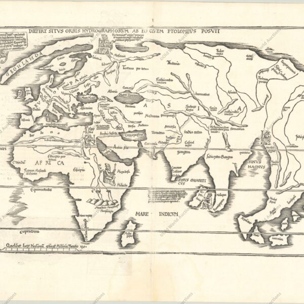
Mapping: A Comprehensive Overview of the History, Science, Techniques and Modern Applications of Cartography The purpose of a map is to express graphically the relations of points and features on the earth’s surface to each other. These are determined by distance and direction. In early times ‘distance’ might be expressed […]
Cartography and Its Creators
Mapping summarizes the ways humans have represented the Earth’s surface by showing relations of points and features through distance and direction.
Early maps and itineraries used time- or journey-based measures and pictorial signs; over time cartography incorporated surveying, trigonometry, magnetic compasses, astronomical coordinates (latitude and longitude) and projection mathematics to improve accuracy and to translate the spherical Earth onto flat media.
Advances in geodesy and triangulation refined large-area mapping, while invention of contours met military and topographic needs.
As users multiplied—travelers, merchants, soldiers, archaeologists, historians and geographers—cartographers developed specialized methods to map distributions such as geology, climate, vegetation and land use.
Progress was uneven, constrained by instrument technology, economic interests and entrenched publishing practices, so historical maps must be read critically.
Today the map’s value for integrating scientific, historical and human data underlies a renewed interest in cartography as both a practical tool and a documentary record.
National Surveys and Modern Atlases: Key Developments
National Surveys and Modern Atlases: Evolution, Methods, and Global Practices in Cartography Cartograthy since the early decades of the nineteenth century is characterized by the execution of regular topographical surveys as national undertakings. Most has been accomplished in Europe, in some countries of Asia (e.g. India, Japan, the Dutch East […]
Eighteenth-Century British Advances in Cartography and Surveying
The British Contribution to Cartography in the Eighteenth Century: Instruments, Surveys and Global Mapping Introduction and scope A detailed study of the British contribution to cartography before the eighteenth century lies outside the scope of this outline. Accounts of the achievements of men such as George Lily, Christopher Saxton, Norden, […]
Reformation of Cartography in France – A Historical Overview
In the seventeenth century, the desire to test new hypotheses of the physical universe stimulated attempts to determine accurately the dimensions and figure of the earth, and these then became possible through the invention of more precise instruments to make the necessary observations. These included the telescope, the pendulum clock, […]
Levantamento topográfico nos séculos XV e XVI
Como vimos, novos mapas de vários países europeus começaram a aparecer nas edições de Ptolomeu antes do final do século XV. Em geral, eles se baseiam nos contornos das cartas náuticas, com nomes contemporâneos no lugar dos nomes de Ptolomeu e algumas características adicionais. Estas últimas provavelmente foram extraídas de […]
Cartography of the Great Discoveries: Navigation and Mapping
Charting the Age of Discovery: The Cartography of Early Global Exploration The second great contribution to the revival of cartography was made by the leaders of overseas expansion: the seamen of many nations — Italian, Portuguese, Spanish, French, Dutch and English — who, in little more than a century, opened […]
The revival of Ptolemy’s Geography in the 15th century
The Revival of Ptolemy’s Geography: From Ancient Texts to Renaissance Printed Maps In discussing the latest forms of the medieval mappa mundi, we have had occasion to refer to the spreading knowledge of the maps accompanying the Geography of Claudius Ptolemaeus (or Claudius Ptolemy) in the fifteenth century, and possibly […]
Fifteenth‑Century World Maps: Fra Mauro and Martin Behaim
CONTEMPORARY with the later Catalan maps are several mainly of Italian origin which also preserve some medieval features, but show very markedly the influence of Ptolemy’s ‘Geography’, manuscripts of which were circulating in western Europe at least as early as the opening decades of the fifteenth century. Andreas Walsperger (1448) […]
Cartography: From Antiquity to Medieval Maps Explained
From Ancient Surveys to Medieval Mappa Mundi: The Evolution of Cartography Introduction It is often noted that contemporary primitive peoples, ranging from the Inuit of the Canadian Arctic to the Bedouin tribesmen of the Arabian Desert, possess an innate ability to produce rough yet precise sketches on animal hide or […]
Medieval Maritime Cartography Advancements Explained
Medieval Maritime Cartography: The Rise and Development of Portolan Charts Introduction Towards the end of the thirteenth century a new type of chart appeared in Western Europe that marked a major advance in medieval cartography. These charts broke with earlier practice by relying on direct observation aided by the new […]
The evolution of European cartography in the 16th and 17th centuries
The evolution of European cartography (16th-17th centuries): Mercator, Ortelius and the Dutch centres Index Introduction The first atlases and supplements Gerhard Mercator: background and early work The problem of navigation and loxodromes Mercator’s map of Europe (1554) Methods and limitations of ancient cartography The reception of Mercator and other maps […]


