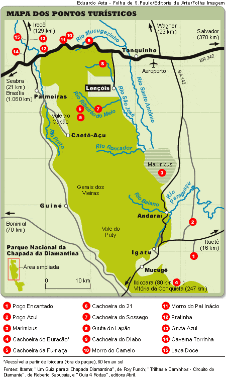
You can also dive into the Blue Well and enjoy the fantastic experience of swimming in the illuminated well.
The cave is approximately 70m high, 40m of which is underwater, and the “swimming” area is 35m long and 20m wide.

Poço Azul was discovered in 1920 by prospectors, one of the region’s earliest inhabitants. The site did not become a tourist attraction until 1994.
Seeing the rock formations with extreme clarity, despite their depth (they vary from 3.5 metres to 16 metres), causes a kind of vertigo. The impression is that you are not at the surface, but at the bottom of the well, so the water is transparent.
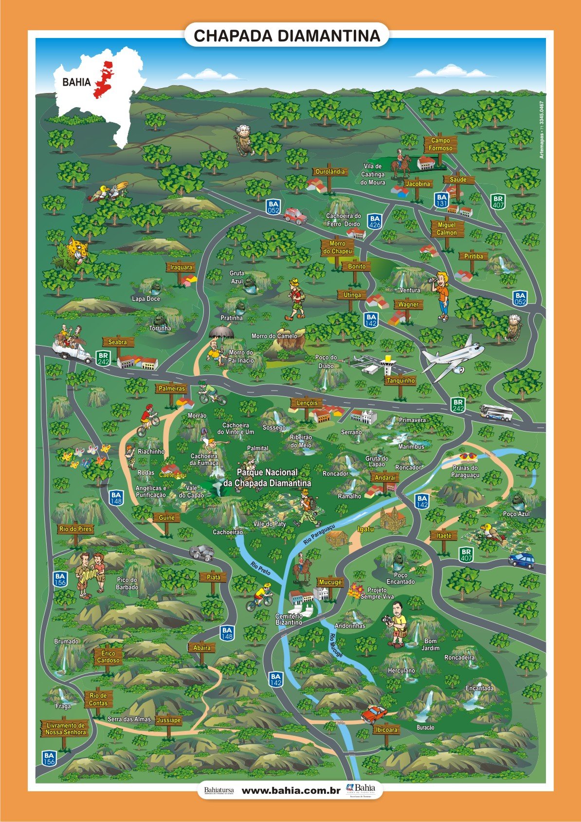
See the map of Chapada Diamantina
Videos of Poço Azul in Chapada Diamantina
Poço Azul - Tudo Que Você Precisa Saber05:48

Poço Azul - Mergulho06:06
O Poço Azul na Chapada Diamantina05:48
Activities not to be missed at Poço Azul: Explore, float and discover
Float
Equipped with vests and snorkels, you can swim and float in the crystal clear waters while admiring the submerged rock formations.
Photography
Between February and October, the sun creates a beam of light that illuminates the water, creating a unique visual spectacle.
Cultural exploration
The Blue Well is also of archaeological importance, as fossils of prehistoric animals have been found there. It is estimated that this area represents only a third of all that is to be explored in the cave.
Swimming is only possible in the front part of the cavern, delimited by ropes. Although the sensitive albino catfish inhabit the Blue Fountain, bathing is permitted.
Guided Tours
Many local tourist offices offer packages that include the Blue Fountain and other attractions such as the Enchanted Well. This is a convenient option for those who don’t have their own vehicle.
Important tips
Best time
Visit the Poço Azul between 12 noon and 2pm, when the sunlight shines directly on the water, enhancing its crystalline colour.
Restrictions
It is not allowed to use sunscreen or repellent before entering the water, to preserve the ecosystem.
Tickets
There is an entrance fee which includes the floatation equipment.
Where you are and how to get to Poço Azul
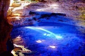
Poço Azul is one of the most impressive sites of the Chapada Diamantina, known for its crystal clear waters and the unique experience of floating in a magical environment. It is located in the Nova Redenção region, near the municipality of Andaraí, in Bahia..
1. Location
Parish: Nova Redenção, in the south of Chapada Diamantina.
Approximate distances
- From Lençóis: 120 km.
- From Andaraí: 38 km.
- From Mucugê: 50 km.
Poço Azul is located on a 25 ha site in Nova Redenção and is 80 m long with two 20 m2 caves.
2. How to get there
1. From Lençóis or another base in the Chapada
- Access to Poço Azul is usually via the BR-242 motorway to the entrance of Nova Redenção.
- From Nova Redenção, follow local signs or directions to Poço Azul.
- The last part of the route is on dirt roads, which can vary in condition.
2. Your own vehicle
- It is possible to hire a car and explore the region with greater freedom, but it is important to check the condition of the vehicle and the dirt roads.
The community of Nova Redenção in Bahia
Located in the Chapada Diamantina region, one of the most beautiful natural areas in the world, the town of Nova Redenção is characterised by the direct contact between man and nature.
Several waterfalls and streams are part of the landscape of this village of 10,000 inhabitants.
It was part of the Municipality of Andaraí until 1991, when it gained emancipation and became a municipality. Its main economic activities are agriculture, livestock, services and commerce.
In terms of tourism, Nova Redenção is known for its Poço Azul, Morro das Araras, Olho D’Água da Urânia, Praia da Peruca and unexplored caves.
Bahia.ws is the largest tourist guide to Bahia, Salvador and the Northeast.
How to get there and features of Poço Azul in Chapada Diamantina.
Publicações Relacionadas
Lapão Cave: The Ultimate Adventure Experience
Tourist Attractions and Documentaries about Chapada Diamantina
History of the settlement of Chapada Diamantina
Relief, Fauna and Flora of Chapada Diamantina
Trail to Buracão Waterfall in Chapada Diamantina
Dive Sites of Chapada Diamantina: A Guide
Waterfalls of Chapada Diamantina: A Guide for Adventurers
Torrinha Cave: A Speleological Marvel in Brazil
Tourist Attractions in Rio de Contas You Must Visit
Trekking - Popular trails in Chapada Diamantina
Chapada Diamantina's architectural style and influences
Rio de Contas: An Unmissable Tourist Destination
Orchids of the Chapada Diamantina in Bahia
Enchanted fountain in Chapada Diamantina: How to get there
Things to do in Lençóis in the Chapada Diamantina — 15 attractions
Piatã: The Highest Municipality in Bahia
Trekking in the Pati Valley in Chapada Diamantina
Chapada Diamantina - Tourist Attractions, Itineraries and Tips
How to get to Fumaça Waterfall in Chapada Diamantina
Mucugê: Discover the local history and culture
Rio de Contas: Learn about the history of how the city was founded
The History of Lençóis in the Chapada Diamantina — Origins, the Diamond Cycle and Heritage
Trekking - Route through the Chapada Diamantina in 7 days
Sempre-Viva: Symbol of Preservation in the Chapada Diamantina
Picos das Almas, Itobira and Barbado Trekking Guide
Campo Formoso: Explore Caves and Emerald Trade
Ibicoara: An Unmissable Tourist Destination
Curiosities about the Rio de Contas in Chapada Diamantina
Ecological tourism in Morro do Chapéu
The highest and most beautiful waterfalls in Chapada Diamantina
Marimbus Pantanal: Adventure in Chapada Diamantina
Trekking in the Pati Valley in Chapada Diamantina
Tourist Information about Chapada Diamantina
Iraquara is also known as the "city of caves"
Ventura Village: A Rich History of Diamonds
Birds Found in Chapada Diamantina: A Guide
This post is also on:
![]() Português
Português ![]() English
English ![]() Deutsch
Deutsch ![]() Español
Español ![]() Français
Français


