The Charm of Ubajara National Park and Its Tourist Attractions
The Ubajara National Park is situated within the municipality of Ubajara, in the state of Ceará.
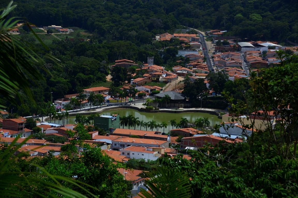
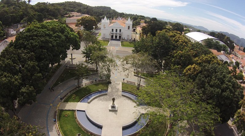
Ubajara is a municipality situated in the Serra da Ibiapaba, some 320 km from Fortaleza. Recognised as the tourism capital of the Serra da Ibiapaba, the town is small, cosy and full of trees, offering an ideal setting for nature lovers.
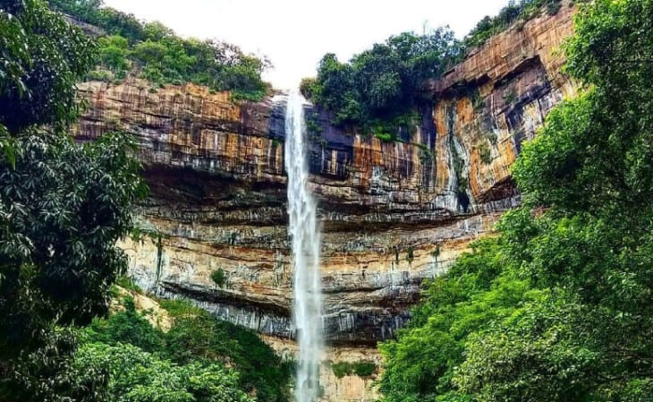
The town has good signage and tourist facilities, including hotels, guesthouses and COOPTUR (Cooperativa de Trabalho e Assistência ao Turismo Ltda). Ubajara is home to a range of natural attractions, such as waterfalls, rivers, streams, caves, grottoes and nature trails.

Geophysical Aspects
The Ibiapaba Plateau, also known as Chapada da Ibiapaba or Serra Grande, begins 40 km from the coast and stretches to the western borders of the state, covering a total of 121 km.
This region comprises nine towns: Viçosa do Ceará, Tianguá, Ibiapina, São Benedito, Carnaubal, Guaraciaba do Norte, Croatá, Ipu and Ubajara.
The altitude of the mountain range varies between 700 and 990 metres, and the temperature ranges from 18 to 29°C. The soil, which is predominantly sandy, consists of crystalline limestone with salt-rich deposits.
The vegetation is rich and varied, including tropical rainforest, tropical cloud forest and caatinga.
The region is supplied by the Jaburu reservoir, which has a capacity of 220,000,000 m³ and is home to an abundance of flora and fauna, making it all the more stunning.


Best Time to Visit
The best time to visit Ubajara National Park is during the local ‘winter’ — in practice, the dry season, between June and September — when temperatures are milder and rainfall is less frequent. During this period, the weather is more pleasant for outdoor activities, such as hiking and visiting waterfalls.
The rainy season runs from January to June, with the heaviest rainfall between February and April, which can make some activities and access to certain areas of the park more difficult. Planning your visit for the drier months usually ensures a more pleasant and safer experience.
Videos about the Serra de Ibiapaba and Ubajara National Park

Viçosa no Ceará11:33

Parque Nacional de Ubajara05:40

Parque Nacional de Ubajara - Reportagem07:23

Serra de Ibiapaba no Ceará
Gruta de Ubajara07:29
Ubajara - Pontos Turísticos04:15
Alguns Pontos Turísticos - Viçosa no Ceará05:42
Tianguá no Ceará04:20
Ubajara - Guia Completo05:40

VIÇOSA DO CEARÁ, A CIDADE HISTÓRICA DA SERRA DA IBIAPABA10:39
Origin of the name Ubajara
The name ‘Ubajara’ is of indigenous origin, meaning ‘Lord of the Canoe’ or ‘Mother of the Water Canoe’. Various translations of the place name ‘Ubajara’ have been proposed, all relating to the cave. The spelling ‘Ubajara’ has prevailed, meaning ‘Lord of the Canoe’ (ubá = canoe; jará = lord).
Historians such as Pedro Ferreira have referred to epic legends associated with the cave, suggesting that the name derives from a chieftain who lived in the region for many years.
The legend tells of an old chieftain who owned a canoe and is said to have been the first inhabitant of the cave, emphasising the importance of water to the region.
Other translations include ‘Lord of the Arrows’ and ‘Master Archer’. In 1740, a settlement named Ubajara was established between the present-day town and the district of Araticum; it was abandoned in 1765 following the end of mining operations in the cave.
In 1877, a settlement called ‘Jacaré’ was rebuilt following a fire, and in 1903 the town came to be known as Ubajara. The municipality was officially established in 1915, with its administrative centre in what was then the village of Ubajara.
Geography
The geographical area of Ubajara is characterised by Palaeozoic (Silurian–Devonian) rocks, belonging to the Serra Grande Group and the Ubajara Group, which consist of sandstones and limestones.
These formations are fundamental to the characterisation of morphological features, particularly the carbonate rocks that form the Ubajara Cave, an ecosystem that is essential for scientific tourism.
Climate in Ceará
The climate in Ubajara is pleasant, with temperatures ranging from 14°C to 30°C and an average of 24°C. The climate is divided into two seasons: ‘winter’, which is the rainy season, and ‘summer’, which is the dry season.
The rainy season runs from January to June, accounting for around 80 to 90 per cent of the total annual rainfall, with the heaviest rainfall occurring in February, March and April.

Tourist Attractions in the Municipality of Ubajara
1. The town of Ubajara
- Major Pergentino de Souza Costa’s House: built in 1917, it retains its original architecture and is well preserved; it is situated in the town centre.
- Eupídio Luiz Ferreira’s House: built in 1928, it is one of the earliest buildings in Ubajara and remains in its original state.
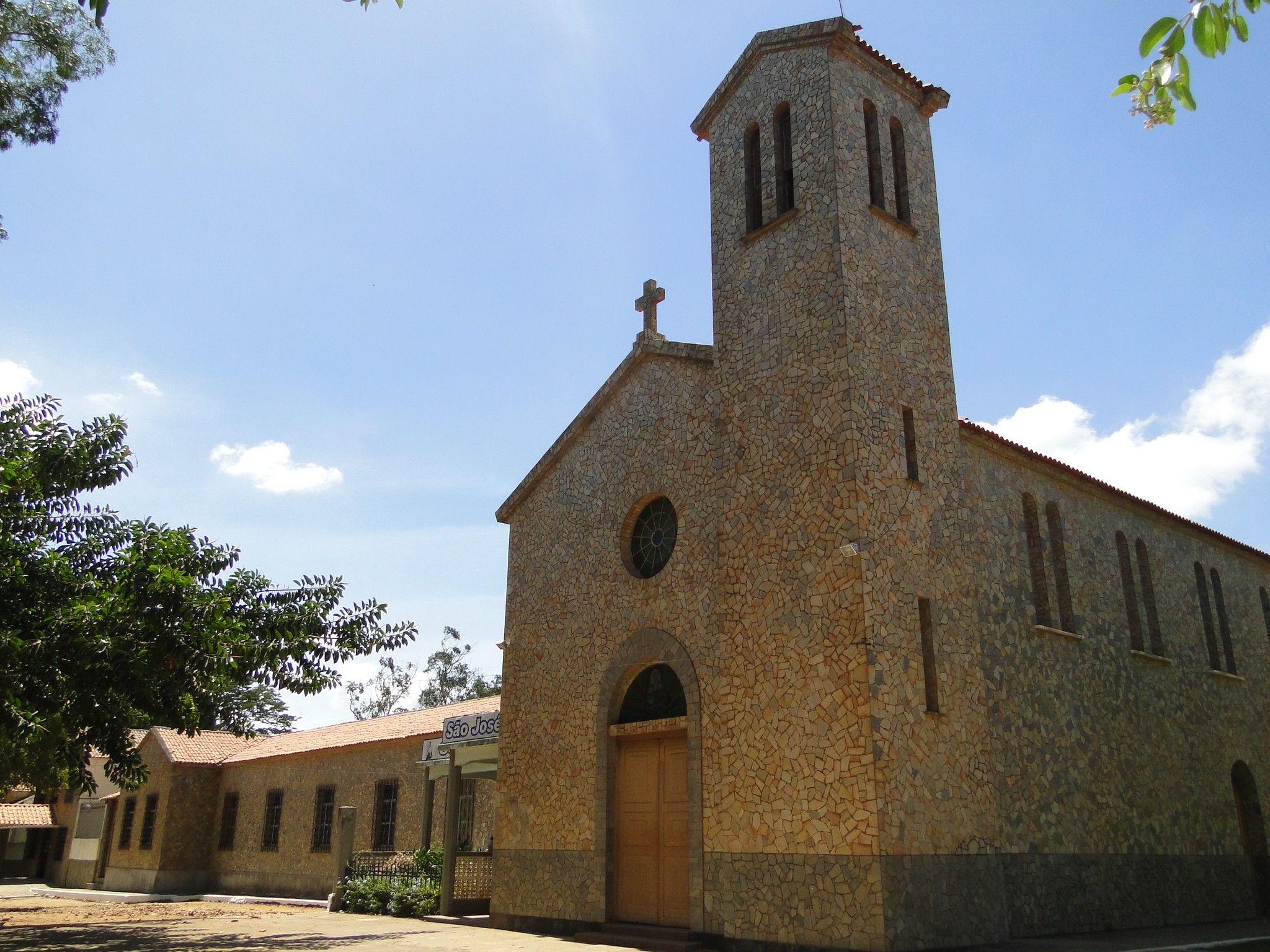
- Parish Church: built in 1886, it features simple décor, with plaster statues, and is situated in the town centre.

2. Ubajara National Park
Ubajara National Park is one of Ubajara’s most important natural attractions and one of the 75 national parks managed by ICMBio (the Chico Mendes Institute for Biodiversity Conservation) throughout Brazil.
Established in 1959 with an area of just 4,000 hectares, the park’s boundaries were reduced to 563 hectares in 1973 — a period during which it was considered one of the country’s smallest national parks. In 2002, however, a new decree expanded the area to its current approximately 6,299 hectares, bringing land in the neighbouring municipalities of Tianguá and Frecheirinha within its boundaries. In other words: although it is still described as ‘Brazil’s smallest national park’ in out-of-date sources, this has not been the case for over two decades.
Situated in the Serra da Ibiapaba, the park protects Ceará’s most important speleological heritage, featuring geological formations of great palaeontological and archaeological significance.

Top Attractions in Ubajara National Park
- Ubajara Cave: formed from limestone shaped by groundwater, it can be reached via a footpath or by cable car.
- Fossil Bear Cave: closed to visitors, it is significant because of the animal fossils found inside.
- Visitor Centre: located near the Neblina Gate, it features a library, a video room and a permanent exhibition providing information about the region.
- Gameleira Waterfall: it has a viewing point offering a beautiful view of the park.
- Cafundó Waterfall: situated on the Bela Vista stream, it forms a natural pool.
- Rio das Minas: a stretch of the River Ubajara, with swimming spots, near the Ubajara Cave.
- Boi Morto Waterfall: located within the park, it is divided into two areas — the upper section (swimming area) and the lower section (natural waterfalls).
- Cachoeira do Frade: situated between two mountains, ideal for swimming and hiking, with a rock shaped like a friar.
- Cable car: one of the iconic sights of the Serra da Ibiapaba.
- Gameleira Viewpoint: around 1,250 metres along the Samambaia trail, with a direct view of the Cafundó Waterfall.
- Bica do Cafundó: nature walks and opportunities for a dip.
- Accessible trails: the Samambaia and Ibiapaba trails have been refurbished to accommodate wheelchair users and people with mobility difficulties, featuring a treetop adventure course, a communal area and an accessible viewing point.


Ubajara National Park Cable Car
The cable car at Ubajara National Park is one of the Serra da Ibiapaba’s most iconic sights: a 550-metre journey taking around three minutes to descend, which replaces the long, nearly four-hour walk to the cave, offering magnificent views of the region along the way.
Following its refurbishment, the cable car is now operating from Tuesday to Sunday, but access requires a booking to be made in advance via the official website bondinhodeubajara.setur.ce.gov.br. It is worth checking timetables and availability before planning your trip.
The cave is divided into three zones: the extensive-use zone (not open to visitors), the intensive-use zone (open to visitors) and the off-limits zone (where visits are not permitted).
Ubajara Grotto
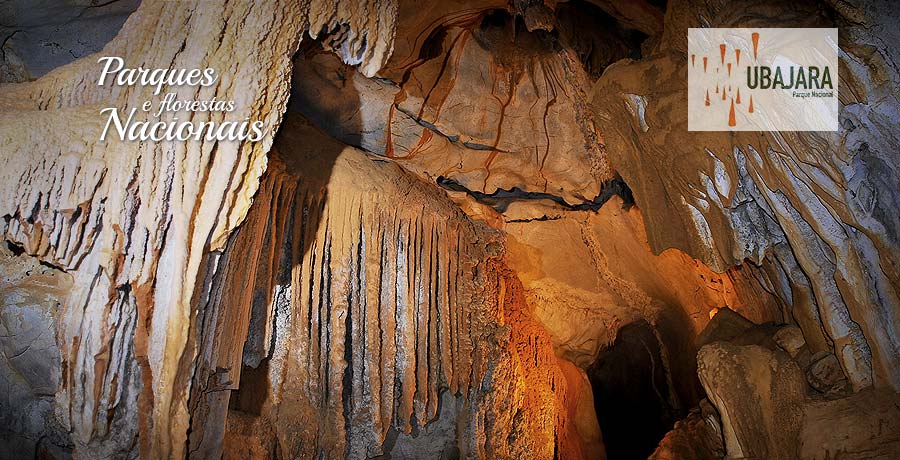
The Ubajara Cave, one of the park’s main attractions, has already undergone structural changes due to the installation of lighting and visitor walkways.
It was formed from limestone through a process of dissolution, in which water and carbon dioxide combine to form carbonic acid, which reacts with the limestone to create channels that eventually become galleries and chambers.

The cave features a variety of speleothems, such as stalactites and stalagmites, as well as other formations in a range of colours. It is situated in a depression some 535 metres deep and is rich in speleothems, offering trails and walking routes.
Chambers of the Ubajara Cave
- Sala da Imagem: limestone formations resembling a petrified waterfall, where there is a statue of Our Lady of Lourdes.
- Bell Room: a stone that produces melodious sounds when struck.
- Sala da Rosa: a room with a rose-shaped ceiling, where water drips down, forming mortar.
- Sala das Cortinas: features limestone formations that resemble luxurious drapes.
- Portrait Room: it features dark patches that resemble portraits.
- Sala do Índio: represents the presence of indigenous tribes in the region.
- Hall of the Breasts: formations resembling women’s breasts, adorned with stalactites and stalagmites.
- Nativity Scene Room: displays depicting biblical figures.
- Hall of Brilliance: containing an abundance of crystalline stones.

Access to Ubajara National Park
To get to Ubajara National Park, visitors can follow these directions:
- By car: from Fortaleza, take the BR-222 towards Tianguá. Once you have passed through Tianguá, follow the signs towards Ubajara. The road is well signposted and easy to follow. The journey is around 320 km and usually takes between 4 hours 30 minutes and 5 hours.
- By bus: several coach companies operate services from Fortaleza to Ubajara. The journey takes approximately 6 hours. Once you arrive in Ubajara, the park is a short distance from the town centre.
- Local transport: once in Ubajara, you can use taxis or local transport services to get to the park.
To check opening times, admission prices and visitor regulations, please visit the official Ubajara National Park page on the ICMBio website before organising your trip.

The Mountains of Ceará
- Serra de Aratanha: situated in the Fortaleza Metropolitan Area, it is an extension of the Baturité Massif.
- Serra de Baturité: home to the state’s largest environmental protection area, covering 32,690 hectares.
- Serra de Ibiapaba: known as Serra Grande, it is a mountainous region in the north-west of Ceará, with Viçosa do Ceará being its oldest town.
- Serra de Meruoca: situated in the municipality of Sobral, famous for its crystal-clear waters and waterfalls.
Frequently Asked Questions about Ubajara National Park
Who manages Ubajara National Park?
The park is managed by ICMBio (the Chico Mendes Institute for Biodiversity Conservation), the federal agency responsible for Brazil’s conservation areas since 2007. Before that, this role was carried out by IBAMA.
How big is Ubajara National Park?
It currently covers around 6,299 hectares. Between 1973 and 2002, the park covered just 563 hectares, a period during which it was one of the smallest in the country — but this information is out of date and still circulates on various websites.
Do you need to book your visit to the cable car in advance?
Yes. Access to the cable car requires a prior online booking via the official SETUR-CE website, and it operates from Tuesday to Sunday.
Is it possible to visit the Ubajara Cave without taking the cable car?
Yes, there is a walking route to the cave, which takes around 4 hours, and it is always recommended to go with an accredited guide.
When is the best time to visit Ubajara National Park?
Between June and September, during the dry season, when rainfall is less frequent and access to the trails and waterfalls is easier.
How long does it take to get from Fortaleza to Ubajara National Park?
Around 320 km, a journey of 4 hours 30 minutes to 5 hours by car via the BR-222, or approximately 6 hours by bus.

Publicações Relacionadas
Aracati, CE: A Complete Guide to Canoa Quebrada and the Surrounding Area
Caetanos de Cima is one of the most beautiful beaches in Ceará
Ceará: Brazil’s Must-See Tourist Destinations
The Costa dos Ventos Route, Ceará: A Complete Guide to 9 Towns
What to Do in Fortaleza in 3 Days: A Complete Itinerary
Route of Emotions: An Adventure through North-East Brazil
Tatajuba, Ceará: things to do, how to get there and top attractions
Cariri in Ceará: A Comprehensive Guide to Tourism and Culture
Salgado River Canyon in Lavras da Mangabeira, Ceará
Beaches on the West Coast of Ceará: A Complete Guide
Where to Stay in Fortaleza: Neighbourhoods and Beaches (2026)
Serra da Ibiapaba: A Complete Guide to Attractions and Tips
Guaramiranga: The Complete Guide to the ‘Switzerland of Ceará’ (Itineraries and Tips)
Aquiraz, Ceará: Guide to Porto das Dunas and Beach Park
Fortaleza: A Guide to Ceará's Vibrant Capital
Cumbuco Beach (Ceará): The Definitive Guide to Kitesurfing and Leisure
The Baturité Massif: A Complete Guide to Tourism in Ceará
The Best Beaches in Fortaleza and Ceará: A Complete Guide with 22 Options
The East Coast of Ceará: A Complete Guide to Beaches and Cliffs
Beach Park – Complete guide: attractions, tickets and tips for Porto das Duna
Jericoacoara, Ceará: Complete Guide and 5-Day Itinerary
Ceará: The Best of Ecotourism and Extreme Sports in Brazil
Icapuí, Ceará: The perfect destination for those seeking the ‘Land of the Lobster’
Icó, Ceará: History, Architecture and Tourist Attractions
Things to Do in Paracuru, Ceará: Beaches and Sports
Religious Tourism in Cariri (CE): Padre Cícero and Pilgrimages
Juazeiro do Norte: Things to Do and a Guide to Religious Tourism
Fortim and the Jaguaribe River, Ceará: A Complete Travel Guide
Quixadá, Ceará: Monoliths, the Cedro Dam and the Sertão
The Cliffs Route in Ceará: A Complete Travel Guide
Tourism in the Cariri region of Ceará: A complete 3-day itinerary through the Araripe Geopark
Kitesurfing in Tatajuba — Spots, Access and Season
The Mountains of Ceará: A Guide to Mountain Towns for Tourists
Canoa Quebrada, Ceará: A Guide to Cliffs and Beaches
This post is also on:
 Português
  English
  Deutsch
  Español
  Français