Ceará Mountains: A destination of natural beauty
The Ceará Mountains and its mountain towns have a pleasant climate, with temperatures ranging from 17ºC to 22ºC, attracting tourists from all over the world seeking quiet, fresh air and close contact with nature.

Characteristics of the Mountains
The Sierras of Ceará, far from the coast, are characterised by different mountainous formations, with altitudes exceeding a thousand metres.
The average altitude of the Serras do Ceará varies and can be considered to be between 800 and 1,000 metres, with notable peaks such as Pico Alto, which reaches 1,114 metres, and Pico da Serra Branca, which reaches 1,154 metres.
In these places, the flat valleys are used for fruit growing and there are many river springs, waterfalls and mineral springs.

Climate and Ecosystem
The topography and climate are ideal for adventure sports. The Ubajarão Cave has humid terrain and is home to most of the state’s vegetation, with forests containing trees up to 30 metres tall.
The state’s main reserves are located on the humid slopes of the Ceará’s mountain ranges, such as the Chapadas da Ibiapaba and Araripe, where the Ubajara National Park and the Araripe National Forest are located. In these plateaus, the altitude varies between 700 and 900 metres.

Areas of Plant Concentration
Other areas of vegetation concentration are found in the Serra da Meruoca, on the south-eastern slope of the state, and in the Guaramiranga, Pico Alto, Maranguape and Baturité mountains.
The latter is home to Pico Alto, at 1,114 metres, one of the highest points in Ceará. Located in Guaramiranga, this mountain is famous for its steep ascent and contact with exuberant nature, which attracts thousands of tourists every year.
The highest point in the state is Pico da Serra Branca, located in Monsenhor Tabosa, at 1,154 metres. As well as cosy inns, the mountain regions offer a geography conducive to adventure tourism, with stunning ecological trails.

Ceará Mountains
1. Serra de Aratanha
The Serra da Aratanha, also known as the Serra de Pacatuba, is located in northern Ceará, in the metropolitan region of Fortaleza, and includes the municipalities of Maracanaú, Maranguape, Guaiúba and Pacatuba, 30 kilometres from Fortaleza.
This mountain range is one of the remaining massifs in the interior of Ceará and, together with the Serra de Maranguape, forms an extension of the Baturité Massif.
2. Serra de Baturité
The Serra de Baturité, also known as the Maciço de Baturité or Serra de Guaramiranga, is located in the central-north of Ceará and comprises twelve municipalities. Towns such as Canindé, Palmácia, Itapiúna, Capistrano, Caridade and Redenção are located in areas of high relief, while Aratuba, Mulungu, Guaramiranga, Pacoti, Baturité and Acarape occupy the mountainous regions.
The region is home to the country’s first and largest nature reserve, covering 32,690 hectares.
3. Serra de Ibiapaba
The Serra da Ibiapaba, also known as Serra Grande, Chapada da Ibiapaba and Cuesta da Ibiapaba, is a mountainous region in the northwest of the state. The oldest town in the mountains is Viçosa do Ceará, colonised by the Jesuits in the 16th century, with architecture listed by IPHAN.
4. Serra de Meruoca
Located in the municipality of Sobral, Serra da Meruoca is 200 kilometres from Fortaleza and has an estimated population of 14,674. Its land is home to crystal-clear waters that form magnificent waterfalls and carve the granite of the region.
Tourist Attractions in the Sierras of Ceará
Sobral no Ceará03:15
Parque Nacional de Ubajara05:59
Gruta de Ubajara06:00

Serra da Ibiapaba
Ubajara - Pontos Turísticos04:15

Guaramiranga no maciço de Baturité05:25
The most important mountain towns in Ceará for tourism are Aratuba, Baturité, Guaramiranga, Maranguape, Mulungu, Pacoti, Palmácia and Redenção.
1) Maranguape
Maranguape is close to the capital, just 30 kilometres from Fortaleza, and is the birthplace of great personalities such as Chico Anísio.

The city is home to the Ypióca Tourist Complex, which combines leisure, entertainment and history, as well as the famous Cachaça Museum.
Nature Sports attractions abound, with trails that allow you to contemplate breathtaking landscapes.
2. Sobral at the foot of Serra da Meruoca
Sobral is another spectacular destination, located 251 kilometres from Fortaleza, in the north of the state and home to the Serra da Meruoca.

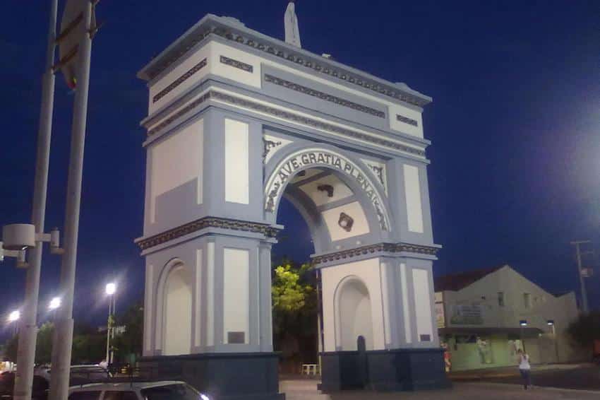
The city is known for its rich culture, with events such as the Nossa Senhora da Conceição Festival and the Winter Festival. Sobral, the second largest municipality in Ceará, is known for its historical heritage, including churches, museums and theatres.


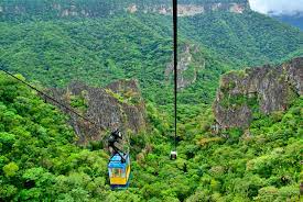
3. Ubajara at the top of the Ibiapaba Mountain Range
Ubajara, located 324 km from Fortaleza, is at the top of the Serra da Ibiapaba, at an altitude of 847 metres.
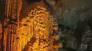
The Ubajara National Park, created in 1959, is one of the main attractions, with its limestone caves and rich biodiversity.

Trails and waterfalls in Ubajara
The park’s classic trail, the Ubajara-Araticum, links the Visitor Centre to the mouth of the cave and offers a unique hiking experience through the Atlantic Forest. Other trails lead to Waterfalls and Viewpoints.

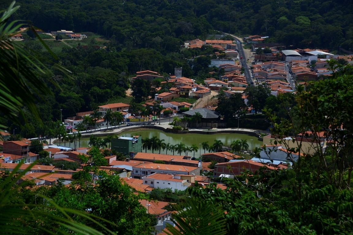
4. Guaramiranga in the Baturité Massif
The Baturité Massif comprises 13 municipalities and is a promising destination for ecotourism. Guaramiranga, located 120 kilometres from Fortaleza, offers a mild climate and adventure activities such as canoeing, abseiling and hiking.

The town’s cultural programme is intense, with festivals and events throughout the year.

Conclusion
The mountainous region of Ceará is ideal for practicing extreme and adventure sports, offering trails and waterfalls that attract nature and sports lovers. It is highly recommended that you hire a specialist guide to explore these landscapes safely.
Publicações Relacionadas
Religious Tourism in Juazeiro do Norte and in Northeast Brazil
Things to do in Guaramiranga — a guide to attractions, trails and itinerarie
Serra de Ibiapaba: A natural paradise for adventure and ecotourism
Ubajara National Park: Adventure Awaits in Ceará
Juazeiro do Norte: A Cultural and Historical Overview
Lavras da Mangabeira and the Rio Salgado Canyon Guide
Icó: A Historical Gem in Ceará, Brazil
Three-day tour of the Cariri region of Ceará
Baturité Massif: A Scenic Destination in Ceará
Cariri in Ceará: An Ecological and Cultural Tourism Destination
This post is also on:
![]() Português
Português ![]() English
English ![]() Deutsch
Deutsch ![]() Español
Español ![]() Français
Français


