Ceará: A Land of Natural Beauty and Cultural Riches
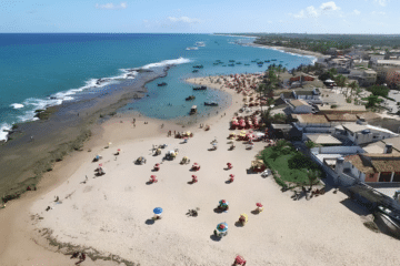
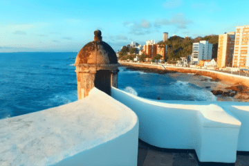
The state of Ceará is renowned for being one of Brazil’s most beautiful tourist destinations, boasting a rich culture combined with stunning landscapes, which include beaches, mountain ranges and waterfalls.
In this article
- The Origin of the Name ‘Ceará’
- Geographical features of Ceará
- Coastline and Vegetation
- Coastal Culture and the Importance of the Raft
- Tourist Attractions in Fortaleza and Ceará
- Fortaleza
- Juazeiro do Norte
- Sobral
- Ubajara
- Famous Beaches in Ceará
- Other Notable Beaches
- When to visit Ceará
- Frequently Asked Questions about Ceará

The Origin of the Name ‘Ceará’
The origin of the name ‘Ceará’ is a matter of debate amongst historians, but it has its roots in Tupi. The first document to record the place name dates from 1608; prior to that, the region was referred to as Macoripe Bay. The most widely accepted theory, put forward by José de Alencar, links the name to “canto da jandaia” — a combination of the Tupi terms “cemo” (to sing loudly, to cry out) and “ara” (a small species of macaw). Other hypotheses include derivation from “Siri-ará”, alluding to the white crabs found on the coast, and a comparison of the state’s landscape of dunes and plateaus with the Sahara desert. No single theory is universally accepted amongst linguists, but all reinforce the connection between the name and the natural landscapes of the state.

Geographical features of Ceará
- Extensive coastline: It has around 573 km of beaches, featuring dunes, cliffs, mangroves, lagoons and coves.
- Dunes and sandbanks: Striking dunes and areas of sandbank with vegetation adapted to sandy, saline soil.
- Climate: Predominantly semi-arid tropical; the coast is more humid and the interior drier, with long dry seasons.
- Mountain ranges and plateaus: Of particular note are the Baturité Massif and the Araripe Plateau, areas rich in biodiversity and important for water supply.
- Rivers and reservoirs: Several rivers flow through the state — the Jaguaribe is one of the main ones — and reservoirs are commonly used to store water during the dry season.
- Vegetation: This ranges from xerophytic caatinga in the hinterland to mangroves and sandbanks along the coast.
- Biodiversity: A variety of ecosystems (mangroves, caatinga, mountain ranges) that are home to a diverse range of flora and fauna.

Coastline and Vegetation
- Landforms and vegetation: Mangroves and sandbanks predominate, alongside stretches of land without vegetation cover, occupied by dunes.
- Climate and rainfall: Rainfall and humidity on the coast are higher than in the Sertaneja Depression, even at relatively low altitudes. Average temperatures range from 22 °C to 32 °C.
- Coastal plain: The plain features a diverse landscape: beaches lined with coconut palms, dunes and cliffs — sedimentary walls that run along the coast and, in places, display a variety of colours due to their mineral composition and erosion.
- Mangroves: Mangrove areas are home to a wealth of biodiversity and are crucial to the local ecosystem, serving as a nursery for various marine species.
Coastal Culture and the Importance of the Raft

The raft plays a key role in the coastal culture of Ceará, symbolising the identity and traditions of the region’s fishermen.
- Cultural heritage: An icon of Ceará’s culture; its construction and use are passed down from generation to generation, preserving ancestral techniques and knowledge.
- Local economy: Small-scale fishing using rafts supports many families in coastal communities, contributing to the local economy by providing fish for both consumption and trade.
- Relationship with the sea: It symbolises the deep connection between fishermen and the sea, not only as a tool for their work, but as a way of life that reflects respect for the forces of nature.
- Tourism: A draw for visitors; raft trips in places such as Jericoacoara and Canoa Quebrada offer an authentic insight into everyday fishing life.
- Identity and pride: It symbolises resilience and local pride, highlighting the struggle and perseverance of fishermen in the face of adversity and pressures on marine resources.
- Artistic expression: A source of inspiration for music, literature and the visual arts, featuring in songs, paintings and photographs that depict coastal life.

Tourist Attractions in Fortaleza and Ceará

Turismo - Guia Turismo27:39

Pontos Turísticos do Ceará03:18

Principais pontos turísticos do Ceará05:39
Strength
Fortaleza, a metropolis with a vibrant cultural life, is the ideal starting point for exploring the east coast, known as the Costa do Sol Nascente, or the west coast, the Costa do Sol Poente.

Juazeiro do Norte: Faith and Devotion
- Centre of devotion: Father Cícero is a religious and cultural figure; his memory inspires devotional practices and pilgrimages.
- Pilgrimage: The city is a major destination for pilgrims, welcoming visitors from various regions of Brazil.
- Religious festivals: Various celebrations take place throughout the year, attracting large crowds and boosting local religious and economic life.

Sobral: Historic Heritage
Ceará also has the charming Sobral, the fifth-largest city in the state and one of the most important in the Ceará hinterland, which was granted city status in 1841 and is now home to a rich architectural heritage listed as a national historic monument.

Ubajara: Nature and Adventure
Unlike the rest of the state, where the heat prevails, a milder climate can be enjoyed in Ubajara.

Situated in a mountainous region, at 847 metres above sea level and amidst areas of Atlantic Forest, the town is the gateway to the Ubajara National Park, which protects a spectacular group of limestone caves. The park is known for its walking trails and the famous Ubajara Cable Car, which offers breathtaking views of the region.
Famous Beaches in Ceará
The most famous beaches in Ceará include Jericoacoara Beach, Canoa Quebrada Beach and Porto das Dunas Beach, all of which have gained international renown. Jericoacoara, in particular, has been named one of the best beaches in the world in several awards.


Other Notable Beaches
In the region, other notable beaches include Praia das Fontes, Morro Branco, Icaraí, Presídio, Baleia, Flecheiras, Cumbuco, Ponta Grossa, Lagoinha and Barra do Cauipe.

Road Network on the Ceará Coast
The coast of Ceará is crossed by two motorways, known as Costa do Sol Nascente and Costa do Sol Poente, which, starting from Fortaleza, head towards the east and west coasts, respectively.
Articles about Ceará on the Bahia.ws website
Explore a range of publications dedicated to Ceará on the Bahia.ws website. Here, you’ll find a wealth of information on tourist attractions, culture, cuisine and much more.
- The historical and cultural tours of the city of Fortaleza.
- The laid-back Canoa Quebrada, the main attraction of the Costa do Sol Nascente.
- Discover the beautiful beaches of Ceará, as well as Morro Branco and Tatajuba.
- The beach at Jericoacoara, a cosmopolitan destination that has not lost the simplicity that characterises the Costa do Sol Poente.
- Juazeiro do Norte, in the hinterland of Ceará, where the largest religious pilgrimages in the North-East take place.
- The historic architectural tour of the town of Sobral and the limestone caves of Ubajara National Park.
- The beauty and charms of Chapada do Araripe.
- Religious tourism
- Kitesurfing in Cumbuco on the west coast of Ceará.
- The History of Lavras da Mangabeira and the Salgado River Canyon in Ceará
- The 18 best beaches along the coast of Fortaleza and Ceará
- Religious tourism in Juazeiro do Norte and the Cariri region
- Guaramiranga is known as the ‘Switzerland of Ceará’
- A three-day sightseeing itinerary in the Cariri region of Ceará
- The best beaches on the Ceará coast
- Icapuí is known for its cliffs and lobster at the easternmost tip of Ceará
- Tatajuba Beach is one of the most charming beaches in Ceará
- Tatajuba is the perfect place for kitesurfing
- Ibiapaba Mountains: nature, local flavours and extreme sports
- Tourist Guide to Ubajara National Park in Ceará
- Tourist Attractions, Architecture and History of Icó in Ceará
- Caetanos de Cima is one of the most beautiful beaches in Ceará
- Jericoacoara is a natural wonder and has plenty to offer
- Quixadá is the best place in Latin America for paragliding and hang-gliding
- Cariri is a special place, blessed with the natural beauty of the Chapada do Araripe
- The lush landscape of the Baturité Massif is one of the most popular destinations
- Aracati, CE: Tourism and Travel Guide
- Aquiraz, in the state of Ceará, is home to Beach Park, vast dunes and deserted beaches
- Canoa Quebrada in Ceará combines sport, fun and leisure
- Ceará is a paradise for tourism and extreme sports
- The Jaguaribe River is Fortim’s biggest attraction in Ceará
- Beach Park on Porto das Dunas beach has put Aquiraz on the tourist map
- Costa dos Ventos attracts tourists looking for sunshine and a gentle breeze
- The natural beauty of Paracuru Beach attracts families and sports enthusiasts
- The Cliffs Route in Ceará offers unforgettable excursions
- The Route of Emotions offers an adrenaline rush and an intimate connection with nature
- Juazeiro do Norte, in the Sertão region of Ceará, is the home of Padre Cícero
- The mountain ranges of Ceará consist of hills reaching altitudes of up to one thousand metres
- Main towns and beaches on the west coast of Ceará
- The east coast of Ceará retains its authenticity even on the liveliest beaches
- Fortaleza is known as the ‘land of the sun’, the wind, the rafts and the endless beaches
When to visit Ceará
- From July to December, to enjoy the sunny coastline. Between January and March, the beaches get very busy and prices go up.
- Between December and May, the rainy and hot season, to make the most of the fuller lagoons, the dunes and the beaches.
- From January to June, when the municipality of Sobral, with an average temperature of 30°C, enjoys milder weather.
- During the three major pilgrimages in honour of Father Cícero: on 15 September; from 30 October to 2 November; and from 30 January to 2 February.
Ceará Tourist Guide
Frequently Asked Questions about Ceará
What are the main tourist destinations in Ceará?
Fortaleza (the capital), Jericoacoara, Canoa Quebrada, Cumbuco, Porto das Dunas and Beach Park, on the coast; and Juazeiro do Norte, Sobral, Ubajara and the Cariri region, inland, are among the state’s most popular destinations.
What is the origin of the name ‘Ceará’?
The most widely accepted theory, put forward by José de Alencar, links the name to the ‘song of the jandaia’, derived from the Tupi terms ‘cemo’ (to sing loudly) and ‘ara’ (a small macaw). Other theories link the name to the white crabs found on the coast (“Siri-ará”) or to a comparison of the dune landscape with the Sahara Desert.
When is the best time to visit Ceará?
From July to December, the coast is sunnier and drier, making it ideal for the beach. Between January and March, the beaches get busier and prices rise, due to the summer and the holidays. Between December and May, however – the rainy season – the lagoons and dunes become fuller and greener — a good time for those looking for lush landscapes outside the peak season.
How many kilometres long is the coastline of Ceará?
The coastline of Ceará is around 573 km long and is divided by the city of Fortaleza into two tourist routes: the Costa do Sol Nascente, to the east, and the Costa do Sol Poente, to the west.
Is Jericoacoara on the east or west coast of Ceará?
Jericoacoara is situated on the west coast of Ceará (the ‘Costa do Sol Poente’), on the border with Piauí. Canoa Quebrada, on the other hand, is situated on the east coast (the ‘Costa do Sol Nascente’), near the border with Rio Grande do Norte.
Is it worth exploring the interior of Ceará, as well as the beaches?
Yes. The Cariri region, comprising the Chapada do Araripe and Juazeiro do Norte, combines history, geology and the largest centre for religious tourism in the North-East. Meanwhile, the Serra de Ibiapaba and the Baturité Massif offer a mild climate, waterfalls and walking trails, providing a contrast to the heat of the coast and the sertão.

Publicações Relacionadas
Icó, Ceará: History, Architecture and Tourist Attractions
The East Coast of Ceará: A Complete Guide to Beaches and Cliffs
Beach Park – Complete guide: attractions, tickets and tips for Porto das Duna
Tourism in the Cariri region of Ceará: A complete 3-day itinerary through the Araripe Geopark
The Baturité Massif: A Complete Guide to Tourism in Ceará
Aracati, CE: A Complete Guide to Canoa Quebrada and the Surrounding Area
Jericoacoara, Ceará: Complete Guide and 5-Day Itinerary
Juazeiro do Norte: Things to Do and a Guide to Religious Tourism
Cumbuco Beach (Ceará): The Definitive Guide to Kitesurfing and Leisure
Things to Do in Paracuru, Ceará: Beaches and Sports
Quixadá, Ceará: Monoliths, the Cedro Dam and the Sertão
Canoa Quebrada, Ceará: A Guide to Cliffs and Beaches
Serra da Ibiapaba: A Complete Guide to Attractions and Tips
Religious Tourism in Cariri (CE): Padre Cícero and Pilgrimages
Route of Emotions: An Adventure through North-East Brazil
Aquiraz, Ceará: Guide to Porto das Dunas and Beach Park
Fortim and the Jaguaribe River, Ceará: A Complete Travel Guide
Ubajara National Park: A Complete Visitor’s Guide
Kitesurfing in Tatajuba — Spots, Access and Season
Icapuí, Ceará: The perfect destination for those seeking the ‘Land of the Lobster’
Beaches on the West Coast of Ceará: A Complete Guide
Ceará: The Best of Ecotourism and Extreme Sports in Brazil
What to Do in Fortaleza in 3 Days: A Complete Itinerary
The Costa dos Ventos Route, Ceará: A Complete Guide to 9 Towns
Guaramiranga: The Complete Guide to the ‘Switzerland of Ceará’ (Itineraries and Tips)
Where to Stay in Fortaleza: Neighbourhoods and Beaches (2026)
Salgado River Canyon in Lavras da Mangabeira, Ceará
The Best Beaches in Fortaleza and Ceará: A Complete Guide with 22 Options
Cariri in Ceará: A Comprehensive Guide to Tourism and Culture
The Cliffs Route in Ceará: A Complete Travel Guide
Caetanos de Cima is one of the most beautiful beaches in Ceará
Tatajuba, Ceará: things to do, how to get there and top attractions
Fortaleza: A Guide to Ceará's Vibrant Capital
The Mountains of Ceará: A Guide to Mountain Towns for Tourists
This post is also on:
 Português
  English
  Deutsch
  Español
  Français