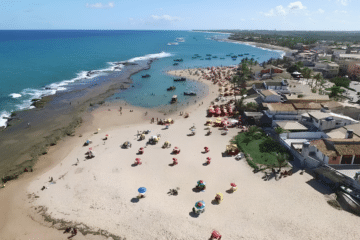
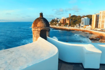
Guaramiranga, affectionately nicknamed “the Switzerland of Ceará” (and also known as the “City of Flowers”), is a mountain retreat situated in the heart of the Baturité Massif. Famous for its mild climate — a refreshing contrast to the heat of the coast — the town is the ideal destination for those seeking ecotourism, relaxation and direct contact with the unspoilt nature of the Atlantic Forest.

Location and how to get to Guaramiranga, in Ceará
Located about 100 km from Fortaleza, it is reached via the mountains of Ceará, making for a scenic journey. The town is situated at an altitude of approximately 865 metres. With average temperatures ranging from 14°C to 25°C, the thermometer can drop to between 10°C and 12°C during winter, making the region perfect for enjoying a hot chocolate and cosy fires. If you’re planning to visit other mountain towns in the state, do take a look at our guide to the Mountains of Ceará as well.

Why visit Guaramiranga: Nature and Culture
The region’s unique climate fosters the growth of a dense Atlantic Forest, protected by the Baturité Massif Environmental Protection Area (APA). As well as its lush natural beauty, Guaramiranga charms visitors with its charming architecture, cosy squares and a vibrant cultural scene. It is a favourite destination for hiking, birdwatching and photography.


The History of Guaramiranga
The settlement, originally named Conceição, was granted town status in September 1890. The name ‘Guaramiranga’, of Tupi origin, means ‘red bird’, a tribute to the rich local wildlife — a connection confirmed by the historian Pompeu Sobrinho.
Things to do in Guaramiranga, Ceará: Top Attractions

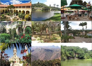
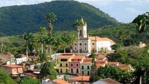
1. Pico Alto Viewpoint
At 1,115 metres above sea level, it is the highest point in the Baturité Massif and one of the highest points in Ceará. Located around 8 km from the town centre, it offers a breathtaking view, especially at sunset.

2. Jesuit Monastery (Baturité)
An imposing historic stone building. It is situated approximately 14 km from Guaramiranga and offers a peaceful atmosphere and an incredible panoramic view.


3. Parque das Trilhas
The ideal spot for those seeking adventure. With guided trails ranging from 1 to 3 km, the park offers abseiling, zip-lining and kayaking, as well as being an excellent place for spotting local wildlife.

4. Festival de Jazz & Blues
The city’s most eagerly awaited event, usually held during the Carnival period. It is one of the most renowned instrumental music festivals in the North-East. Tip: Book your accommodation well in advance for this time of year.
5. Waterfalls and Ecotourism
As well as the parks, the region has plenty of waterfalls and lakes. Always check whether you need local guides to reach the more remote waterfalls and to help preserve the area. Combine your visit with other destinations in the mountains and hinterland of Ceará, such as Quixadá.
Recommended Itineraries for Guaramiranga
To make the most of your visit, we recommend the following accommodation options:
- 1-day itinerary: Focus on the historic centre, the Capuchin Convent, Parque das Trilhas in the afternoon, and rounding off the day with the sunset at Pico Alto.
- 2-day itinerary: Day 1: exploring the town centre and walking trails; Day 2: visiting the Jesuit Monastery (Baturité) and a tour of the waterfalls.
- 3-day itinerary: A total immersion experience with longer walks, visits to smaller viewing points, relaxation in the town centre and time to enjoy the local mountain cuisine.
Practical Tips for Your Trip to Guaramiranga
- Best time to visit: It’s pleasant all year round, but the period from June to August is the coldest.
- What to pack: Warm clothes for the evening (essential!), comfortable walking shoes and light clothing for the day.
- Logistics: Check the opening times of attractions such as the Monastery and Parque das Trilhas before you set off.

Frequently Asked Questions about Guaramiranga, Ceará
Where is Guaramiranga, in Ceará?
Guaramiranga is situated in the mountains of Ceará, in the Baturité Massif region, around 100 km from Fortaleza. It is the smallest municipality in the state in terms of area.
Why is Guaramiranga known as the ‘Switzerland of Ceará’?
Due to its cool, mild climate – which is unusual for the state – situated at an altitude of 865 metres, it has temperatures ranging from 14°C to 25°C, which can drop to 10–12°C in winter, in stark contrast to the heat of the Ceará coast.
What does the name Guaramiranga mean?
It is a word of Tupi origin meaning ‘red bird’, a tribute to the local wildlife, according to the historian Pompeu Sobrinho.
When is the best time to visit Guaramiranga?
The town is pleasant all year round, but the period from June to August marks the height of the cold season, ideal for those seeking the lowest temperatures in the ‘Switzerland of Ceará’.
How many days are recommended for visiting Guaramiranga?
A one-day itinerary covers the historic centre and Pico Alto. To include the Jesuit Monastery in Baturité and visit the waterfalls at a leisurely pace, a stay of two to three days is recommended.
When does the Guaramiranga Jazz & Blues Festival take place?
The festival is usually held during the Carnival period and is one of the most renowned instrumental music events in the North-East — it’s worth booking accommodation well in advance for this time of year.
Now that you know what to do in Guaramiranga, it’s time to pack your bags and enjoy the best mountain climate in Ceará!

Publicações Relacionadas
Cumbuco Beach (Ceará): The Definitive Guide to Kitesurfing and Leisure
Beaches on the West Coast of Ceará: A Complete Guide
Jericoacoara, Ceará: Complete Guide and 5-Day Itinerary
Aquiraz, Ceará: Guide to Porto das Dunas and Beach Park
Caetanos de Cima is one of the most beautiful beaches in Ceará
The Best Beaches in Fortaleza and Ceará: A Complete Guide with 22 Options
Things to Do in Paracuru, Ceará: Beaches and Sports
Kitesurfing in Tatajuba — Spots, Access and Season
Fortim and the Jaguaribe River, Ceará: A Complete Travel Guide
Juazeiro do Norte: Things to Do and a Guide to Religious Tourism
Beach Park – Complete guide: attractions, tickets and tips for Porto das Duna
Aracati, CE: A Complete Guide to Canoa Quebrada and the Surrounding Area
Tatajuba, Ceará: things to do, how to get there and top attractions
Ceará: The Best of Ecotourism and Extreme Sports in Brazil
What to Do in Fortaleza in 3 Days: A Complete Itinerary
The Baturité Massif: A Complete Guide to Tourism in Ceará
Quixadá, Ceará: Monoliths, the Cedro Dam and the Sertão
Ceará: Must-see tourist destinations in Brazil
Canoa Quebrada, Ceará: A Guide to Cliffs and Beaches
Route of Emotions: An Adventure through North-East Brazil
The Mountains of Ceará: A Guide to Mountain Towns for Tourists
East Coast of Ceará: A Traveler's Paradise
Fortaleza: A Guide to Ceará's Vibrant Capital
Serra da Ibiapaba: A Complete Guide to Attractions and Tips
Icó, Ceará: History, Architecture and Tourist Attractions
Where to Stay in Fortaleza: Neighbourhoods and Beaches (2026)
Religious Tourism in Cariri (CE): Padre Cícero and Pilgrimages
Ubajara National Park: A Complete Visitor’s Guide
The Cliffs Route in Ceará: A Complete Travel Guide
Icapuí, Ceará: The perfect destination for those seeking the ‘Land of the Lobster’
The Costa dos Ventos Route, Ceará: A Complete Guide to 9 Towns
Cariri in Ceará: A Comprehensive Guide to Tourism and Culture
Tourism in the Cariri region of Ceará: A complete 3-day itinerary through the Araripe Geopark
Salgado River Canyon in Lavras da Mangabeira, Ceará
This post is also on:
 Português
  English
  Deutsch
  Español
  Français