Publication: De Nieuwe Groote Lichtende Zee-Fakkel
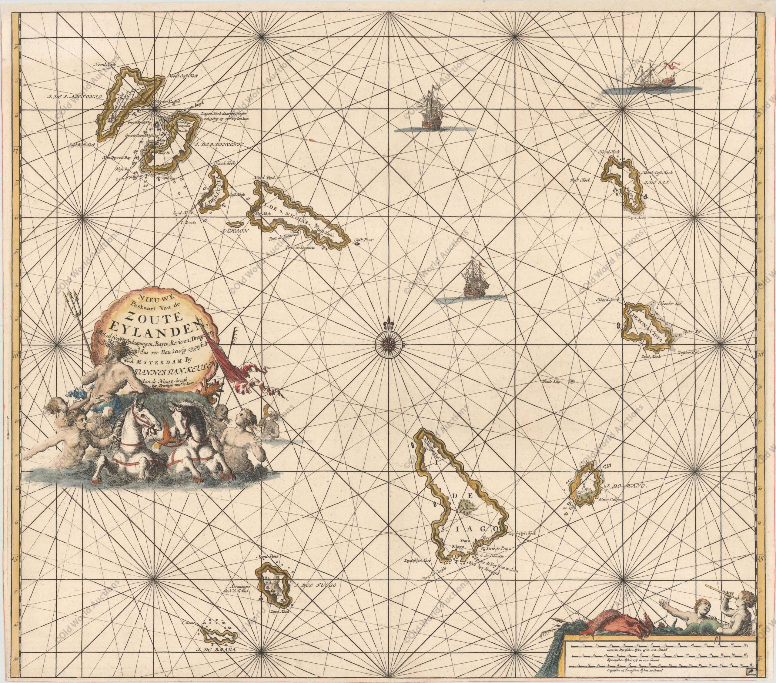
“Nieuwe Paskaart van de Zoute Eylanden…”, Keulen, Johannes van
Map of the Cape Verde Islands, 1697
A large copper engraved sea chart of the Cape Verde Islands. A beautiful decorative title cartouche with a sea shell surrounds the title that rests above a scene of Poseidon, mermaids and horses. The chart is further adorned with two sailing ships and a distance scale at bottom right featuring sea-boys and fish.
Publication: De Nieuwe Groote Lichtende Zee-Fakkel
“Nieuwe Paskaart van de Zoute Eylanden…”, Keulen, Johannes van
Publicações Relacionadas
Map of Brazil from 1850: A Historical Overview
Engraving of Sirinhaém from 1671
Map of South America 1601 - Historical Map
Map of South America, 1840
Map of Brazil from 1850 - Historical Map of Brazil
Map of Recife of 1764 - Historical Map
Map of Southern South America, 1668 - Historical Map
Southeastern Colonial Map of the United States, Bahamas and Greater Antilles, 1706
Map of West Africa and the Cape Verde Islands from 1699
1643 Map of the Western Hemisphere - Historical Map
1671 Map of Jamaica
Map of Brazil from 1750 - Historical Map of Brazil
1730 Historical Map of the Western Hemisphere
Engraving of Todos os Santos Bay from 1671 Explained
Painting of the Three Kings Fort in Natal from 1647
1757 Map of the Western Hemisphere
1607 Map of the Western Hemisphere - Historical Map
Map of Southern South America, 1656 - Historical Map
1730 Map of the Western Hemisphere - Historical Map
Engraving of Salvador de Bahia from 1770 - Historical Maps
1719 Historical Map of the Western Hemisphere
Engraving of Vila de Olinda in 1671 - Historical Engraving
Map of Rio de Janeiro of 1764 - Historical Map
View of Rio de Janeiro in 1840: Beauty Captured
Map of Brazil 1747 - Historical Maps of Brazil
1719 Map of the Western Hemisphere - Historical Map
Map of the Gulf of Mexico, the Caribbean and the Southern United States, 1682
1628 Map of the Western Hemisphere - Historical Map
1575 Map of Europe - Historical Map
Map of Brazil 1554 - Historical Maps of Brazil
Map of Brazil from 1652: A Historical Perspective
1638 Map of the Gulf of Mexico and the Caribbean - Historical Map
Map of South America and the Caribbean 1596 - Historical Map
Map of the Captaincy of Pernambuco and Ceará from 1680
Map of Rio de Janeiro, 1775 - Historical Map
1631 Map of the Western Hemisphere - Historical Map
This post is also on:
![]() Português
Português ![]() English
English ![]() Deutsch
Deutsch ![]() Español
Español ![]() Français
Français


