Publication: De Nieuwe Groote Lichtende Zee-Fakkel
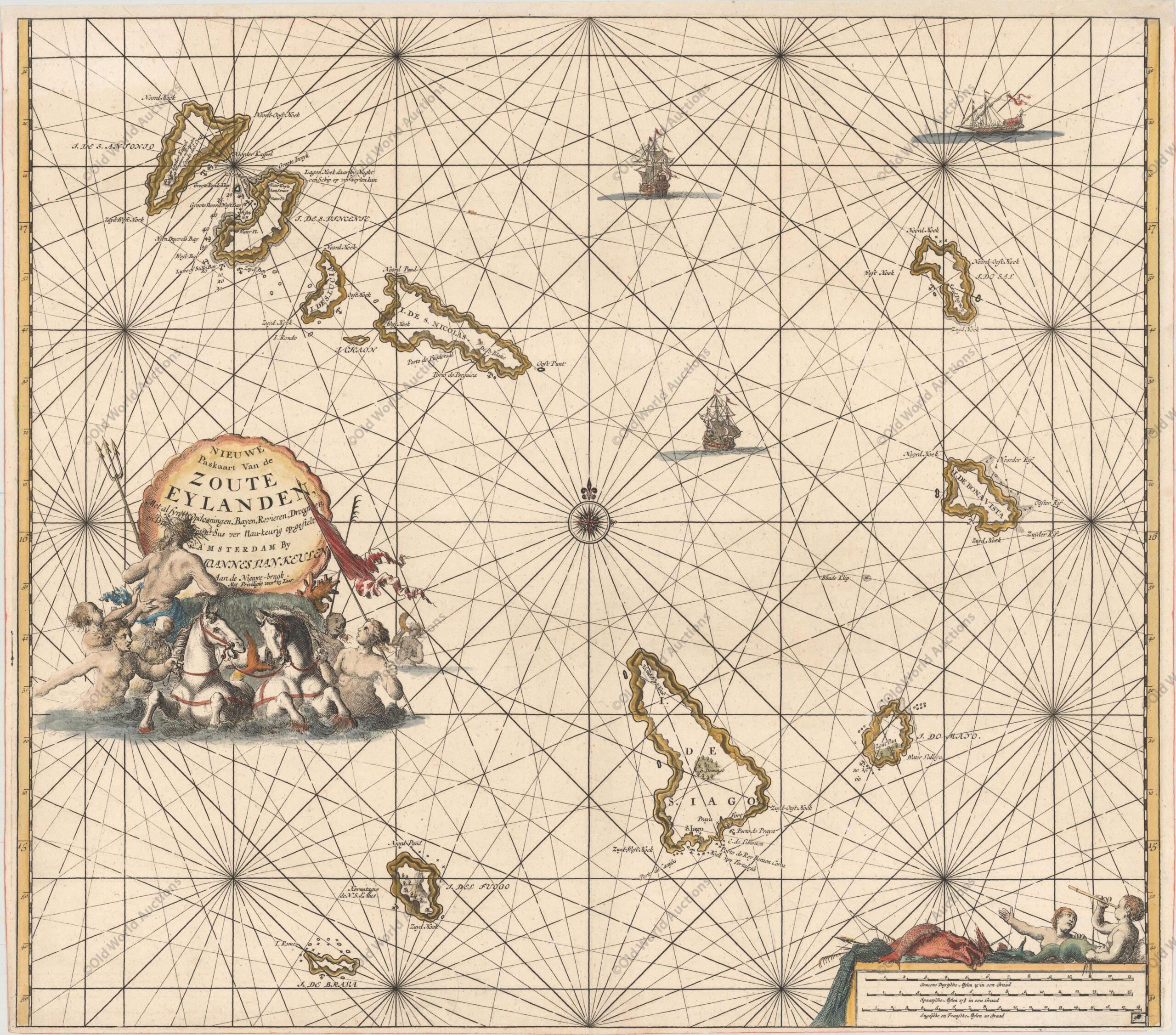
“Nieuwe Paskaart van de Zoute Eylanden…”, Keulen, Johannes van
Mapa das Ilhas de Cabo Verde de 1697
Um grande mapa marítimo gravado em cobre das Ilhas de Cabo Verde. Uma bela cartela decorativa com uma concha marinha envolve o título, que repousa acima de uma cena com Poseidon, sereias e cavalos. O mapa é ainda adornado com dois veleiros e uma escala de distância no canto inferior direito, com meninos do mar e peixes.
Publicação: De Nieuwe Groote Lichtende Zee-Fakkel
“Nieuwe Paskaart van de Zoute Eylanden…”, Colónia, Johannes van
Publicações Relacionadas
Mapa da Jamaica de 1671
Mapa do hemisfério ocidental de 1579 - América
Mapa da Europa de 1644: Um Clássico da Cartografia
Mapa do Brasil de 1695: A História por Trás da Obra
Mapa do Brasil de 1747
Mapa do Rio de Janeiro de 1794
Gravura Forte Orange na Ilha de Itamaraca de 1671
Gravura de Salvador da Bahia de 1748: Um Olhar Histórico
Mapa do Rio de Janeiro de 1810
Mapa de Olinda em Pernambuco de 1640
Mapa do Mundo de 1584
Mapa do hemisfério ocidental de 1700
Mapa do Hemisfério Ocidental de 1713
Mapa do Hemisfério Ocidental de 1628
Mapa do leste do Brasil 1664
Mapa do Norte da America do Sul de 1730
Mapa do Hemisfério Ocidental de 1579
Mapa da Baia de Todos os Santos e Pernambuco de 1700
Mapa da Africa de 1593
Mapa histórico do Hemisfério Ocidental, 1628
Mapa da África Ocidental e das Ilhas de Cabo Verde de 1699
Mapa da América do Sul e Brasil de 1624
Mapa da Madeira e das Ilhas Canárias de 1692
Mapas históricos mostrando a evolução e a expansão territorial do Brasil
Gravura do Cabo Santo Agostinho de 1645
Mapa da Africa de 1570
Mapa da Ilha de Santa Catarina de 1777
Mapa do Hemisfério Ocidental de 1550
Mapa do Brasil de 1798
Mapa da Paraíba de 1690
Mapa da America do Sul de 1650 com Detalhes Únicos
Mapa da Provincia da Paraíba de 1698
Mapa do Golfo do México e Caribe de 1594
Paisagem urbana do Rio de Janeiro de 1840: Uma Análise
Mapa do Golfo do México e das Caraíbas de 1675
Mapa de Recife de 1679
Este post também está disponível em:
 Português
  English
  Deutsch
  Español
  Français