Map of Southern South America, 1668 – Historical Map

Mapa do Sul da América do Sul de 1668
Map of South America of 1668

Map of southern South America of 1668 – Cartes Generales de Toutes les Parties du Monde…

“La Terre et les Isles Magellaniques Tirees des Relations les Plus Recentes”, Sanson/Mariette

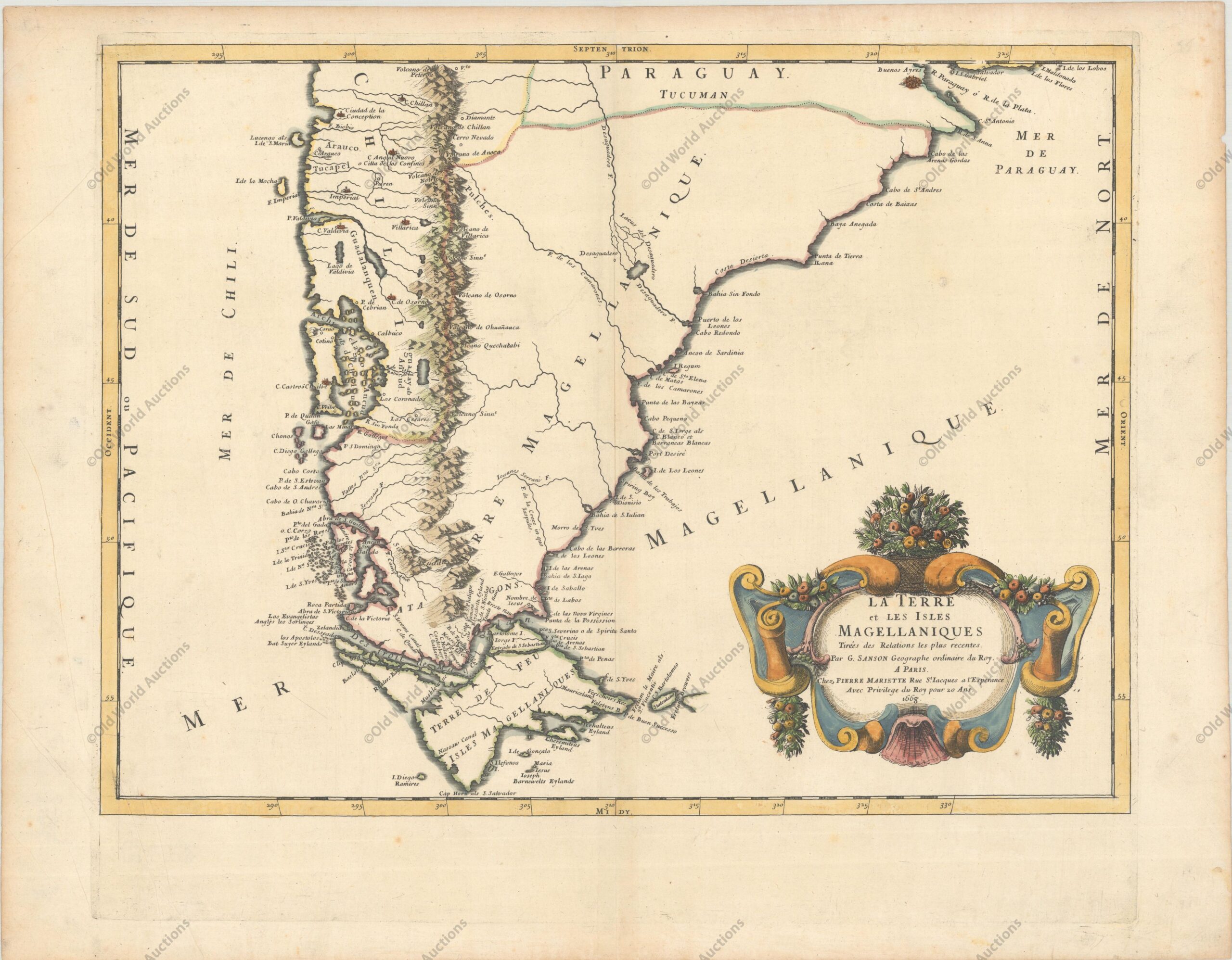
An unusual map of Patagonia, southern Chile and Tierra del Fuego.

Buenos Aires and the mouth of the River Plate are in the northernmost part of the map.

The Andes are shown pictorially, and eleven volcanoes are noted and named.

The Desaguadero River is shown, with a tentative watershed and a lake. The title cartouche is decorated with fruits between rococo curves.

This map is quite rare, as it was not included in Sanson’s Cartes Generales de Toutes les Parties du Monde until the 1670 edition.

References: Pastoureau, SANSON V E [217].

Map of Southern South America of 1668 – Historical Map

Publicações Relacionadas

Map of Brazil from 1652: A Historical Perspective

Map of the Captaincy of Paraíba and Rio Grande, 1720

All Saints Bay Map of 1644 - Historical Map

Map of Rio de Janeiro of 1764 - Historical Map

1581 Map of the Western Hemisphere - Historical Map

Gravura da Baia de Todos os Santos de 1690

1579 Map of the Western Hemisphere - America - Historical Map

Map of South America from 1750 - Historical Maps of Brazil

Engraving of Sirinhaém from 1671

1677 Map of the Western Hemisphere - Historical Map

Map of Santa Catarina Island 1777: A Historical Treasure

1584 World Map - Historical Map

Map of the Cape Verde Islands, 1697

1587 Map of the Western Hemisphere - Historical Map

Map of South America from 1619: A Historical Insight

1671 Map of Mexico and Central America - Historical Map

1628 Map of the Western Hemisphere - Historical Map

Map of Cabo Santo Agostinho from 1645 - Historical Map of Brazil

Engraving of Salvador de Bahia from 1770 - Historical Maps

1639 Map of Paraíba - Historical Map of Brazil

Map of Recife in Pernambuco from 1679: Historical Insights

Map of Rio de Janeiro, 1794 - Historical Map

1628 Map of the Western Hemisphere - Historical Map

Map of Brazil divided into fourteen hereditary captainships from 1657 onwards

1631 Map of the Western Hemisphere - Historical Map

1607 Map of the Western Hemisphere - Historical Map

1579 Map of the Western Hemisphere - Historical Map

Map of Brazil from 1850: A Historical Overview

Map of Europe from 1644: A Classic Antique

Map of the Brazilian Coast from 1678 - Historical Map of Brazil

Map of West Africa and the Cape Verde Islands from 1699

Maritime chart of the east coast of Brazil Ilha Grande and Sapetiba Bay 1884

Map of the Azores from 1584

1660 Map of the Western Hemisphere - Historical Map

Map of Rio de Janeiro of 1810 - Historical Map

Map of Brazil from 1750 - Historical Map of Brazil

This post is also on: Português English Deutsch Español Français