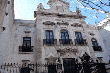
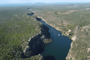
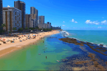
Map of Mexico and Central America, 1671 – Historical Map

Map of Mexico and Central America from 1671"Yucatan Conventus Iuridici Hispaniae Novae Pars Occidentalis, et Guatimala Conventus Iuridicus", Montanus/Ogilby Montanus' work was perhaps the greatest illustrated book on the New World produced in the seventeenth century. It contained over one hundred beautifully engraved plates, views, and maps of North and South America. The plates vividly depict forts, festivals, occupations, Dutch fleets, battles, religious rites, and customs of the native inhabitants. This important work was translated into German by Olivier Dapper, and into English by John Ogilby. Several of the plates were later acquired by Pierre Vander Aa. This decorative map covers the region from Mexico City to Panama City and extends to include part of Cuba, and is based on Blaeu's map of the Yucatan peninsula. Cozumel is named, and Lake Nicaragua is presented on an east-west orientation. This map is richly adorned with ships engaged in battle, Neptune and his entourage, and an elaborate title cartouche with Natives, putti, and a large shell. Map of Mexico and Central America from 1671 - Historical Map
Map of Mexico and Central America, 1671 “Yucatan Conventus Iuridici Hispaniae Novae Pars Occidentalis, et Guatimala Conventus Iuridicus”, Montanus/Ogilby Montanus’s work was perhaps the greatest illustrated book of the New World produced in the seventeenth century. It contained over one hundred beautifully engraved plates, views and maps of North and South America. The plates vividly depicted forts, festivals, occupations, Dutch fleets, battles, religious rites and native customs. This important work was translated into German by Olivier Dapper and into English by John Ogilby. Some of the plates were later acquired by Pierre Vander Aa. This decorative map covers the region from Mexico City to Panama City, including part of Cuba, and is based on Blaeu’s map of the Yucatan Peninsula. Cozumel is named and Lake Nicaragua is shown in an east-west orientation. This map is richly decorated with ships in battle, Neptune and his entourage, and an elaborate title cartouche with natives, putti, and a large shell. Map of Mexico and Central America of 1671 – Historical Map

Map of Mexico and Central America, 1671

“Yucatan Conventus Iuridici Hispaniae Novae Pars Occidentalis, et Guatimala Conventus Iuridicus”, Montanus/Ogilby

Montanus’ work was perhaps the greatest illustrated book on the New World produced in the seventeenth century.

It contained over one hundred beautifully engraved plates, views and maps of North and South America.

The plates vividly depicted forts, festivals, occupations, Dutch fleets, battles, religious rites and native customs.

This important work was translated into German by Olivier Dapper and into English by John Ogilby. Some of the plates were later acquired by Pierre Vander Aa.

This decorative map covers the region from Mexico City to Panama City, including part of Cuba, and is based on Blaeu’s map of the Yucatan Peninsula.

Cozumel is named and Lake Nicaragua is shown in an east-west orientation.

This map is richly decorated with ships in battle, Neptune and his entourage, and an elaborate title cartouche with natives, putti, and a large shell.

Map of Mexico and Central America 1671 – Historical Map

Publicações Relacionadas

1730 Map of the Western Hemisphere - Historical Map

Map of Brazil 1730 - Historical Map

Map of Brazil from 1606 - Historical Map

Map of South America from 1750 - Historical Maps of Brazil

Engraving of Vila de Olinda in 1671 - Historical Engraving

Map of Rio de Janeiro, 1775 - Historical Map

Map of the Captaincy of Paraíba and Rio Grande, 1720

Reis Magos Fort Engraving from 1690 - Engravings Stories

Map of the Gulf of Mexico and the Caribbean from 1650-80

1587 Map of the Western Hemisphere - Historical Map

Map of Rio de Janeiro of 1764 - Historical Map

1631 Map of the Western Hemisphere - Historical Map

Engraving of the town of Olinda in 1633 - Historical Engraving

1719 Map of the Western Hemisphere - Historical Map

1671 Map of Jamaica

1628 Map of the Western Hemisphere - Historical Map

Map of Olinda in Pernambuco from 1640 - Historical Map

Map of Brazil from 1652: A Historical Perspective

Painting of the Three Kings Fort in Natal from 1647

Engraving of the Fort of the Three Kings in Natal, 1671

Map of Brazil from 1850 - Historical Map of Brazil

Map of Southern South America, 1656 - Historical Map

Map of the Gulf of Mexico, the Caribbean and the Southern United States, 1682

Map of Rio de Janeiro, 1840 - Historical Map

Map of the Brazilian coast from the Paraíba River to Cabo de Santo Agostinho

Map of Rio de Janeiro, 1750 - Historical Map

Map of South America and Brazil 1624 - Historical Map

Map of Cabo Santo Agostinho from 1645 - Historical Map of Brazil

Map of Rio de Janeiro, 1794 - Historical Map

Historical maps showing the territorial development of Brazil

Map of South America from 1650: A Historical Overview

Map of the Captaincy of Pernambuco and Ceará from 1680

Map of Brazil 1747 - Historical Map of Brazil

Map of Brazil 1554 - Historical Maps of Brazil

Map of South America from 1615: Explore the Details

1719 Map of the Western Hemisphere - Historical Map

This post is also on: English