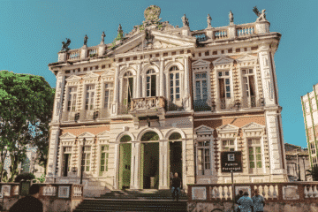
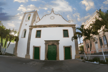
Ouro Preto, a World Heritage Site, is one of the most important tourist destinations in Brazil. With its baroque churches, colonial mansions and rich cultural life, the city attracts visitors interested in history, art and nature. Ouro Preto: From gold to World Heritage The city of Ouro Preto, formerly Vila […]
Posts — Travel Guides and Tips for the North-East and Brazil | Bahia.ws
Map of South America and the Caribbean 1596 – Historical Map
Map of South America and the Caribbean from 1596 – Itinerario… “Delineatio Omnium Orarum Totius Australis Partis Americae, Dictae Peruvianae, a R. de la Plata, Brasiliam, Pariam, & Castellam Auream…”, Linschoten/Langren This is one of the most impressive and decorative maps of South America and an important early record of […]
Map of the Gulf of Mexico and the Caribbean, 1675
Map of the Gulf of Mexico and the Caribbean, 1675 “Indiarum Occidentalium Tractus Littorales cum Insulis Caribicis / Pascaert van Westindien ende Caribise Eylanden”, Wit, Frederick de This is a scarce first edition of one of the most beautifully engraved maps of the West Indies. It extends to show the […]
1666 Map of the Gulf of Mexico and the Caribbean – Historical Map
Map of the Gulf of Mexico and the Caribbean from 1666 – De Zee-Atlas, ofte Water-Weereld Scarce sea chart with an interesting depiction of the coastline of the USA, “Pascaerte van Westindien de Vaste Kusten en de Eylanden”, Goos, Pieter Goos’s scarce map of the Gulf of Mexico and the […]
Map of the Gulf of Mexico and the Caribbean from 1650-80
Map of the Gulf of Mexico and the Caribbean from 1650-80 – Atlas Minor sive Geographia “Insulae Americanae in Oceano Septentrionali ac Regiones Adiacentes, a C. de May Usque ad Lineam Aequinoctialem”, Visscher, Nicolas This handsome map focuses on the West Indies and covers the region from the Chesapeake through the […]
Southeastern Colonial Map of the United States, Bahamas and Greater Antilles, 1706
Colonial Map of the Southeastern United States, Bahamas and Greater Antilles, 1706 “De Vaste Kust van Chicora Tussen Florida en Virginie, door Lucas Vasquez d’Ayllon en Andere, van Hispaniola Besterend”, Aa, Pieter van der Scarce map of an unusually shaped Florida, with the Carolinas to the north as far as […]
Brazil’s historic moments illustrated in great works
From the arrival of the Portuguese colonisers in 1500 to Brazil’s independence, many important events marked the history of Brazil. These historical events were recorded in the works of painters such as Oscar Pereira da Silva, Victor Meirelles, Jean-Baptiste Debret, Manuel José de Araújo and Pedro Américo. Main historical events […]
Biography of Victor Meirelles and analysis of the work “The First Mass in Brazil”
The first mass in Brazil, held on 26 April 1500, just four days after the Portuguese landed at Porto Seguro, was depicted by Victor Meirelles between 1859 and 1861, whilst the artist was living in Paris. The painting was inspired by the letter written by Pero Vaz de Caminha to […]
Map of the Gulf of Mexico and the Caribbean, 1594
Map of the Gulf of Mexico and the Caribbean, 1594 – Grands Voyages, Part IV De Bry’s Superb Map of the Southeastern United States, the Caribbean & Northern South America “Occidentalis Americae Partis, vel, Earum Regionum quas Christophorus Columbus Primu Detexit Tabula Chorographicae Multorum Auctorum Scriptis…”, Bry, Theodore de. This […]
Map of Southern South America, 1656 – Historical Map
Map of southern South America from 1656 – Cartes Generales de Toutes les Parties du Monde… “Le Paraguayr, le Chili. La Terre, et les Isles Magellanicques. Various relations”, Sanson/Mariette Excellent map of the southern part of the continent by the influential French cartographer. Particular attention is paid to the river […]
Painting of the Three Kings Fort in Natal from 1647
Painting of the Fort of the Three Kings in Natal from 1647 – Brazil – Rerum per Octennium in Brasilia “Fluvius Grandis”, Barlaeus, Caspar This finely drawn view shows Fort Ceulen (also known as Fort of the Three Wise Men) on the Potengi River in the present-day Natal region. In […]
1607 Map of the Western Hemisphere – Historical Map
Map of the Western Hemisphere of 1607 – America Mercator’s foundation map of America “America sive India Nova, ad Magnae Gerardi Mercatoris aui Universalis Imitationem in Compendium Redacta”, Mercator, Michael This is one of the most famous maps of the Americas and an important base map for a collection of […]
1579 Map of the Western Hemisphere – America – Historical Map
1579 Map of the Western Hemisphere – America – Theatrum Orbis Terrarum Ortelius’ Influential Map of the New World – Second Plate in Contemporary Colour “Americae sive Novi Orbis, Nova Descriptio”, Ortelius, Abraham This is one of the most famous maps of America, which had an enormous influence on the […]
Jean-Baptiste Debret: biography and works in Brazil
Jean-Baptiste Debret (1768-1848) was a renowned French painter, draughtsman and lithographer, known for his significant contribution to the art and historical documentation of Brazil in the 19th century. A graduate of the Paris Academy of Fine Arts and a disciple of Jacques-Louis David, he initially stood out for his works […]
Map of Southern South America, 1668 – Historical Map
Map of southern South America of 1668 – Cartes Generales de Toutes les Parties du Monde… “La Terre et les Isles Magellaniques Tirees des Relations les Plus Recentes”, Sanson/Mariette An unusual map of Patagonia, southern Chile and Tierra del Fuego. Buenos Aires and the mouth of the River Plate are […]
Baroque architecture in Brazil: Minas and Nordeste churches
Baroque architecture was born in Europe at the end of the 16th century and reached Brazil in the 17th century, brought by the religious orders. That is why it left gilded churches, soapstone façades and entire listed towns here, above all in Minas Gerais, Bahia and Pernambuco. So, in this […]
Map of Rio de Janeiro, 1794 – Historical Map
Map of Rio de Janeiro, 1794 “Plan of the Bay and Harbour of Rio-janeiro on the Coast of Brazil”, Laurie & Whittle This rare plan of Rio de Janeiro is based on the work of D’Apres de Mannevillette, with improvements by Sampson Hall, first mate of the Royal Bishop, and […]
Map of Brazil 1698 – Historical Map
Map of Brazil from 1698 – Istoria delle Guerre del Regno del Brasile “Itamaraca, Brazil”, Horatius, Andreas Antonius This magnificent map of the Brazilian province of Itamaraca, including part of Paraíba, was one of the 23 maps in this rare account of the Dutch-Portuguese colonial war. Written by João José […]
Map of Rio de Janeiro from 1682 – Historical Map
Map of Rio de Janeiro 1682 “Pas-kaart, Van de Zee-Kusten van, Brazilia, Tusschen, C.S. Thome en I.S. Catharina…”, Keulen, Johannes van Rare sea chart of the Brazilian coast from the island of Santa Catarina to Cape S. Thomé. Thomé, together with an inset of the Rio Ianeiro (Rio de Janeiro […]
Map of Rio de Janeiro of 1810 – Historical Map
Map of Rio de Janeiro of 1810 “Esquisse de la Ville et du Port de Rio De Janeiro”, Tardieu, Pierre Francois This rare aerial view of Rio de Janeiro shows forts, batteries and landing places for ships. Soundings, anchorages, sandbanks and navigational hazards are shown. A note in the lower […]