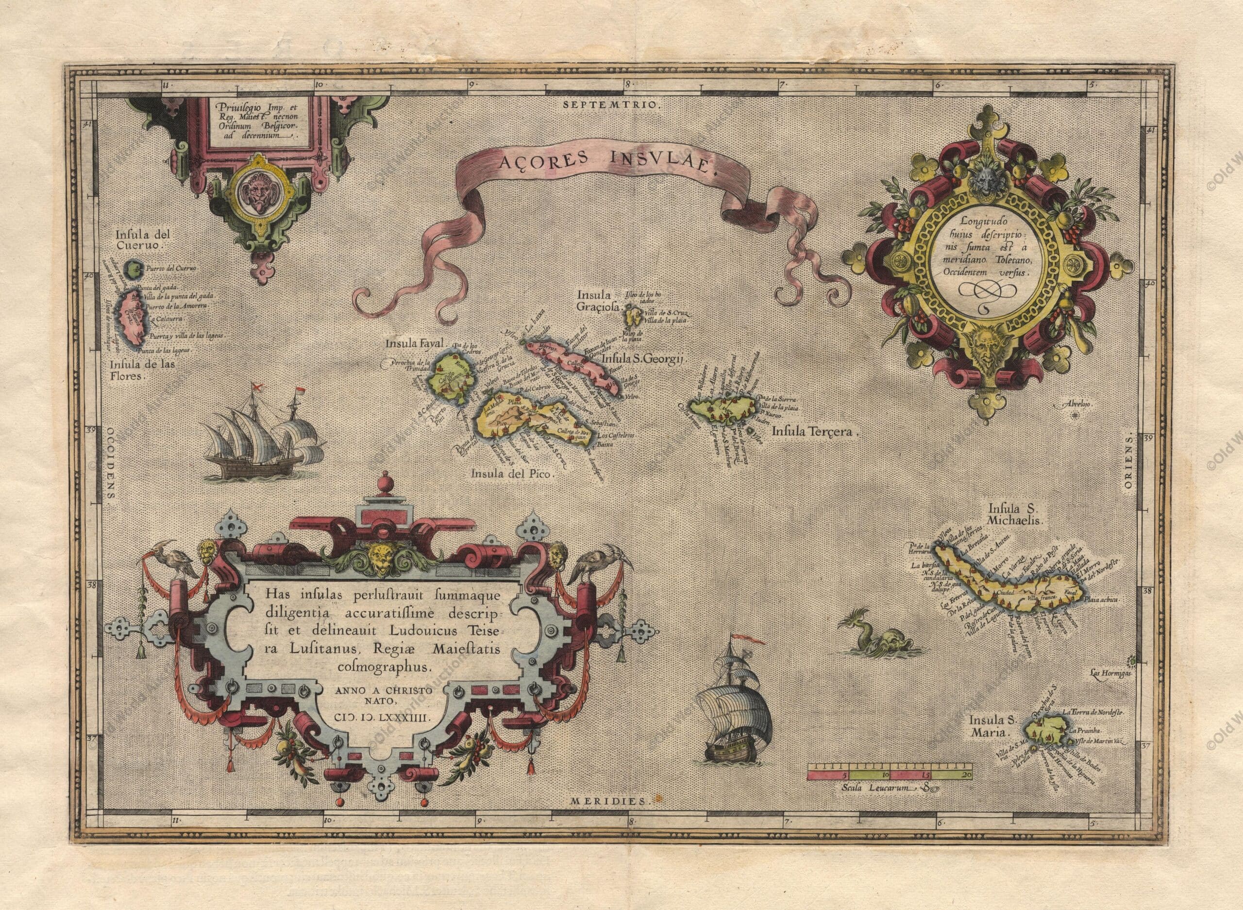
Map of the Azores from 1584
Map of the Azores based on the cartography of Luis Teixeira. The islands are shown in good detail and the map is richly embellished with three large ornate cartouches, a title banner, sailing ships and a sea monster. “Acores Insulae”, Ortelius, Abraham. Publication: Theatrum Orbis
Publicações Relacionadas
Map of Brazil from 1850 - Historical Map of Brazil
Painting of the Three Kings Fort in Natal from 1647
Maritime chart of the east coast of Brazil Ilha Grande and Sapetiba Bay 1884
Map of South America 1601 - Historical Map
Map of Paraíba from 1662: An Engraved Masterpiece
Map of the Captaincy of Pernambuco from 1698 Overview
1579 Map of the Western Hemisphere - Historical Map
Map of South America and Brazil 1624 - Historical Map
Map of the Western Hemisphere from 1700 - Historical Map
Engraving of the Bay of Todos os Santos from 1690 – Historical Engraving
1694 Map of South America - Historical Map
Map of Paraíba of 1690 - Historical Maps of Brazil
Engraving of the Fort of the Three Kings in Natal, 1671
Map of Brazil from 1798: Explore Historical Details
The Catalan Atlas: Redrawing the Medieval World and Asia
Map of All Saints Bay 1769 - Historical Maps
Map of Brazil 1747 - Historical Map of Brazil
Map of Rio de Janeiro, 1840 - Historical Map
Southeastern Colonial Map of the United States, Bahamas and Greater Antilles, 1706
Map of eastern Brazil 1664 - Historical Map of Brazil
Engraving of Sirinhaém from 1671
Map of Brazil from 1850: A Historical Overview
1727 Map of the Western Hemisphere - Historical Map
Map of Brasil from 1757: Historic Coastal Views
1575 Map of Europe - Historical Map
Map of Olinda in Pernambuco from 1640 - Historical Map
Map of Brazil 1747 - Historical Maps of Brazil
1609 Map of the Western Hemisphere - Historical Map
Map of the Province of Paraíba from 1698 Overview
Map of the Captaincy of Paraíba and Rio Grande, 1720
Map of Recife of 1764 - Historical Map
Map of Cabo Santo Agostinho from 1645 - Historical Map of Brazil
1623 Map of the Western Hemisphere - Historical Map
Engraving of Todos os Santos Bay from 1671 Explained
Map of Brazil 1554 - Historical Maps of Brazil
Map of Brazil from 1750 - Historical Map of Brazil
This post is also on:
![]() Português
Português ![]() English
English ![]() Deutsch
Deutsch ![]() Español
Español ![]() Français
Français


