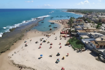
Sugar mills on the outskirts of Porto de Galinhas PE, date back to colonial Brazil. The historical origins and the social and economic development of the state of Pernambuco are closely linked to the sugar agro-industry, which, after four centuries at its peak, has left the Pernambucans a legacy of […]
Posts — Travel Guides and Tips for the North-East and Brazil | Bahia.ws
Map of Brazil from 1850: A Historical Overview
Map of Brazil from 1850 The maps in The Illustrated Atlas were first published as a series for an audience that was isolated by the cost and difficulty of travel. All this changed as the nineteenth century brought rapid and dramatic changes in public awareness of distant places. Undoubtedly, Tallis’s […]
Map of South America from 1740: Historical Insights
Map of South America from 1740 Beautifully engraved Italian edition of Delisle’s map of South America, extending from Nicaragua to Tierra del Fuego. Place names in South America are mainly concentrated along the coasts and along the Amazon and Paraná rivers. Two mythical lakes also appear: Lake Cassipa Dorada (a […]
Map of South America from 1619: A Historical Insight
Map of South America published in 1619 Excellent folio map of the continent, added by Jodocus Hondius for publication in his continuation of the Mercator Atlas. The interior shows the great mythical Parime Lacus straddling the equator and an equally interesting river system. The huge Rio de la Plata flows […]
Map of South America from 1615: Explore the Details
Map of South America published in 1615 Excellent folio map of the continent, added by Jodocus Hondius for publication in his continuation of the Mercator Atlas. The interior shows the great mythical Parime Lacus straddling the equator and an equally interesting river system. The huge Rio de la Plata flows […]
Map of Recife in Pernambuco from 1679: Historical Insights
Map of Recife in Pernambuco from 1679 – Brazil A rare aerial view of the city of Recife and its surroundings, particularly notable for its Dutch fortifications. Although originally founded by the Portuguese, the Dutch decided to invade several cities in Pernambuco due to the local sugar cane industry. From […]
Copper Engraving of Salvador from 1748: History Explored
Copper engraving of Salvador, Bahia, 1748 This sheet shows two views of São Salvador, the capital of colonial Brazil. At the top is a panoramic view of the city’s fortifications, and at the bottom is a perspective view of Fort St Bartholomew and its protective harbour. Below is a key […]
Map of Brazil from 1798: Explore Historical Details
Map of Brazil from 1798 This is an unusual Italian map of Brazil, Paraguay and Uruguay. It covers the area around Buenos Aires. It provides a good level of detail, including extensive river systems. The large landscape-style title page shows Indians tending a fire. “Brazil and the Land of the […]
Map of the Province of Paraíba from 1698 Overview
Map of the Province of Paraíba from 1698 This impressive map covers the province of Paraíba, showing its major rivers and flourishing sugar cane plantations. It was one of 23 maps in this rare account of the Dutch-Portuguese colonial war. Written by João José de Santa Teresa, known to bibliophiles […]
Map of Brazil from 1695: A Historical Overview
Map of Brazil from 1695 This rare and beautiful map is Johannes Blaeu’s third map of Brazil. Designed by Joannes de Broen and engraved by Abraham Wolfgang, it was completed shortly before the great fire that destroyed the printing works and was therefore never included in Blaeu’s atlases. In 1694 […]
Lajedo de Pai Mateus and Its Unique Geological Features
The Lajedo de Pai Mateus The Lajedo de Pai Mateus is a remarkable geological and tourist attraction located in the state of Paraíba, Brazil. This impressive rock formation is characterised by large blocks of stone spread over a vast flat surface of granite. With its unique beauty, the Lajedo has […]
Areia (PB): attractions, historic center and sugar mills
Areia, in Paraíba, is the “Princesa do Brejo” (Princess of the Brejo): a historic town high up in the Serra da Borborema, more than 600 m above sea level, with a mild climate all year round. The historic center, listed by IPHAN, has cobblestone streets, colorful mansions and the Teatro […]
Mataraca (PB): Beaches, Barra de Camaratuba and Things to Do
Mataraca is the last municipality on the northern coast of Paraíba, on the border with Rio Grande do Norte. It is famous for Barra de Camaratuba, where the Camaratuba River meets the sea, and for the mangroves of the Parque Ecológico do Caranguejo-Uçá. In addition, the town has the Igreja […]
Map of South America, 1840
Map of South America, 1840 This impressive large map is taken from Louis Stanislas D’Arcy Delarochette’s monumental eight-sheet map of South America, which was used to settle countless boundary disputes across the continent. It contains the most up-to-date geographical information and numerous interesting annotations. Three insets at the bottom of […]
Map of Paraíba from 1662: An Engraved Masterpiece
Map of Paraíba from 1662 Excellent map of the Brazilian coast, including the captaincies of Paraíba and Rio Grande. The map was drawn after actual surveys by Georg Markgraf, Elias Herckmanns and others, and was one of the first maps of Brazil based on non-Portuguese data. The map is richly […]
View of Rio de Janeiro in 1840: Beauty Captured
View of Rio de Janeiro in 1840 This is a fine view of Rio de Janeiro and its harbour, drawn by E. Duncan and engraved by R.A. Prior. “Rio de Janeiro”, Blackie, W.G. & Son
Map of the Captaincy of Espírito Santo and Porto Seguro from 1698
Map of the Captaincy of Espírito Santo and Porto Seguro from 1698 This impressive map covers the coast from Rio de Janeiro to about Ilhéus. It was one of 23 maps in this rare account of the Dutch-Portuguese colonial war. Written by João José de Santa Teresa, known to bibliophiles […]
Map of South America from 1650: A Historical Overview
Map of South America from 1650 This attractive map shows the continent with Sanson’s characteristic attention to detail. The relatively unknown Amazon region is the subject of little speculation. The mythical Lac de Parime still appears, with the legendary Manoa del Dora (City of Gold) on its western shore, although […]
Map of the Captaincy of Pernambuco from 1698 Overview
Map of the Captaincy of Pernambuco from 1698 This magnificent map of the Brazilian province of Pernambuco was one of 23 maps in this rare account of the Portuguese-Dutch colonial war. Written by João José de Santa Teresa, known to bibliophiles as Santa Teresa, it is considered one of the […]
Map of Santa Catarina Island 1777: A Historical Treasure
Map of Santa Catarina Island 1777 This is a rare Spanish map of the island of Santa Catalina, now the city of Florianópolis and a major tourist destination. It shows the unspoilt island with a few small villages and several sheltered anchorages. A view of the approach to the coast […]