Exploring Juazeiro: Cultural and natural heritage on the banks of the São Francisco River
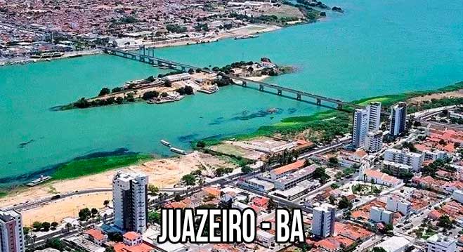
Juazeiro is a Brazilian municipality located in the state of Bahia, on the banks of the São Francisco River.
Founded on 15 July 1878, it is part of the sub-middle region of the São Francisco river basin and, together with Petrolina (PE), forms the largest urban agglomeration in the Brazilian Semiarid region, which is characterised by a climate with low rainfall.

Juazeiro is known as the Land of the Carrancas, famous figures that symbolise protection on the boats that used to sail down the river.
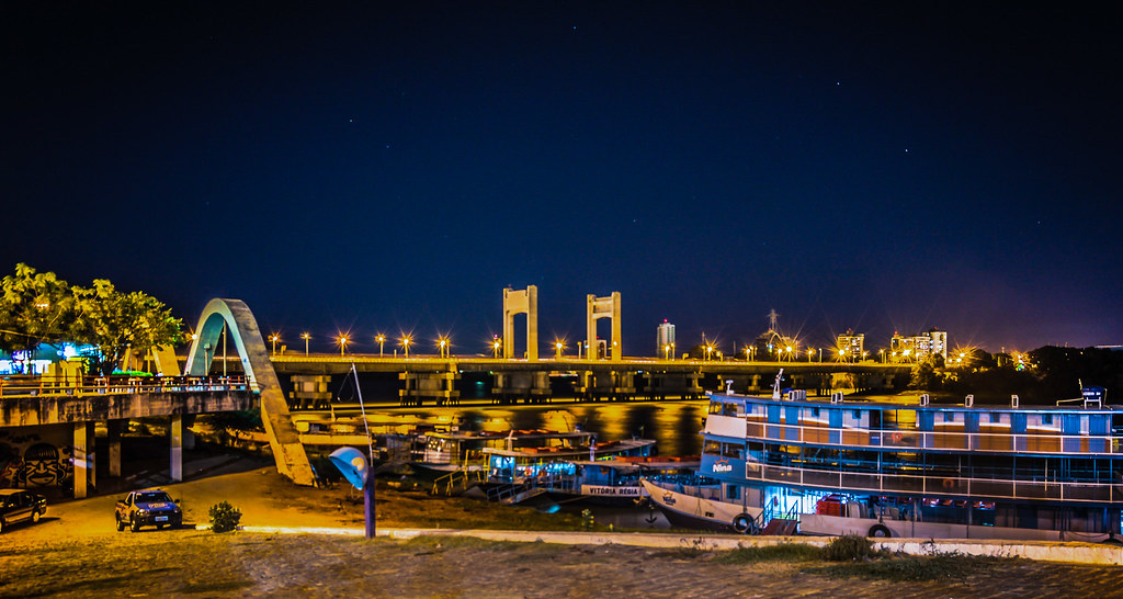
Contrary to the image of a rough place, Juazeiro is a modern city with new buildings and paved streets, as well as a public promenade along the river, ideal for enjoying the sunset.
The river is home to several islands, such as Massanganos, popular for luaus at night, and trails for trekking enthusiasts.

What “Terra das Carrancas” means
The expression “Land of the Carrancas” refers to Juazeiro because of the carrancas, carved wooden figures, usually with human or animal faces, that were traditionally placed on the bow of boats sailing down the São Francisco River.

These figures were used to ward off evil spirits and protect navigators during their crossings. The carrancas are a representation of popular culture and local identity, symbolising the relationship of the inhabitants with the river and their traditions.
The title “Terra das Carrancas” therefore emphasises the cultural and historical importance of this element in Juazeiro’s identity, as well as the beauty and uniqueness of the region.
History of Juazeiro
Juazeiro began as an old port for marketers and traders, and its name comes from the juazeiros, the trees of the region.
The city has developed into an agro-industrial centre, with intense export activity, and stands out for its irrigated agriculture, especially in the production of tropical fruits such as mangoes and grapes.
CULTURE
Juazeiro is rich in cultural traditions, with festivals such as the São João Festival, which celebrates northeastern folklore with typical dances and food.
The city is also known for its music, especially styles such as forró and axé, which attract many visitors to local events.
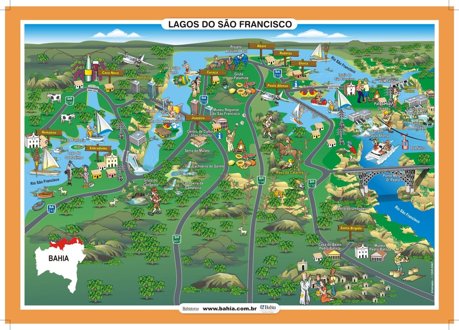
See the map of Lagos de São Francisco
Main attractions
- Rodeadouro Island: Known for its white sandy beaches and visitor infrastructure.
- Ilha do Fogo: Located in the centre of the Eurico Gaspar Dutra Bridge, with a 20m high rock. Ilha do Fogo is located between the municipalities of Petrolina, in the Sertão region of Pernambuco, and Juazeiro.
- Ilha Culpe o Vento: Ideal for wild camping.
- Ilha de Nossa Senhora: Rich in vegetation and popular for its beautiful beaches.
- Salitre Waterfall: A 2 metre waterfall, popular with children.
- Gameleira Waterfall: located in a paradisiacal setting, ideal for jumping.
- Gruta do Convento: With stalactites and stalagmites, perfect for ecotourism.
- Valley of São Francisco: A region of unique natural beauty.
- São Francisco Museum: important for learning about the history and culture of the region.


How to get there
The city is approximately 500 kilometres from Salvador, although this distance can vary. The Petrolina airport, located about 15 kilometres from Juazeiro, is also an option.
Juazeiro is a destination that combines history, culture and nature, offering visitors many options.
Publicações Relacionadas
Discover the São Francisco River Valley Region - Tourist Guide
Wine Tourism in the São Francisco Valley Guide
Barreiras: Where Carnival Meets Adventure Tourism
Campo Formoso: Explore Caves and Emerald Trade
Santa Rita de Cássia: Attractions and Activities
Paulo Afonso's Beautiful Waterfalls and Canyons
Correntina: Discovering the Heart of Bahia
São Desidório: Explore Caves and Biodiversity
Bom Jesus da Lapa Sanctuary: Faith, History and Natural Beauty in Bahia
History of grape and wine production in the São Francisco Valley
This post is also on:
![]() Português
Português ![]() English
English ![]() Deutsch
Deutsch ![]() Español
Español ![]() Français
Français


