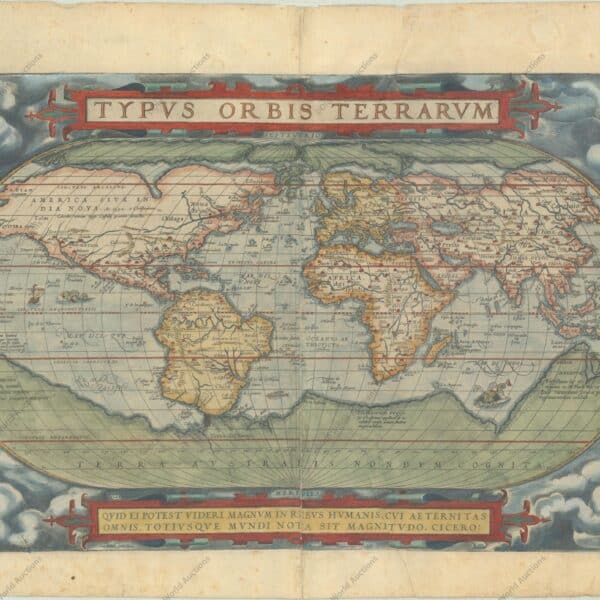
Charting the Age of Discovery: The Cartography of Early Global Exploration The second great contribution to the revival of cartography was made by the leaders of overseas expansion: the seamen of many nations — Italian, Portuguese, Spanish, French, Dutch and English — who, in little more than a century, opened […]
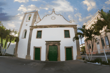
Posts — Travel Guides and Tips for the North-East and Brazil | Bahia.ws
The revival of Ptolemy’s Geography in the 15th century
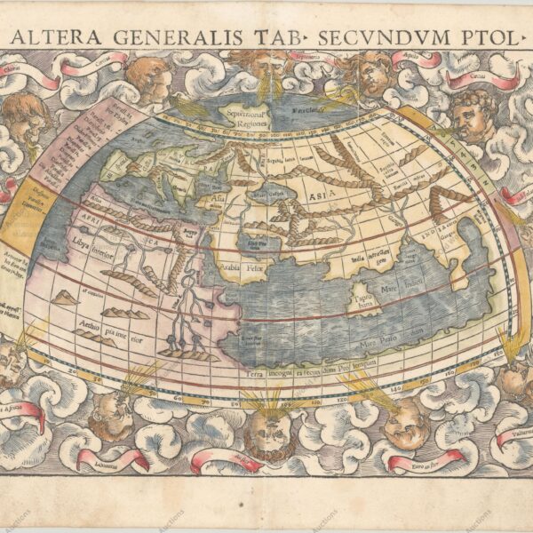
The Revival of Ptolemy’s Geography: From Ancient Texts to Renaissance Printed Maps In discussing the latest forms of the medieval mappa mundi, we have had occasion to refer to the spreading knowledge of the maps accompanying the Geography of Claudius Ptolemaeus (or Claudius Ptolemy) in the fifteenth century, and possibly […]
Fifteenth‑Century World Maps: Fra Mauro and Martin Behaim
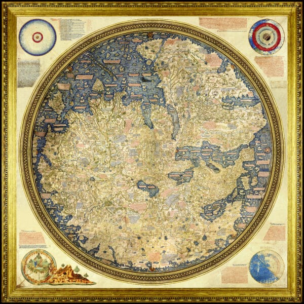
CONTEMPORARY with the later Catalan maps are several mainly of Italian origin which also preserve some medieval features, but show very markedly the influence of Ptolemy’s ‘Geography’, manuscripts of which were circulating in western Europe at least as early as the opening decades of the fifteenth century. Andreas Walsperger (1448) […]
The Catalan Atlas: Redrawing the Medieval World and Asia
Catalan World Maps: Transforming Medieval Cartography and the Representation of Asia Introduction Another notable stage was reached in the fourteenth century, when European cartographers made the first attempt since classical times to include the continent of Asia within their world picture on the basis of contemporary knowledge. The results of […]
Cartography: From Antiquity to Medieval Maps Explained
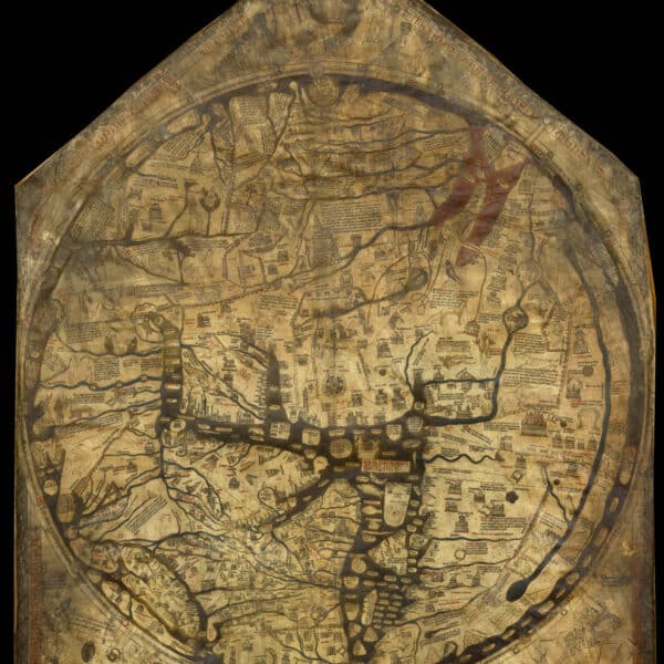
From Ancient Surveys to Medieval Mappa Mundi: The Evolution of Cartography Introduction It is often noted that contemporary primitive peoples, ranging from the Inuit of the Canadian Arctic to the Bedouin tribesmen of the Arabian Desert, possess an innate ability to produce rough yet precise sketches on animal hide or […]
Medieval Maritime Cartography Advancements Explained
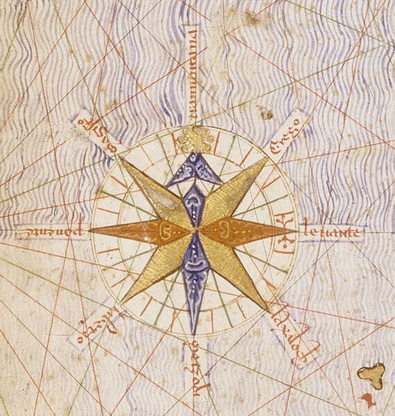
Medieval Maritime Cartography: The Rise and Development of Portolan Charts Introduction Towards the end of the thirteenth century a new type of chart appeared in Western Europe that marked a major advance in medieval cartography. These charts broke with earlier practice by relying on direct observation aided by the new […]
The evolution of European cartography in the 16th and 17th centuries
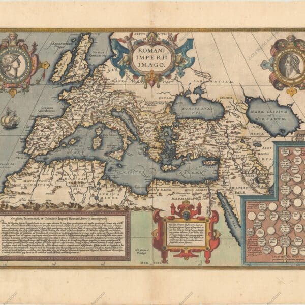
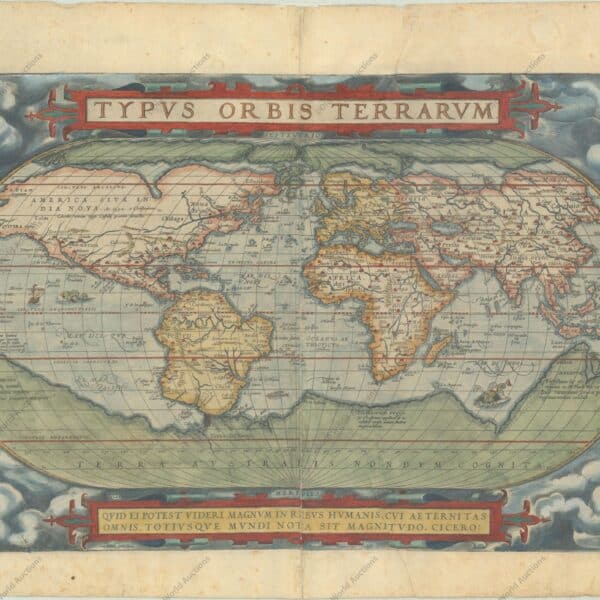
The evolution of European cartography (16th-17th centuries): Mercator, Ortelius and the Dutch centres Index Introduction The first atlases and supplements Gerhard Mercator: background and early work The problem of navigation and loxodromes Mercator’s map of Europe (1554) Methods and limitations of ancient cartography The reception of Mercator and other maps […]
3 Days in Maceió and Surroundings: A Guide
Maceió, the capital of Alagoas, is known for its idyllic beaches and natural pools with warm, crystal clear waters. A 3-day itinerary is perfect to see the highlights of the city, relax and enjoy its natural beauty. 3 days in Maceió and surroundings See also Maceió: A must-see destination in Alagoas. […]
What to Do in Fortaleza in 3 Days: A Complete Itinerary
Fortaleza, the capital of Ceará, is a vibrant city on Brazil’s north-eastern coast, famous for its stretches of beach, tropical climate and vibrant cultural scene. If you’re wondering what to do in Fortaleza in 3 days, this itinerary combines city beaches, culture and day trips to the surrounding area. With […]
1671 Map of Mexico and Central America – Historical Map
1671 Map of Mexico and Central America “Yucatan Conventus Iuridici Hispaniae Novae Pars Occidentalis, et Guatimala Conventus Iuridicus”, Montanus/Ogilby Montanus’ work was perhaps the largest illustrated book on the New World produced in the 17th century. It contains over one hundred beautifully engraved plates, views and maps of North and […]
Skydiving in Bahia: Paragliding and Hot-Air Balloons
Want to see Bahia from above? Skydiving in Bahia lets you jump over the beaches of the north coast, while paragliding in Jacobina and hot-air ballooning in the Recôncavo offer calmer flights. In addition, there are options for every level of adrenaline, from families to thrill-seekers. For this reason, in […]
Carlos Julião: The Military Engineer and Artist Who Depicted Colonial Brazil
Carlos Julião, a military engineer and a draughtsman of Italian origin in the service of the Portuguese Crown, never actually lived or settled in Brazil. He lived in Portugal, where he worked in the colonial administration, but produced a vast body of work on the Portuguese colonies, including Brazil. His drawings and watercolours document the social life, cultural life and ethnic life of the colonies and […]
Jews in Colonial Brazil: A Hidden History
Jews in colonial Brazil faced a complex and often difficult situation. During the colonial period, Brazil was a Portuguese colony, and the Inquisition had a great influence on social and religious life. Judaism was therefore prohibited, and any Jewish practices were strictly repressed. Judaism had four phases in colonial Brazil […]
Explore the Archaeological Marvels of São Raimundo Nonato
São Raimundo Nonato, located in the state of Piauí, is a city that attracts tourists interested in history, culture, archaeology and nature. São Raimundo Nonato is the main gateway to the Parque Nacional da Serra da Capivara, one of the most important archaeological sites in Brazil and the world. The […]
Bonito MS Tourist Attractions: Unforgettable experiences
Bonito Tourist Attractions: Unforgettable experiences Until the mid-1980s, the city of Bonito was a quiet farming town, a route for large herds of cattle. Just over a decade later, Bonito became the mecca of ecotourism in Brazil. Located between the Bodoquena Mountains and the Miranda River, 285 kilometres from the […]
Miranda, Mato Grosso do Sul: Rural Tourism Guide
The town of Miranda, in Mato Grosso do Sul, is a base for travellers crossing the southern part of the Pantanal, and there are a few ranches in the area where you can spend the day, stay overnight and go on some Pantanal tours. The town of Miranda is situated […]
11 Heritage-Listed Historic Towns in Bahia, Brazil
Bahia has 11 heritage-listed historic towns, with urban ensembles protected by IPHAN, Brazil’s national heritage institute. After all, these towns tell the story of how Bahia was settled, from the sugar-cane coast to the diamond backlands. For this reason, in this guide you will get to know each town, the […]
Chronology of Portuguese discoveries and maritime expansion
Portuguese discoveries were the result of Portuguese maritime expansion, which marked the history of Portugal and the world. Throughout the 15th century, the Portuguese transformed and perfected all known shipbuilding and navigation techniques. Portuguese maritime expansion was an unprecedented development. One gets the impression that if it took eighty years […]
Chronology of slavery in colonial and imperial Brazil – History
Sunday 13 May 1888 dawned sunny in Rio de Janeiro, the capital of the Brazilian Empire. It was a day of celebration. Slavery was ended by a law passed by the Senate and signed by Princess Isabel. Brazil was the last country in the Americas to abolish slavery. Over the […]
Map of Africa from 1570
Historical Map of Africa from 1570 Ortelius’ Cornerstone Map of Africa “Africae Tabula Nova”, Ortelius, Abraham Period: 1570 Publication: Theatrum Orbis Terrarum This striking map is one of the cornerstone maps of Africa and remained the standard map of Africa well into the seventeenth century. It was designed by Ortelius […]