Published on · Updated on
The Marajó Archipelago lies at the mouth of the Amazon River, in Pará, where the Amazon meets the Atlantic Ocean. It is made up of thousands of islands, and the largest of them is Marajó Island, covering about 40,100 km², the largest fluvial-marine island in the world. In addition, the region is famous for its buffalo, açaí berries, carimbó (a traditional dance and rhythm) and cerâmica marajoara (Marajoara pottery).
- Where it is: at the mouth of the Amazon River, in Pará, near Belém.
- Islands: estimates range from 2,500 to 3,000 islands.
- Marajó Island: about 40,100 km², divided into 12 municipalities.
- Most visited towns: Soure and Salvaterra.
- How to get there: by boat or ferry from Belém, to Porto de Camará, in Salvaterra.
- Highlights: buffalo, queijo do Marajó (buffalo-milk cheese), Marajoara pottery, river and sea beaches and carimbó.

Map of Marajó Island
On the map of Brazil, Marajó Island lies in northern Pará, just above Belém, between the mouth of the Amazon River to the west and the baía do Marajó to the east. As a result, it is bathed by the Amazon River, the Pará River and the Atlantic Ocean.
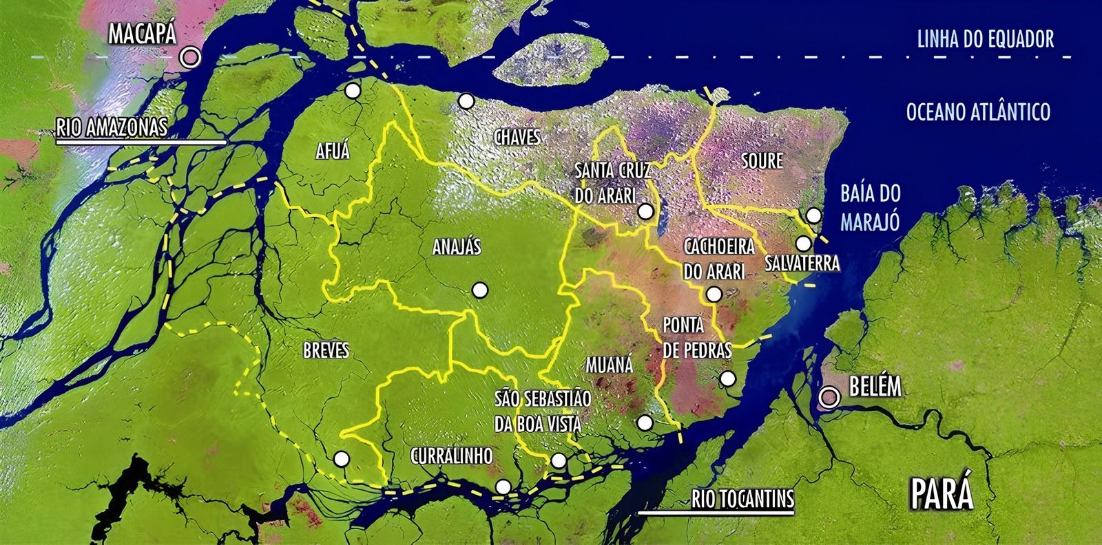
The eastern side of the island, for example, has fields and floodplains, where Soure, Salvaterra and Cachoeira do Arari are located. The western side, on the other hand, is covered by dense forest, with towns such as Breves, the most populous in the archipelago, with 106,968 inhabitants (IBGE, 2022 Census).
Nature and culture of Marajó

Baía de Marajó09:23

Arquipelago de Marajó10:07

Descubra A Ilha de Marajó: O Paraíso da Amazônia03:42
At about 40,100 km², Marajó Island is larger than Belgium. Its fauna and flora, moreover, are among the richest in the Amazon, with many birds, fish and mangroves.
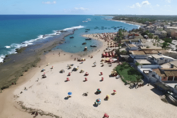
The calm-water beaches, bathed by both river and sea, are another attraction. Besides that, Marajó is famous for açaí, for the rhythms of carimbó and lundu (traditional dances and rhythms) and for Marajoara pottery, created by Indigenous peoples who lived on the island between roughly 400 and 1400 AD.
Pororoca
The Marajó region is also home to the pororoca (tidal bore), a phenomenon in which the ocean tide pushes into the rivers and forms powerful waves. In general, it is strongest during the full-moon and new-moon tides, especially in the first half of the year. For this reason, it attracts surfers and curious onlookers.

Buffalo of Marajó
During the rainy season, from January to May, much of the grassland is flooded. This condition, however, favors buffalo farming, and Marajó has the largest herd in Brazil.
The buffalo are used for farm work and even for transportation. In Soure, for example, the police patrol on buffalo. Buffalo meat and milk also feature in several typical dishes, such as queijo do Marajó.

How to get to Marajó
The most common way in is by river, from Belém. First, boats, speedboats and ferries take you to Porto de Camará, in Salvaterra; the trip usually takes two to three hours, depending on the vessel. Then, to reach Soure, you cross the Paracauari River by ferry or boat.
Since schedules and prices change, check in advance at the terminals in Belém.
What to do in Marajó
- Beaches: in Soure, for example, you will find the praias do Pesqueiro, Barra Velha and Araruna; in Salvaterra, meanwhile, there is Joanes.
- Farms: many of them welcome visitors for buffalo rides and birdwatching.
- Food: try queijo do Marajó, buffalo steak and açaí.
- Handicrafts: above all, buy pieces of Marajoara pottery made by local artisans.
- Best time to go: in general, from July to December, during the drier season, which is good for the beaches.
See also other islands of Brazil.
Frequently asked questions about the Marajó Archipelago
On a map of Marajó Island, where exactly is it?
In northern Pará, at the mouth of the Amazon River, just north of Belém.
Thus, it lies between the Amazon River, the Pará River and the Atlantic Ocean.
How big is Marajó Island?
About 40,100 km², the largest island in Brazil.
For this reason, it is also the largest fluvial-marine island in the world.
How many islands does the Marajó Archipelago have?
Estimates range from 2,500 to 3,000 islands.
The largest, however, is by far Marajó Island.
How do you get to Marajó Island?
By boat or ferry, from Belém, to Porto de Camará, in Salvaterra.
After that, a ferry crosses the river to Soure.
When is the best time to visit Marajó?
In general, from July to December, when it rains less.
From January to May, by contrast, many fields are flooded.

Publicações Relacionadas
Alcatrazes Archipelago: Secrets of Evolution Revealed

Jararaca-ilhoa: Endemic Species of Queimada Grande
Trindade and Martim Vaz: Discovering the Archipelago

Anchieta Island: History, Beaches, and Nature
Ponta do Boi Lighthouse: History and Significance

Ilha de Itamaracá (PE): beaches, Forte Orange and things to do

São Pedro e São Paulo Archipelago: An Overview
Ilha Grande: The Ultimate Tropical Paradise
Florianópolis: Guide to Beaches, Tours and Nightlife
Ilhabela: A Tropical Paradise Awaiting You
Atol das Rocas - Origin, biology, climate and shipwrecks

Islands of Brazil: map, oceanic and coastal islands