Exploring the Southern Coast of Alagoas: Biodiversity and Tourism
The southern coast of Alagoas is known as the Region of the Lagoons and Southern Seas.
Nature spared no effort in bestowing its bounty upon this part of Alagoas. There are vast coconut groves, idyllic beaches, lagoons and rivers that flow into the sea, creating a scene of pure magic.
As well as its lush natural surroundings, the history and culture are evident in its historical heritage, folk traditions, music, crafts and cuisine, which is made using ingredients sourced from the waters of this incredibly diverse area in the Lagoas and Mares do Sul region.


Tourist Attractions and Towns on the Southern Coast of Alagoas

Região das Lagoas e Mares do Sul de Alagoas06:08

Pontal do Coruripe04:55

Praia do Frances02:58

Litoral Sul de Maceió05:07
Marechal Deodoro em Alagoas02:41
1. Pilar
Located 42 km from Maceió, the town of Pilar was founded in the 19th century as a sugar cane mill. In 1860, the town was visited by King Pedro II, and there are still some examples of houses dating from this period of colonial Brazil.

Pilar’s main attraction is its natural beauty. The town, situated on the shores of Lagoa Manguaba, is surrounded by remnants of Atlantic Forest, numerous farms with nature reserves, and mineral water springs.
Pilar em Alagoas
The population is approximately 36,000. Pilar is a lively town, and highlights of its events calendar include the Catfish Festival, the Crab Festival and the Feast of the Patron Saint, Our Lady of Pilar, which attract many visitors.
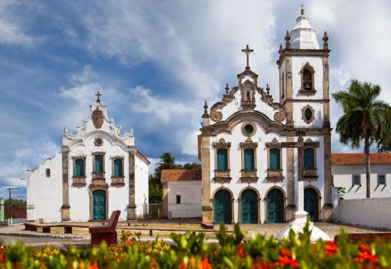
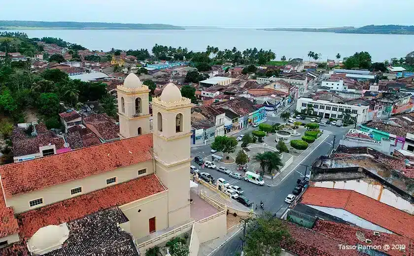
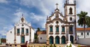
2. Marshal Deodoro
Marechal Deodoro is situated on the southern coast of Alagoas, 30 km from Maceió. It has a population of approximately 45,000. Marechal Deodoro was the first capital of Alagoas, and is named after the illustrious son of the city who proclaimed the Republic of Brazil.
The town boasts a fine collection of architectural treasures, to be found in the museum and in churches dating from the 16th, 17th and 18th centuries.

Marechal Deodoro - Guia de Turismo02:41

Museu de Artes Sacra de Marechal Deodoro
Praia do Francês em Alagoas02:19

Massagueira em Alagoas02:07
Marechal Deodoro em Alagoas - Drone
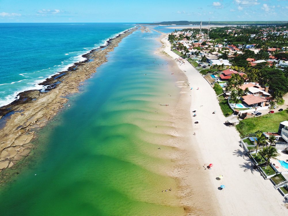
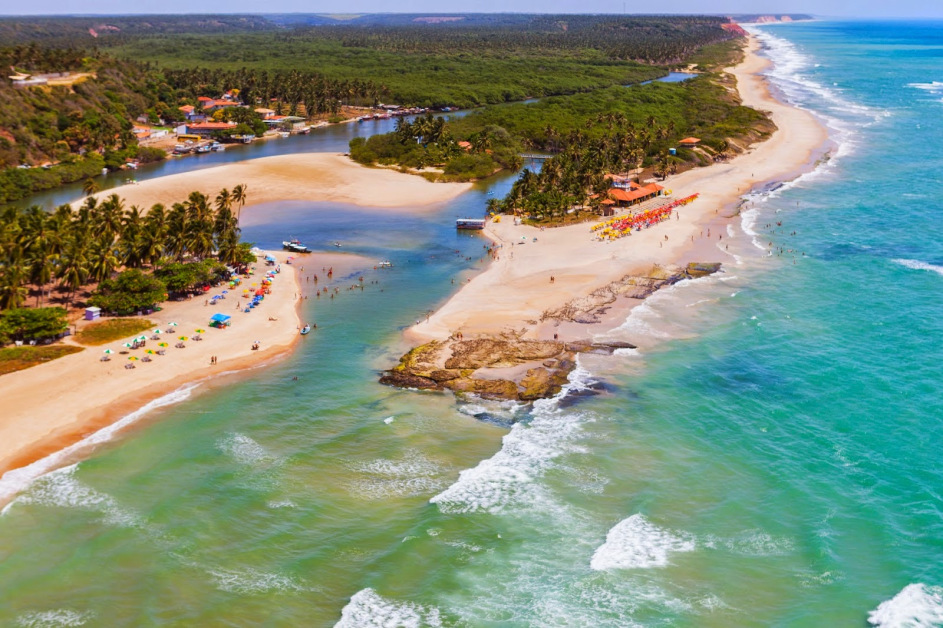
Marechal Deodoro boasts enviable natural beauty: the Manguaba Lagoon, nestled amongst islands and channels, which joins the Mundaú Lagoon to form the country’s largest lagoon complex, home to many islands, the most important of which is Santa Rita, the country’s largest lake island.
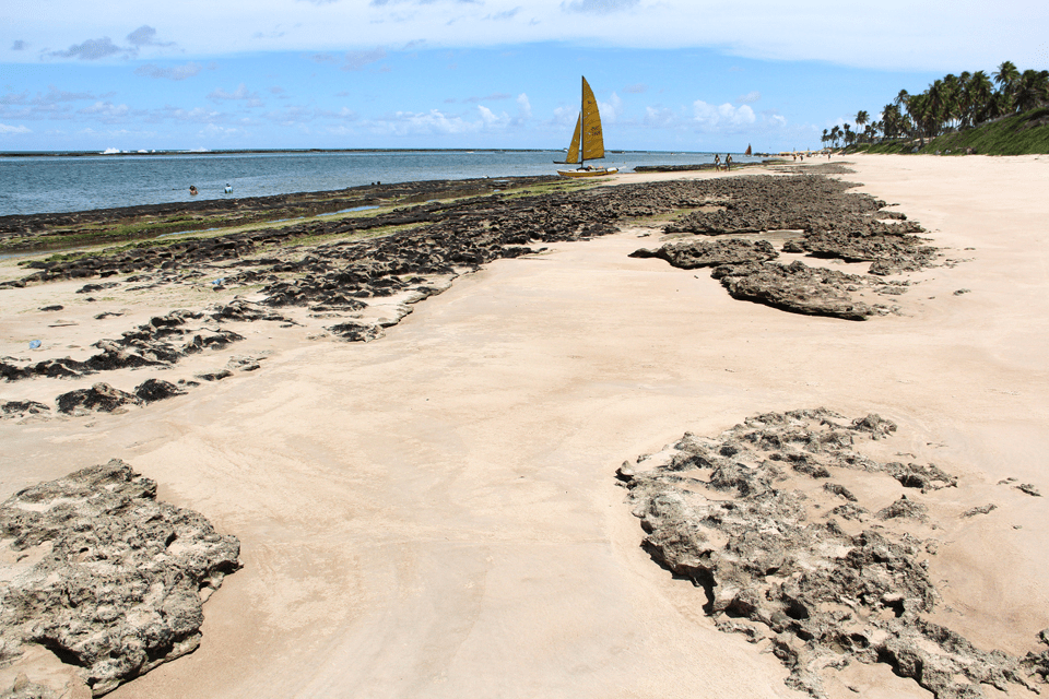
Praia do Francês in Marechal Deodoro is a picture-postcard spot, with its impressive array of restaurants and guesthouses ready to welcome visitors from all over.

Folklore and music are an attraction in their own right. The diverse handicrafts, renowned for their beauty and creativity, are exported throughout Brazil. The flavours of the cuisine are unrivalled and cater to every palate.
On the shores of Lagoa Mundaú lies Massagueira, the largest culinary hub in the North-East.

3. Barra de São Miguel
Barra de São Miguel is situated on the southern coast of Alagoas, 33 km from Maceió, and has a population of approximately 9,000 inhabitants. Barra de São Miguel offers excellent accommodation, restaurants and other entertainment options.
Praia de Barra de São Miguel em Alagoas03:11
Praia das Conchas na Barra de Santo Antonio
Praia do Gunga em Alagoas03:29
Conheça a Barra de São Miguel - AL
It is the ideal place for leisure and relaxation. The main attractions of Barra de São Miguel are its beautiful beaches, notably Conchas, Niquim and Meio, where the sea is bordered by a wall of reefs, ideal for refreshing dips in the calm, crystal-clear waters.
Gazing out at the horizon, one is struck by the deep blue of the sea, which blends into the blue of the sky – a scene conceived by the Creator.
The Niquim and São Miguel rivers are rich in mangroves, and the lagoon showcases the exuberance of the ecosystem. The point where the river, lagoon and sea meet can be seen from the Alto de Santana Viewpoint.
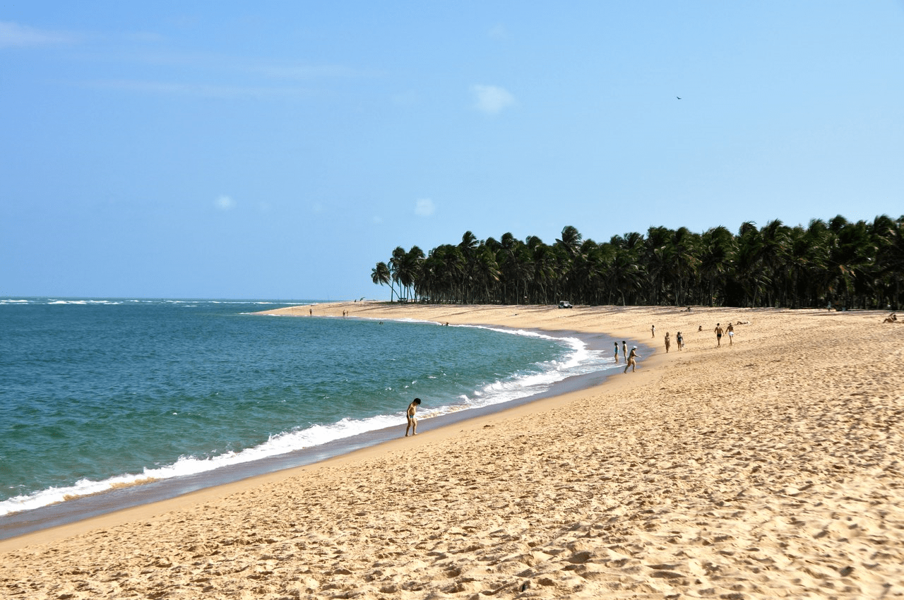
The view is wonderful: the deep blue of the ocean, dotted with coconut palms. Several boats glide across the water until they reach the most popular destination, Gunga Beach, framed by coconut palms stretching as far as the eye can see.
Gunga Beach is situated where Lagoa do Roteiro meets the sea – a heavenly spot unlike any other.


4. Itinerary
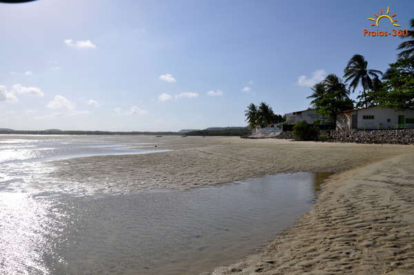
The town of Roteiro is 49 km from Maceió and has a population of approximately 8,000 inhabitants. Its first inhabitants were the Caetés indigenous people, around 1853.

Cidade de Roteiro em Alagoas
The village was founded in 1900 following the construction of the first chapel, dedicated to Nossa Senhora do Livramento.
In 1963, the village was granted town status. Roteiro is home to one of Alagoas’s biggest tourist attractions and is internationally renowned as one of Brazil’s most beautiful beaches.
It is a place of outstanding beauty, ideal for leisure and water sports. From the viewing point, there is a beautiful view of Gunga Beach and the beaches of Barra.
5. Jequiá da Praia
Jequiá da Praia is a town in the state of Alagoas. Situated 65 km from Maceió, it has a population of 15,000 inhabitants.
The name Jequiá da Praia is of indigenous origin and means ‘basket full of fish’. Jequiá da Praia is an unspoilt corner of the countryside which, until 1998, belonged to the municipality of São Miguel dos Campos.
Dunas de Marapé e Jequiá da Praia03:02

Dunas de Marapé e Jequiá da Praia04:58

Atrações turísticas no município de Jequiá da Praia
The municipality boasts a vast ecosystem of preserved flora and fauna, with a lake system comprising 3 rivers and 7 lagoons – notably the Azeda, Jacarecica and Jequiá lagoons – the third largest in Brazil – as well as several exotic beaches, such as Jacarecica do Sul and Barra de Jequiá, which complete the scenery created by nature.
It boasts a range of tourist facilities, including guesthouses, restaurants and a leisure complex set amidst the natural beauty of the area, preserving the local vegetation and offering visitors the chance to interact with wildlife.


6. Coruripe
Coruripe is situated on the southern coast of Alagoas, 90 km from Maceió, and has a population of 50,000 inhabitants. The town’s name is of indigenous origin and means ‘on the river of frogs’. At the start of colonisation, the area was inhabited by the Caetés indigenous people.
Pontal do Coruripe em Alagoas
The municipality of Coruripe began to develop around the 19th century. Prior to that, it had been influenced culturally by the Portuguese and the Dutch, events which have shaped the municipality’s history.
The Parish Church of Nossa Senhora da Conceição, dating from the 18th century, is built in the Neoclassical style. The statues of Saint Sebastian, Saint Joseph, Saint Anthony, Our Glorious Lord and Our Lady of the Immaculate Conception form part of the church’s collection.
Hiring a horse and setting off on a ride along the paths through the coconut groves is a chance to discover landscapes that seem to exist only in dreams. Nature has really outdone itself in Coruripe.
The stunning sea and abundance of coconut palms make this a truly special place. The municipality boasts beautiful beaches, notably Lagoa do Pau, Miaí de Cima and Miaí de Baixo.
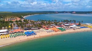
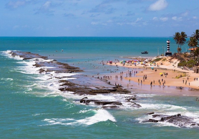
Each one stands out for the unique nature of its beauty, as is the case with Pontal de Coruripe, which has been a landmark since 1948, when a lighthouse was built to guide ships.

Pontal is a fishing village that has become an attractive tourist destination. It offers comfortable guesthouses and all the facilities needed for a leisurely stay.
Handicrafts are a major attraction; the fishermen’s wives spend their days making small baskets, jewellery boxes, handbags and hats from the straw of the ouricuri, a species of palm tree found in the region.
7. Happy Desert
Feliz Deserto is 118 km from Maceió and has a population of 4,000 inhabitants. There is a legend that explains the origin of the town’s name.
It is said that Mr Domingos, having survived a shipwreck, found an image of Our Lady, Mother of Mankind beneath a leafy cashew tree.

Feliz Deserto em Alagoas
Mr Domingos was amazed to come across such a sight in such a desolate place. Originally, the lands of Feliz Deserto were occupied by the Caetés indigenous people, who lived there.
The village became a town in 1960, having previously been part of the municipality of Piaçabuçu.
Feliz Deserto has spots where nature reveals its splendour, such as the Toco and Maçunim beaches. The handicrafts, made from cattail straw, are renowned nationwide for their beauty and creativity.

This post is also on:
![]() Português
Português ![]() English
English ![]() Deutsch
Deutsch ![]() Español
Español ![]() Français
Français


