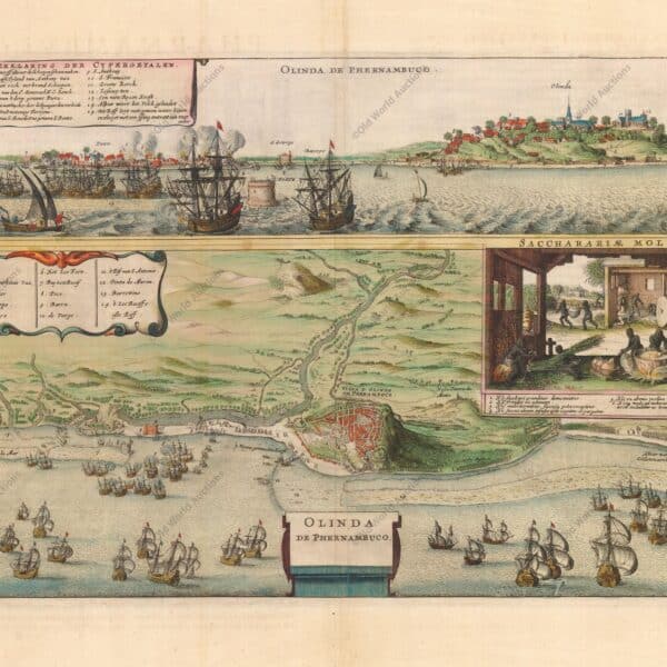
Map of Olinda in Pernambuco from 1640 This map shows two views of the Portuguese sugar colonies in Brazil during the Dutch invasion in 1630. The top view shows the Dutch fleet attacking the port and fort. Below is a plan of the town of Olinda and its surroundings, with […]
Tag: Jansson
Map of Brazil from 1652: A Historical Perspective
Map of Brazil from 1652 Beautiful depiction of Brazil with north oriented to the right by a beautiful compass rose. The map shows two regions of Dutch interest in the area, Baía de Todos os Santos and Pernambuco. The interior is devoid of geographical information, except for largely imaginary rivers […]


