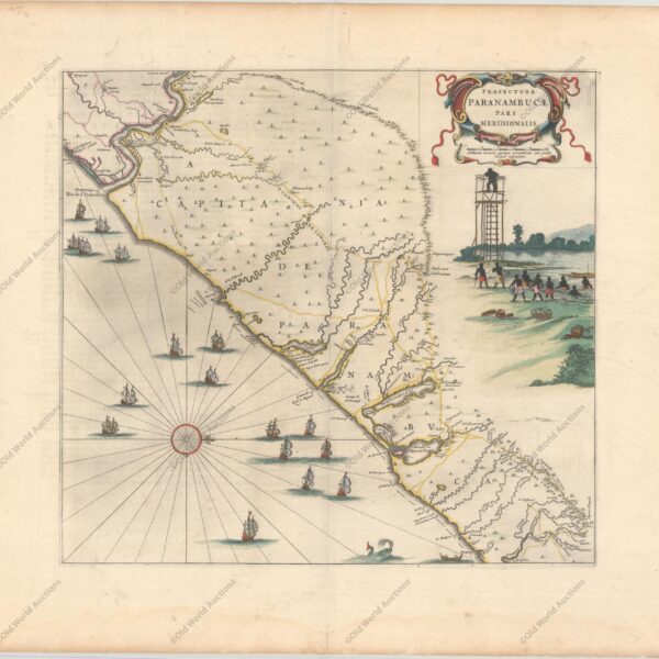
Map of Eastern Brazil 1664 This beautiful map of the Brazilian coast is richly decorated with a scene of natives with a watchtower and a huge fleet of ships. With north to the right, the map covers the coastal region from São Francisco to Recife. It was based on real […]
Tag: Blaeu
Map of the Captaincy of Paraíba and Rio Grande, 1720
Map of the Captaincy of Paraíba and Rio Grande from 1720 Excellent map of the Brazilian coast, including the captaincies of Paraíba and Rio Grande. The map was drawn after real research by Georg Markgraf, Elias Herckmanns and others and was one of the first maps of Brazil based on […]
Map of the East Coast of Brazil, 1647 – Historical Maps
Map of the East Coast of Brazil from 1647 This beautiful map of the Brazilian coast is decorated at the top with a huge garland of native fruits and a jaguar, tapir and capybara. With north to the right, the map covers the coastal region from São Francisco south to […]
Map of Paraíba from 1662
Map of Paraíba from 1662 – Atlas Maior “Praefecturae de Paraiba, et Rio Grande”, Blaeu, Johannes Superb map of the Brazilian coastline including the capitanias of Paraiba and Rio Grande. The map was drawn after actual surveys by Georg Markgraf, Elias Herckmanns and others, and was among the first maps of Brazil […]