The trail to the Buracão Waterfall is one of the most fascinating in the region and offers an unforgettable experience. Located in the municipality of Ibicoara, the trail combines adventure and natural beauty, passing through impressive canyons, rivers and exuberant vegetation.
The Buracão Waterfall in the Chapada Diamantina has opened up tourism to the municipality of Ibicoara.
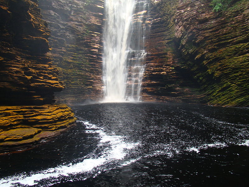
Trail to Buracão Waterfall
The trail to reach the waterfall is easy, taking about an hour and with practically no climbing.
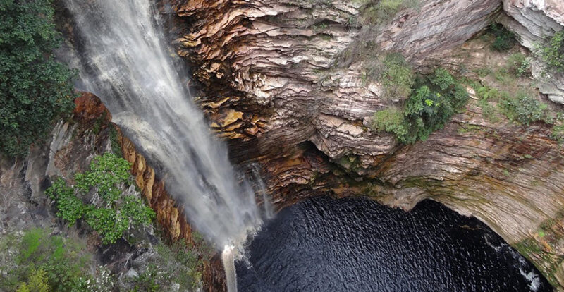
It starts at the entrance to the Espalhado Municipal Park, following the bed of the Espalhado River, which flows into the Buracão waterfall.
It all starts with the beautiful road from Ibicoara (28 kilometres of dirt), from where you can see huge mountains amidst the bucolic atmosphere of the farms.
The car is parked at the start of the trail (an hour’s walk), which follows a riverbed until you see the waterfall from above.
There begins the descent that passes the Recanto Verde water fall – a thin veil of water that falls through the forest – and leads to the canyon where the Buracão is located.

To see the falls from the front of the Buracão Waterfall there are two options: cross a footbridge and walk along narrow paths, always clinging to the wall; or swim (the guides offer life jackets).
The scenery is impressive: a hole in the middle of the rock and a drop that forms a huge pool.
Information about the trail
- Distance: Approximately 3 km (round trip), moderate level.
- Access: Starts at the Espalhado Municipal Natural Park, after a short drive from Ibicoara.
- Highlights: The route includes stretches inside the river (with the need to cross small currents), walks along the banks and, finally, the spectacle of the 85-metre waterfall, which plummets into an imposing canyon.
- Accompaniment: We recommend hiring a local guide for safety and to make the most of the historical and natural sights along the way.
At the end of the trail, you can swim in the well of the waterfall, which is one of the most memorable experiences on the Chapada Diamantina route.
Video about the Buracão Waterfall Trail


Cachoeira do Buracão - Parte 109:34

Cachoeira do Buracão - Parte 208:34

Cachoeira recanto verde na trilha do Buracão01:08
See the map of Chapada Diamantina
Map of the Chapada Diamantina Trails and Sights
Chapada Diamantina Tourist Guide
Bahia.ws is the largest tourist guide in Bahia and Salvador.
Publicações Relacionadas
Ventura Village: A Rich History of Diamonds
Poço Encantado in Chapada Diamantina
Rio de Contas: Learn about the history of the city's formation
Chapada Diamantina's architectural style and influences
Trekking in the Pati Valley in Chapada Diamantina
The highest and most beautiful waterfalls in Chapada Diamantina
How to get to Fumaça Waterfall in Chapada Diamantina
Discover the Beauty of Mucugê: Mountains, Rivers, and Waterfalls
Waterfalls of Chapada Diamantina: A Guide for Adventurers
Marimbus Pantanal: Adventure in Chapada Diamantina
Rio de Contas is considered the first planned city in Brazil
Igatu: Explore the 19th-Century Stone Houses
Torrinha Cave in Iraquara, Chapada Diamantina
How to get to Cachoeira da Fumaça in Vale do Capão
Piatã is the highest mountain town in the entire northeast with 1180 m of altitude
The municipality of Rio de Contas is today known for its natural beauties
Trekking - Route through Chapada Diamantina
Mining in the Chapada Diamantina History Explained
This post is also on:
![]() Português
Português ![]() English
English ![]() Deutsch
Deutsch ![]() Español
Español ![]() Français
Français


