Fernando de Noronha Archipelago: History, Geography and Tourism
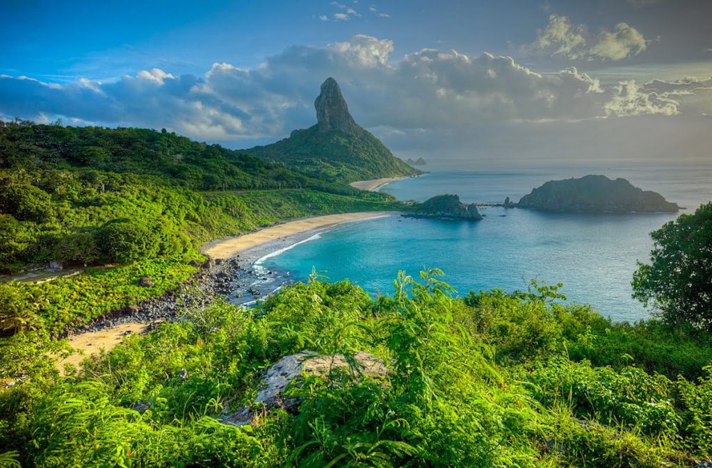
The Fernando de Noronha Archipelago consists of 21 islands, islets and rocks of volcanic origin in the South Equatorial Atlantic Ocean.
The main island, also known as Fernando de Noronha, is the only inhabited island and accounts for about 91 per cent of the total area of the archipelago.
Located about 350 km from Cabo de São Roque, in the state of Rio Grande do Norte, and 545 km from Recife, the capital of Pernambuco, the archipelago has a total area of 26 km², of which the main island covers about 17 km².
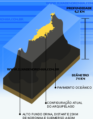
The geological formation of the archipelago is the result of volcanic activity that took place about 12 million years ago. The base of this volcanic structure lies at a depth of approximately 4,000 metres on the ocean floor.
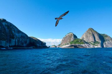
In addition to the main island, Rata, Sela Gineta, Cabeluda, São José and the islets of Leão and Viúva stand out.
Video about Fernando de Noronha Archipelago


Documentário sobre o arquipelago Fernando de Noronha35:45

Geografia do arquipelado Fernando de Noronha45:38

História do arquipelado Fernando de Noronha

Turismo em Fernando de Noronha05:30
1. tourist information
Planning a trip to Fernando de Noronha can be the fulfilment of a dream for many Brazilians. With a population of around 3,140, the archipelago is renowned for its sustainable tourism, which promotes a harmonious coexistence between man and nature.
To fully enjoy the natural beauty and rich history of the place, a minimum stay of 5 days is recommended. The activities available cater for different visitor profiles and offer unique experiences.
The main activities in Fernando de Noronha include
- Scuba diving: Considered one of the world’s best destinations for scuba diving, with crystal clear waters and rich marine life.
- Snorkelling: Ideal for observing the diversity of marine life in places such as Praia do Porto and Praia da Conceição.
- Dolphin watching: Especially the spinner dolphins, which can be seen on boat trips.
- Surfing: The beaches of the archipelago offer good conditions for surfing.
- Ecological trails: Walks that take in breathtaking scenery and unique vantage points, such as the Atalaia trail.
2. Geography
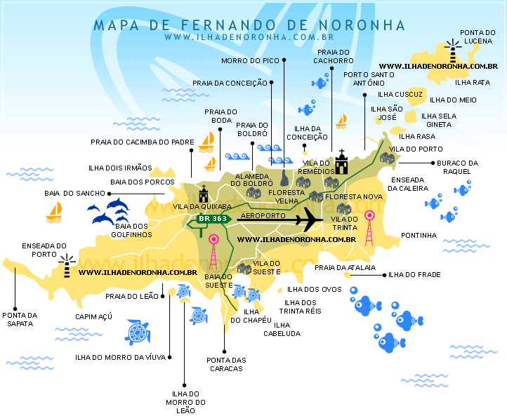

2.1 Fernando de Noronha Island
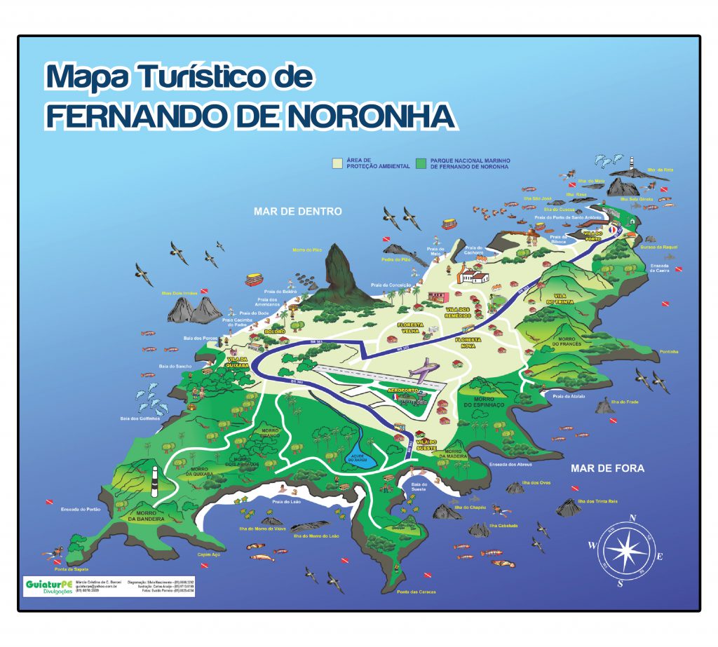
- Pico Hill: 323 metres
- Espinhaço Hill: 223 m
- Morro do Francês: 195 m
- Alto da Bandeira: 160 m
- Morro do Curral: 126 m
- Morro de Santo Antônio: 105 m
The island has historical sites such as Vila dos Remédios, Vila da Quixaba and the ruins of colonial forts. Infrastructure includes an airport, hospital, schools, electricity and water treatment plants.
The island is divided into two protected areas:
- APA (Environmental Protection Area): approximately 8 km².
- National Marine Park: about 112.7 km², including the marine part.
2.2 Secondary islands
- Rata Island: the second largest, covering about 6.8 square kilometres, is important for seabirds.
- Middle Island: between Rata Island and Sela Gineta Rock.
- Rasa Island: Low and with a flat top.
- São José Island: connected to the main island by a symbol, with the São José do Morro fort.
- Ilha do Cuscuz: Small formation near Morro de São José.
- Lucena Island: Fragment of Rata Island.
- Chapéu do Nordeste Island: Rocky island near Morro de São José.
- Cabeluda Island: At the exit of Sueste Bay, with dense vegetation.
- Chapéu do Sueste Island: Next to Sueste Bay, with a peculiar shape.
- Ovos Island: Opposite Enseada do Abreu, an area of sea birds.
- Trinta-Réis Island: small, with the presence of the birds of the same name.
- Sela Gineta Rock: between the islands of Rasa and Meio.
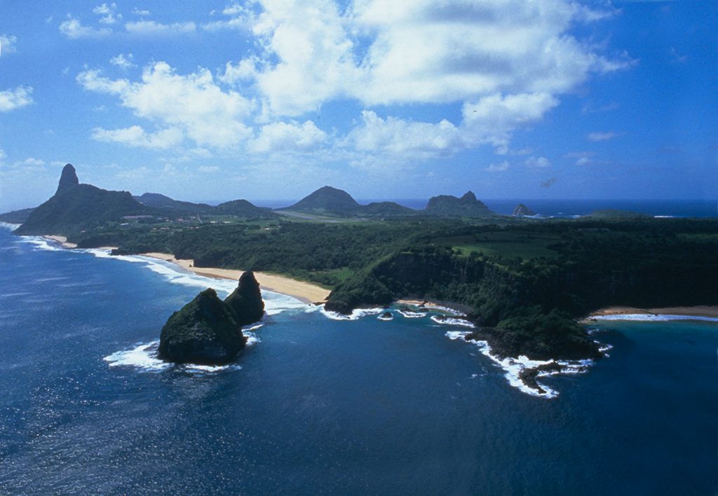
- Dois Irmãos Rock: near Cacimba do Padre beach, a postcard.
- Frade Island Rock: resembles a sitting monk.
- Rock near Ilha dos Ovos: Small rock formation.
- Rock near Ponta das Caracas: Near Baía do Sueste.
- Morro do Leão Rock: with the appearance of a sea lion.
- Morro da Viuvinha Rock: Seabird reserve.
- Pedras Secas R: Three rocks in the open sea, an excellent snorkelling spot.
3. History of the Fernando de Noronha Archipelago
In addition to its beaches, coves and rich nature, the Fernando de Noronha Archipelago has other surprises in store for tourists.
The archipelago’s 500 years of history make it not only a natural heritage site, but also a true historical heritage that deserves to be visited and, above all, preserved.
In this section you can find out more about the history of the Fernando de Noronha archipelago, from its discovery to the present day.
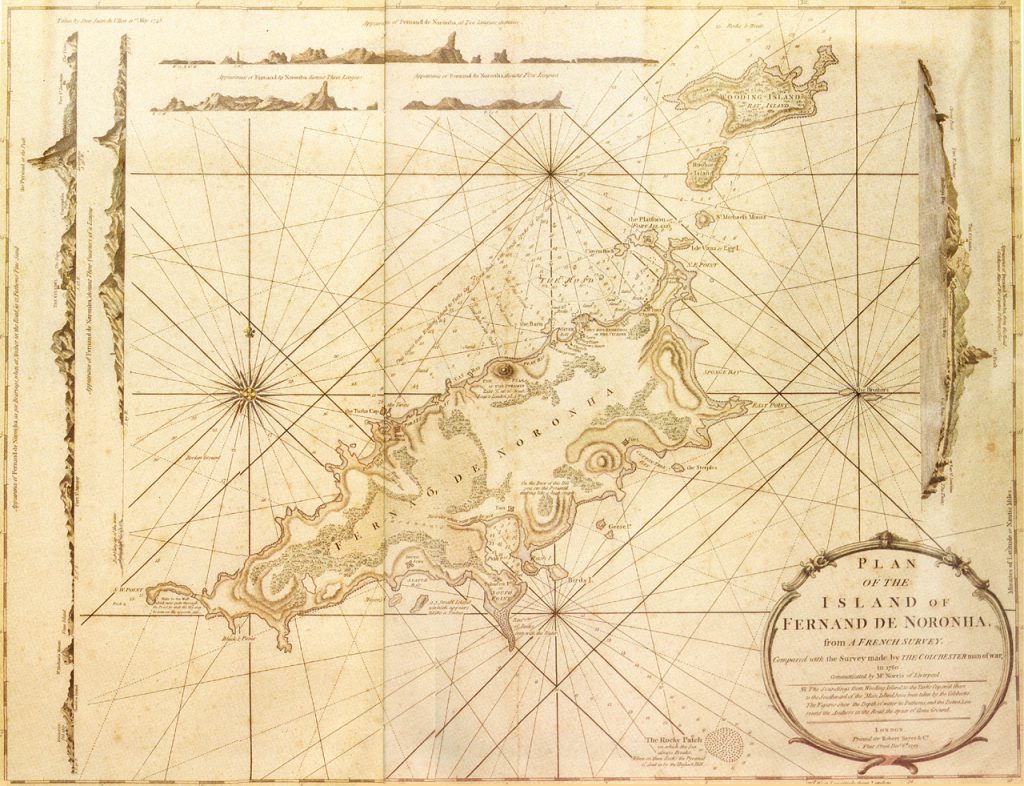
3.1 Historical periods
PERIODS OF ABANDONMENT, TEMPORARY OCCUPATION AND APPROACHES (1500 – 1736)
- 1500 – Appears on Cantino’s map under the name “Quaresma”.
- 1503 – Discovered by Américo Vespúcio during the expedition of Gonçalo Coelho.
- 1504 – Donated as a hereditary captaincy to Fernão de Loronha.
- 1505 – Rescue of the castaways by a ship from Normandy, commanded by Binot Paulmier de Gonneville.
- 1534 – Stay of Ulrich Schmidel, German traveller.
- 1556 – Arrival of the French from Rio with André Thevet.
- 1558 – Visited by Jean de Léry.
- 1577 – Visited by the English navigator Francis Drake.
- 1612 – French approach with Claude d’Abbeville and Daniel de la Touche.
- 1619 – Visit by Pedro de Castro, Portuguese.
- 1626 – Dutch stop for supplies.
- 1629 – 1654 – Dutch occupation by Cornelis Jol (“Perna de Pau”).
- 1631 – Island leased to Michel de Pavw, called “Pavonia”.
- 1654 – End of the Dutch occupation.
- 1700 – Handed over to the Government of Pernambuco, without effective occupation.
- 1736 – French occupation by the East India Company, who called it “Isle Dauphine”.
OCCUPATION AND DEVELOPMENT (1737 – 2003)
- 1737 – Reclaimed by Pernambuco; creation of a correctional colony and a system of fortifications.
- 1739 – Forced expulsion of “gypsies”, considered vagrants.
- 1745 – Passage of the Spaniards Juan and Ulloa.
- 1760 – Visit reported by Ekeberg, on board a Swedish ship.
- 1816 – French artistic mission; Debret paints Morro do Pico.
- 1817 – Pernambuco uprising; destruction of buildings by João de Barros Falcão.
- 1819 – Deportation of Indians from the villages of Cimbres and Escada.
- 1824 – Late arrival of news of Independence.
- 1823 – 1827 – Administration of the Ministry of War.
- 1832 – Passage of Charles Darwin.
- 1844 – Exile of the Farroupilhas.
- 1877 – 1891 – Administration by the Ministry of Justice.
- 1890 – Dismissal of the capoeiristas considered to be troublemakers.
- 1893 – Establishment of the South American Cables Ltda..
- 1914 – Cable concession to the French company.
- 1925 – Arrival of the Italcable company.
- 1927 – Creation of the Compagnie Générale Aéropostale.
- 1930 – 1931 – Operation of German and French aircraft.
- 1934 – Construction of the first runway.
- 1938 – Transfer to the Federal Government; establishment of a political prison.
- 1942 – Establishment of the American base during the World War II; second runway.
- 1942 – Creation of the Federal Territory of Fernando de Noronha
- 1942 – 1981 – Administration by the Army.
- 1981 – 1986 – By the Air Force
- 1986 – 1987 – By the EMFA.
- 1987 – 1988 – By the MINTER
- 1946 – FAB Air Control and Meteorology Detachment.
- 1957 – 1965 – American observation of missiles at Boldró.
- 1988 – Creation of the National Marine Park; reintegration into Pernambuco.
- 2001 – Listed by UNESCO as a World Natural Heritage Site.
- 2003 – 500th anniversary of the discovery.
3.2 HISTORICAL OVERVIEW
3.2.1 Discovery and first references
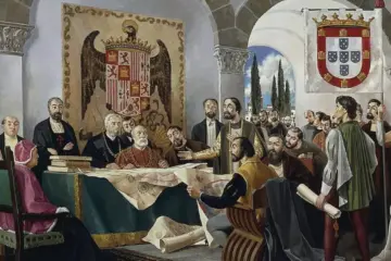
The occupation of Fernando de Noronha dates back to the beginning of the 16th century. Due to its strategic position in the South Atlantic, the archipelago was one of the first countries sighted in the New World. It appears on a nautical chart of 1500 by the Spanish cartographer Juan de La Cosa, and on another of 1502 by the Portuguese Alberto Cantino, where it is called “Quaresma“.
The island was officially discovered on 10 August 1503 by a Portuguese expedition led by Gonçalo Coelho and financed by the Lisbon merchant Fernão de Loronha.
The navigator Américo Vespúcio, a member of the expedition, recorded the island as“São Lourenço“, in honour of the saint of the day.
In 1504, King Manuel I granted the island to Fernão de Loronha as a hereditary captaincy, the first in Brazil. However, Loronha never actually occupied the territory.
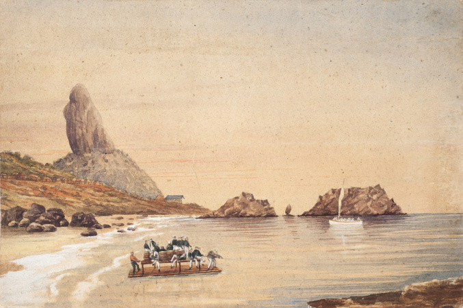
3.2.2 Foreign invasions
During the 17th and 18th centuries, the archipelago was the target of foreign invasions. In the 17th century, the Dutch temporarily occupied the island and called it“Pavonia“. In the 18th century, in 1736, the French tried to colonise it, renaming it“Île Delphine“.
In response, the Portuguese government sent an expedition in 1737, commanded by João Lobo de Lacerda, which expelled the French and began building a defensive system of ten fortresses, including the Fortress of Nossa Senhora dos Remédios.
3.2.3 Presidio and environmental changes
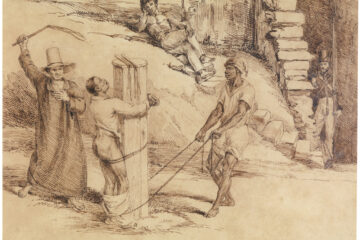
After the final Portuguese occupation, the archipelago was transformed into a common prison, housing prisoners sentenced to long terms. These prisoners were responsible for building the fortifications and the road system linking villages and forts.
To prevent escape and to provide hiding places, the original vegetation was gradually cut down, changing the climate and landscape of the island.
Today, remnants of native vegetation can be found in places such as Ponta da Sapata, the slope of Morro do Pico and the viewpoints of Sancho, Baía dos Golfinhos and Praia do Leão.
3.2.4 Scientific interest
The archipelago has always attracted the interest of scientists and naturalists.
On 20 February 1832, the naturalist Charles Darwin visited Fernando de Noronha during the expedition of the ship HMS Beagle. In his diary, Darwin described the island as a dense forest and recognised the volcanic origin of the archipelago’s rocks.
3.2.5 Military period
In 1938, the archipelago was ceded to the Federal Government for the establishment of a political prison.
During the Second World War, in 1942, the Federal Territory of Fernando de Noronha was created, with the installation of a military base in partnership with the United States, which used the island as a strategic point for operations in the South Atlantic.
From 1942 to 1988, the administration of the island was under military control: first by the Army (until 1981), then by the Air Force, Air Force (until 1986) and later by the Elite Military General Staff (EMFA) (until 1987).
In 1988, with the promulgation of the new Constitution, Fernando de Noronha was reintegrated into the State of Pernambuco, becoming a State District.
3.2.6 Environmental Recognition and World Heritage
Also in 1988, the Fernando de Noronha National Marine Park was created to protect its rich marine and terrestrial biodiversity. In 2001, UNESCO recognised the archipelago, together with Atol das Rocas, as a World Natural Heritage Site, highlighting its ecological importance and the need for conservation.
3.2.7 Vila dos Remédios
Although discovered in 1503 and donated as a Hereditary Captaincy in 1504, the Fernando de Noronha Archipelago remained abandoned for more than two centuries, receiving temporary approaches from navigators of various nationalities.
In the 17th century, the Dutch stayed there for 25 years.
Almost nothing remains of that time, except for part of the walls of what is now the Fortaleza dos Remédios (where they built a fortress in 1629) and the areas for agricultural experiments.
Accounts of this period speak of“storehouses“,“dwellings“,“warehouses“,“corrals“,“vegetable gardens“, a small“Calvinist Reformed Congregation” and other constructive evidence of such a long occupation.
There are also the“Elizabeth Gardens“, where crops were experimented with, especially indigo. It was in the area of this Dutch “Vila” that VILA DOS REMÉDIOS was built in the following century, after the final occupation of Portugal by the Captaincy of Pernambuco.
Vila dos Remédios was chosen by both the Dutch and the Portuguese-Brazilians as the main urban centre of the Fernando de Noronha archipelago.
The strategic conditions of this location were obvious: close to a water stream called Riacho Mulungu and other springs; easy access to Enseada do Cachorro, which later served as an anchorage; the source of drinking water, later transformed into Bica do Cachorro; direct access to the new fortress(Remédios).
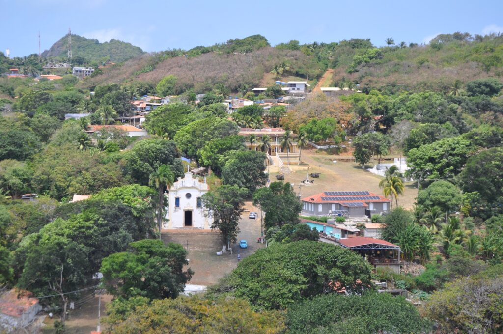
3.2.8 The urban development of Vila dos Remédios
The Nossa Senhora dos Remédios Fortress was a landmark in the urban development of Vila dos Remédios in the Fernando de Noronha archipelago, with its planned structure consisting of two courtyards (two spatial units).
The upper courtyard housed the administration, the civil power, and the lower courtyard housed the church, the religious power.
The entire area of the Nossa Senhora dos Remédios fortress was paved with stone and the buildings were always large.
It’s worth noting that one of the main functions of the village in its origins was to support the prison system that also existed at the time. Strategically, the village should not be seen from the sea.
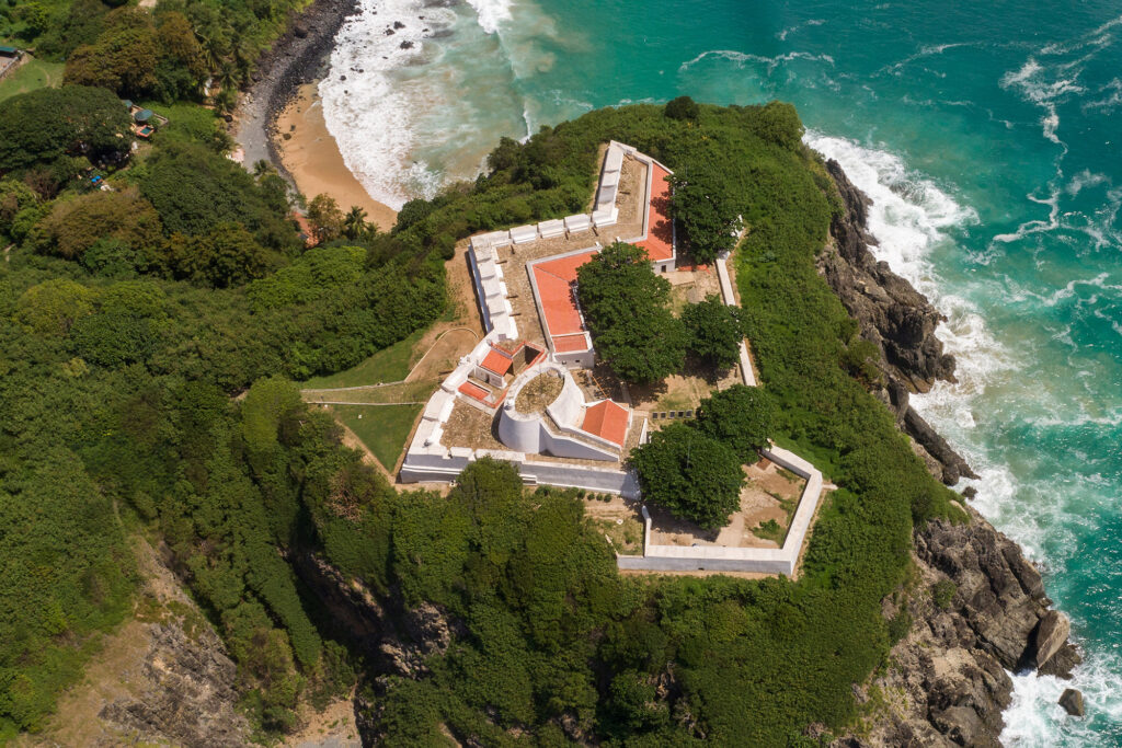
The VILA DOS REMÉDIOS in the Fernando de Noronha archipelago became the main urban centre of the island.
From the 18th century it was home to the administration, with its public buildings, prison accommodation and workshops for inmates, the church, the command post or Plaza d’armas, the dwellings, the warehouse, the school, the hospital and the warehouses for storing agricultural produce and goods from the mainland.
It also gave rise to a paved road system throughout the island, using the “cabeça de nego” model, always concerned with rainwater drainage and soil conservation, a procedure adopted in the patios and streets that define the city.
For more than two hundred years this centre has been used and preserved in its original structure, with minor modifications and additions.
In 1938, when the archipelago was handed over to the Federal Government, the town was in a very poor state of architectural repair. The major disturbances and disfigurements occurred mainly from 1942, with the occupation during World War II.
Part of the old urban face was then lost, and the influence of prefabricated construction emerged, due to its practicality in times of emergency, becoming a benchmark in this technology.
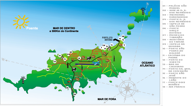
4. The urban heritage of Fernando de Noronha
4.1 Vila do Trinta
Built after the military occupation in 1942 around the army barracks (the 30th Hunter Battalion), its name comes from the “30” painted on the roof of the barracks. Around it was the “Sergeants’ Village”, dating from 1975.
The former barracks now house the island’s supermarket and various other services. Next door is the old “Usina Eléctrica” building, dating from 1942, and the houses that have been added over time. The building is now called the “Centro de Convivência”.
Next to the Vila, a large building serves as the fishmonger’s and baker’s shop, which was one of the island’s supply centres during the military era, known as the “Reimbursable Warehouse”. Opposite were the officers’ houses.
4.2 Vila da Floresta Velha / School (1964)
Occupied from 1964, houses were built for army officers and the Arquipélago School building (formerly known as the “Integrated Teaching Unit”).
Behind this urban centre is the island’s Cemetery, which dates from 1843 and was enlarged in 1883. There used to be a chapel in honour of Our Lady of the Conception, now destroyed. Next to it are houses built on the bases of war groups.
In front of this complex, the Vila para Cabos was built, with prefabricated houses, and later one of the island’s evangelical churches was installed there.
4.3 Vila da Floresta Nova (from 1987)
This is a village of wooden houses, typical of Paraná, built in 1987 during the administration of the Ministry of the Interior and the island’s first Civil Governor. In this area, at the top of the hill, is the Golfinho Radio and TV System, in a pre-cast structure.
4.4 Flamboyant Park (Bosque)
A social space with trees and recreational facilities, it was laid out during the military period and extended and landscaped at various times. Nearby was the building that housed the island’s second school, demolished during the Air Force regime.
4.5 Preformed houses in Rua São Miguel
A series of prefabricated houses from the Corporal’s Village of the Military Period, on the former Rua do Sol, now Rua São Miguel. There are several houses in front of this village, including the one that served as the Mothers’ Club. There are also Soldiers’ Villages (“Vila Fruta-Pão”).
To the left of Rua São Miguel, there are traces of the old houses that were demolished to widen the road during the army period.
4.6 Vila dos Três Paus
A small urban centre away from the main road, this is a circular settlement built in this century, probably to house convicts and their families. During the military occupation there was a leisure centre: the “Boite Três Paus”.
4.7 The port
Used as a harbour since its discovery, the bay of Sto. Antônio has always been a place for loading and unloading ships arriving or leaving the archipelago. During World War II, a wooden and iron jetty was built to allow ships to dock and cannons to be unloaded.
A permanent jetty was built in 1987 using stones from the blasting of Boa Vista Hill, but is not yet complete. Various tourist facilities support this site, where fishing and diving boats are based.
4.8 Air France
The site where the French settled in 1927 to support air navigation. There were three buildings to house the technicians and store their equipment. Today, the house that remains has been restored and has become the “Air France Cultural Space”, home to the Noronhenses Artists and Craftsmen Association.
4.9 Alameda do Boldró
The area where the Americans set up their Guided Missile Observation Post in 1957. Along this avenue are the Tubarão Thermoelectric Power Station, the Piraúna Power Station, the Esmeralda Hotel, the TAMAR Project Headquarters, the IBAMA Headquarters and several houses.
Further along, facing the sea, is the Mirante do Boldró Bar. Down by the sea, another bar caters for beach goers.
4.10 Basinha
Next to the São Pedro do Boldró Fort is the Hotel, which houses the technicians of the archipelago administration when they are on duty on the island. These are wooden houses, similar to those in the New Forest, with a capacity of 16 people.
In front of the hotel, other houses made of the same material house technicians who need to live on the island, such as doctors, teachers, electricity and water treatment personnel, among others.
4.11 Vila da Quixaba
One of the earliest urban centres on the island, Vila da Quixaba was built around the Chapel of Our Lady of the Conception and the Sentenced Prisoners’ Accommodation, a beautiful mansion destroyed by an explosion during World War II. In addition to the chapel and main building, 28 houses were used as open regime prisoners’ accommodation.
The Chapel of Our Lady of the Conception was built in three stages. Built by convicts, it collapsed, was rebuilt and collapsed again in a stormy night.
The current appearance of the chapel dates from the second half of the 18th century, and is the third time it has been rebuilt. It is a small stone building with a central door and a massive altar, with details that, when analysed at the end of 1999, favoured its complete restoration.
The entire building and its surroundings were also restored, preserving the memory of the old Vila da Quixaba and encouraging the start of a Heritage Education campaign and archaeological research in the area to identify the former priest’s rest house and the former “prison accommodation”.
The work carried out in 1999 led to the installation of a ceramic information panel, illustrated with photographs, giving a complete retrospective of the Vila da Quixaba area and the stages of restoration.
4.12 Casa Grande do Sueste
Located on the old road to Sueste, this building is probably the oldest house on the island. It served as a summer residence for the commanders of the prison and twice housed the Beriberi Hospital, due to the climate and the large amount of citrus fruit in the area. Next to it is the Pedreira Dam, the result of the blasting of Boa Vista Hill to obtain stones for the construction of the harbour breakwater.
4.13 Frigorífico Velho
On the road to Praia de Atalaia is this large building from the time of the American presence in World War II. Now unused, it is a building of great proportions that could be included in the redevelopment process.
4.14 Air Force Transit Hotel
This large building on the hill of Sto. Antônio had three different periods of construction and different uses. There was the Naval Meteorological Station, still standing in 1934, when it was depicted by Percy Lau.
Under its ruins stood the house of the Military Governor of the Army in the 60s. It was later demolished to make way for the present building, which also served as the government’s residence until the Archipelago was reintegrated into Pernambuco, when the area was donated to the Ministry of Aviation and used as a transit hotel for authorities visiting Fernando de Noronha.
4.15 Chapel of St Peter the Fisherman
A small chapel located in the upper part of the Air France region, it has no regular services and is only used on the occasion of the Feast of St Peter, when the “Buscada Marítima” in honour of the patron saint of fishermen takes place. The area is an excellent lookout point.
4.16 The built heritage of Vila dos Remédios
4.16.1 The Church of Nossa Senhora dos Remédios
The Church of Nossa Senhora dos Remédios is the main Catholic church in the Fernando de Noronha archipelago. Construction began in 1737 and the building was completed in 1772, the date it bears on its façade. From then on, ornaments and movable cultural objects were added, and it was completed in 1784.
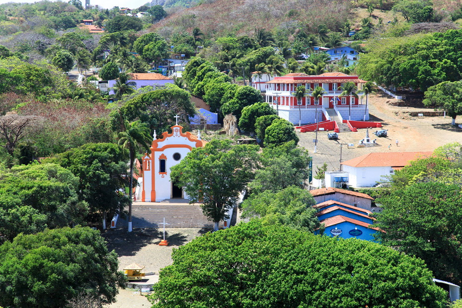
This devotion inspired the name of the main fort built in the area and the entire village. The Virgin of Remedies has been the patron saint of the common prison since 1768. In 1789, the church was ecclesiastically attached to the Parish of St Peter Gonçalves as an extension of the same, a dependency that still exists today.
The first major restoration took place in 1891, followed by further interventions in 1915 and 1919. The last and most faithful restoration took place in 1988, with federal funds, and was inaugurated by the Archbishop Emeritus of Olinda and Recife, Dom Hélder Câmara.
In 1997 the church was revitalised by painting and night lighting, making it stand out in the landscape at night. In 1981, the church was listed by the National Historic and Artistic Heritage Institute, the second monument in the archipelago to receive this distinction. In 1998, the church was again revitalised by painting, when it returned to its original colours.
4.16.2 São Miguel Palace
Seat of the administration of the State District of Fernando de Noronha, it was built in 1947/48 on the ruins of the old “Directoria do Presídio”. It was a colonial mansion in the centre of the Vila dos Remédios square, with ogival windows, one floor and a large staircase.
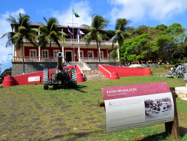
The palace was built by the island’s own people, under the coordination of former communist political prisoner Mariano Lucena. Its construction and architectural alterations were designed to house the seat of government of the Federal Military Territory. At times the lower floor also served as the residence of the Governor.
Inside there is evidence of the earlier stone construction, the result of prison labour. Inaugurated in 1948, it has mid-century furniture and two large canvases by the Pernambuco painter Wash Rodrigues, who was brought to Noronha to do the work.
There is also a stained glass window with a life-size image of the Archangel St Michael, made by the stained glass artist Aurora Lima, a student of the German artist Henri Moser, which was restored in 2000 by followers of Moser’s school.
4.16.3 Former Agricultural Products Warehouse
A building with the largest volume of Noronha’s civil architecture, as evidenced by the iconography from many periods in which the building appears in various guises. Today, it is an object of interest as a landmark in the recovery of the island’s scenography.
It has served as the residence of the Director of Prisons, a warehouse for agricultural products, a storehouse, a bakery, a carpentry, a barracks for soldiers during the World War II, and once again as a residence for islanders. Eventually abandoned, it began to deteriorate and it is known for certain that it was standing and covered in 1972.
The damage to the building is already considerable and needs to be tackled to avoid the total loss of this excellent example of the island’s civil architecture. The main redevelopment proposal is to turn it into a contemporary cultural space, given its excellent location and architectural proportions.
In 2003 it was registered in the National Register of Archaeological Sites ( CNSA) of the National Institute of Historical and Artistic Heritage.
4.16.4 Former grain store
A large building located at the end of the plaza in front of the Remedios Church, used to store grain and later as the prison garage. Abandoned, it fell into disrepair, and in 1990 part of it was restored to house the Cachorro Beach Tourist Terminal, to serve the cruise ships that began arriving that year, and today it houses the famous “Cachorro Bar”.
4.16.5 Former Penitentiary Village
The only remaining building from the prison system that operated in Fernando de Noronha for over 200 years, the Aldeia dos Sentenciados is a remarkable large building with well-defined internal spaces, designed to house individual prisoners.
Located in the Vila dos Remédios, in the old Praça d’Armas, next to the Palace of São Miguel, it was also called the “Women’s Prison” in the last century, when it was authorised to send female prisoners to the archipelago, because it housed women convicts.
Inside, there were collective cells, rooms for confined prisoners, a bakery, a canteen, a kitchen, administrative areas and internal ‘open air’ courtyards. In front of this building, prisoners of good behaviour, who lived with their families, were forced to go to morning roll call every day. Next door are the ruins of the Atlantic Club, built on the remains of the old French Cape Chalet. During the World War II the building housed soldiers. It was then abandoned and used as a makeshift residence, a situation which continues to this day.
4.16.6 Elizabeth Garden
Used since the 17th century as a place to acclimatise plants, it was also the “Horta da Vila”, designed to supply the Vila dos Remédios with agricultural produce. It also has bridges, terraces suitable for agriculture, stone roads and lots of vegetation.
It is also a functional landmark of Noronha, as a port for repairing ships, using the abundant material in these areas of permanent reforestation. Rediscovered in 1997, during the study of the elements that would guide the implementation of the “Ecotourism Trails Project”, it is a pleasant corner that today has a constant flow of tourists.
4.16.7 Secular roads
The original nucleus, Vila dos Remédios, built in the 18th century, required the construction of access roads throughout the island, linking it to the other inhabited areas and creating a stone road system using prison labour. The most notable are Estrada do Pico, Estrada do Porto, Rua da Estrela and Estrada da Ponte. All of these roads appear on the plan drawn up by José Fernandes Portugal in 1798.
These access routes have deteriorated with use and, above all, with the introduction of vehicles for travelling around the island. Large sections without stones have problems with decomposition and are threatened by use due to the fragility of the whole system.
4.16.8 Bica da Praia do Cachorro
A centuries-old fountain used for freshwater bathing by those who use the Praia do Cachorro for recreation. It is next to the Sant’Anna Redoubt, built in the 18th century. It is partly ruined, and the bronze dog’s face that gave it its name is no longer there. There are records of this area from the beginning of the last century and the fountain is still in use.
4.16.9 Old school
The first educational experiences in Noronha were improvised. The sacristy of the church was used as a base for the school. At the end of the last century, some simple buildings, built as residences, were improvised as schools for boys and girls.
In this century, in the Praça d’Armas, in front of the “Directoria do Presídio”, a building was constructed as a school, with two classrooms (girls’ and boys’) and a school board. A solarium completed the beautiful building, with the Coat of Arms of the Republic at the top. During the World War II this house was used as the headquarters of Radio PTI, with the addition of the solarium and an antenna at the back.
A staircase was also added to the rear of the building to provide access to the solarium. Abandoned, the building deteriorated almost completely, but was saved by the Banco Real, which had been on the island since 1975 (in a room in the São Miguel Palace), which adapted it to house a branch of the bank. As it was impossible to restore the solarium, a tiled roof was added, similar to that of the neighbouring church. Inside the agency, a retrospective panel shows, iconographically, the faces of this building over time.
History, Geography and Tourism of the Fernando de Noronha Archipelago
Publicações Relacionadas
Experience the Tropical Paradise of Ilha Grande in Rio de Janeiro
How to get there, when to go and what to do in Fernando de Noronha?
Itamaracá Island: Your Ultimate Guide to Tropical Bliss in Brazil
Atol das Rocas - Origin, Biology, Climate and Shipwrecks
Alcatrazes Archipelago: Secrets of Evolution Revealed
Ilhabela is the hottest spot on the north coast of São Paulo State
Diving in the Fernando de Noronha Archipelago
Jararaca-ilhoa: Endemic Species of Queimada Grande
Anchieta Island: History, Beaches, and Nature
Brazil has oceanic and continental islands
Wreck of the Corvette Ipiranga in Fernando de Noronha
The island of Santa Catarina is part of the municipality of Florianópolis
History of Itaparica Island in the Baía de Todos os Santos
Fernando de Noronha Beaches: A Complete Guide
The Marajó Archipelago
São Pedro and São Paulo Archipelago
Spinner Dolphins in Fernando de Noronha: A Guide
Trindade and Martim Vaz: Discovering the Archipelago
This post is also on:
Português
English
Deutsch
Español
Français


