Cartografia Marítima Medieval: Mapeando o Mediterrâneo

Publicado em · Atualizado em

Cartografia Marítima Medieval: A Ascensão e o Desenvolvimento das Cartas Portulanas

Introdução

No final do século XIII, surgiu na Europa Ocidental um novo tipo de carta náutica que marcou um grande avanço na cartografia medieval.

Essas cartas romperam com a prática anterior, baseando-se na observação direta auxiliada por um novo instrumento, a bússola náutica.

As costas do Mar Negro, do Mediterrâneo e do sudoeste da Europa foram mapeadas com notável precisão, estabelecendo um padrão que perdurou por séculos até que a localização astronômica se tornou comum no século XVIII.

"Romani Imperii Imago", Ortelius, Abraham - Mediterranean, Roman Empire, 1584 - Dramatic map of the Roman Empire centered on the Mediterranean and covering most of Europe, Northern Africa, and the Near and Middle East. The map is richly decorated with several strapwork cartouches, two containing portraits of Remus and Romulus, the founder of Rome. The cartouches in the lower section of the map contain an account of Roman history at left and a large genealogical tree of the rulers of Rome at righthistory at left and a large genealogical tree of the rulers of Rome at right.
“Romani Imperii Imago”, Ortelius, Abraham – Mediterrâneo, Império Romano, 1584 – Mapa dramático do Império Romano centrado no Mediterrâneo e cobrindo a maior parte da Europa, Norte de África e Próximo e Médio Oriente. O mapa é ricamente decorado com vários cartuchos com motivos decorativos, dois dos quais contêm retratos de Remo e Rômulo, os fundadores de Roma. Os cartuchos na parte inferior do mapa contêm um relato da história romana à esquerda e uma grande árvore genealógica dos governantes de Roma à direita.

Terminologia e forma

Essas cartas são comumente chamadas de “portolanas”, embora, estritamente falando, um portolano seja um conjunto escrito de instruções de navegação, uma distinção que pode causar confusão.

Alguns preferem o termo neutro cartas náuticas medievais, enquanto o rótulo de compromisso carta portulana identifica o tipo característico dos séculos XIV e XV.

Sobrevivência e atlas

As cartas portulanas sobrevivem isoladamente ou em atlas (cartas padrão divididas em seções, às vezes encadernadas com um calendário, mapa-múndi ou dados astronômicos).

Poucos exemplares sobreviveram do século XIV — provavelmente menos de vinte — e apenas sete desenhistas podem ser identificados com certeza: Petrus Vesconte, Angellino de Dalorto (Dalcert), Johannes de Carignano, Perrinus Vesconte, Francesco Pizigano, Angellino Dulcert e Guillelmus Soleri.

Os mapas mais antigos foram produzidos principalmente por desenhistas italianos; três mapas “mundiais” relacionados também datam desse período.

Produção de Maiorca e o Atlas Catalão

A obra mais conhecida que sobreviveu é o grande Atlas Catalão de 1375, atribuído a Cresques, o Judeu, e agora na Bibliothèque Nationale, em Paris.

Muitos mapas existentes são de Maiorca ou trazem inscrições em catalão, indicando o surgimento de Maiorca como um centro cartográfico à medida que o século avançava.

Materiais e aparência

Os mapas eram desenhados em peles únicas de pergamino, muitas vezes preservando o contorno natural da pele. Os tamanhos variavam aproximadamente de 36 × 18 polegadas a 56 × 30 polegadas. A linha costeira é mostrada em preto (muitas vezes desbotado) e enfatizada por numerosos nomes de portos e costas escritos perpendicularmente a ela.

Os nomes estão em preto, com portos importantes em vermelho. Pequenas ilhas e deltas são preenchidos em vermelho ou dourado; rochas e bancos de areia são indicados por pequenas cruzes ou pontos. Os detalhes do interior no portulano típico ou “normal” são mínimos — rios ocasionais, cadeias de montanhas e pequenas vinhetas de grandes cidades com faixas.

Exemplos posteriores são ricamente desenhados e coloridos, sugerindo produção para armadores ou comerciantes ricos; cartas de trabalho usadas no mar eram mais propensas a serem perdidas ou descartadas.

Cartas representativas

  • Carte Pisane (provavelmente genovesa, final do século XIII) se estende do Mar Negro ao sul da Inglaterra; rudimentar em algumas partes, inclui ventos nomeados e uma escala, com duas séries de linhas irradiando de centros próximos a Esmirna e a oeste da Sardenha.
  • O Atlas de Petrus Vesconte (1318) está dividido em nove seções e é mais cuidadosamente desenhado.
  • Perinetto Vesconte (1327) assemelha-se ao atlas, mas melhora a costa sul da Inglaterra e adiciona vinhetas do interior.
  • Angellino de Dalorto (c. 1325) é muito preciso e finamente colorido; se estende até o Báltico, acrescenta rios (o Reno, Elba, Danúbio), cadeias de montanhas verdes e muitas cidades.

Escalas e unidades

Todos esses mapas mostram escalas subdivididas em quintos por pontos, mas a unidade de comprimento nunca é indicada.

As medições do professor Wagner sugerem duas unidades diferentes: cerca de 4.100 pés no Mediterrâneo oriental (aproximadamente dois terços de uma milha náutica moderna) e cerca de 5.000 pés para a costa atlântica. Essa discrepância faz com que a costa atlântica pareça contraída.

Cobertura geográfica e precisão

Os mapas geralmente cobrem o Mediterrâneo e o Mar Negro e partes da costa atlântica da Europa.

Ao sul do Estreito de Gibraltar, a costa é mapeada a uma curta distância além das Montanhas Atlas.

Ao norte, as costas da Espanha, França, sul da Inglaterra e Países Baixos são representadas com menos precisão; as tentativas no Báltico são incompletas.

Os mapas mais precisos correspondem às regiões onde o comércio genovês e veneziano era extenso — Veneza dominava o comércio do Mar Negro, Gênova o Mediterrâneo oriental após 1298 — e ambas as cidades-estado comercializavam no norte da África e até os Países Baixos.

Sistema de linhas de direção e rosas dos ventos

Uma característica marcante é o sistema de linhas radiais.

A partir de dois pontos no Mediterrâneo ocidental e oriental, dezesseis ou trinta e duas linhas se irradiam; centros subsidiários nas circunferências dos círculos são igualmente espaçados para cobrir o mapa sistematicamente.

Mapas posteriores mostram essas linhas emanando de rosas dos ventos, representando linhas de direção (rumos).

Nos mapas anteriores, as linhas radiais nem sempre estão explicitamente ligadas a uma bússola desenhada ou rosa dos ventos, e os pontos cardeais às vezes aparecem apenas nas margens. O mapa de Petrus Vesconte, de 1311, usa símbolos para indicar os pontos cardeais, e o mapa de Dalorto, de 1325, mostra um círculo com uma estrela de oito pontas denotando os pontos principais.

A rosa dos ventos completa aparece integralmente no mapa catalão de 1375. Dado o arranjo consistente das linhas nas cartas, é razoável concluir que elas representam rumos de bússola.

Variação magnética e orientação da carta

Em comparação com as cartas modernas, o eixo central do Mediterrâneo nos portolanos está girado cerca de 10° para a esquerda. Acredita-se que a variação magnética no Mediterrâneo naquela época era de aproximadamente dez graus a leste, sugerindo que os mapas foram desenhados com o norte magnético na vertical.

Usando as linhas para navegação

Nenhum manual contemporâneo sobreviveu explicando o sistema de linhas de direção, mas John Rotz, do século XVI, descreve um método que usa divisores para encontrar o raio mais próximo do curso entre dois pontos no mapa e, em seguida, ler a direção na rosa dos ventos mais próxima.

Os navegadores posteriores usavam uma régua paralela. As linhas eram frequentemente desenhadas em cores alternadas para reduzir erros.

Este sistema permitia traçar rapidamente rotas em longas distâncias, contrastando com a navegação costeira usando portolanos escritos, e marcava uma diferença fundamental entre cartas náuticas e livros de direção de navegação.

Projeção e esfericidade da Terra

As cartas portulanas não possuem uma grade de paralelos e meridianos; elas tratam a área mapeada como um plano e ignoram a convergência dos meridianos. Para a faixa latitudinal limitada coberta, isso não era um defeito grave: as linhas de direção se aproximam das loxodromias (linhas de rumo constante).

Somente no início do século XVI as cartas começaram a incluir uma escala de latitudes.

À medida que a navegação oceânica se expandia, as observações de latitude tornaram-se importantes para verificar a navegação por estimativa e a esfericidade da Terra não podia mais ser ignorada, levando finalmente à projeção de Mercator, que representa linhas de rumo constante como linhas retas.

Origens, a bússola e a datação

As cartas portulanas estavam intimamente ligadas à bússola, cuja introdução tornou sua construção viável.

Alguns estudiosos (por exemplo, o professor Wagner) defendem origens mais antigas com base em comparações de escala com unidades antigas, propondo a incorporação de direções de navegação mais antigas. Os portolani medievais que sobreviveram incluem breves listas direcionais (por exemplo, a referência do século XII de Adam de Bremen), mas tais resumos por si só provavelmente não poderiam produzir cartas detalhadas; o método da linha direcional dependia da bússola.

Provavelmente, já existia uma bússola primitiva com agulha flutuante no século XII, com uma agulha melhorada equilibrada em um pino por volta de 1250; mais tarde, foi adicionada a roseta da bússola, permitindo que as orientações fossem feitas rapidamente.

O primeiro mapa físico remonta provavelmente ao terceiro quartel do século XIII: a Carte Pisane é geralmente atribuída ao final do século XIII, o primeiro mapa datado é de 1311 e as referências literárias aos mapas aparecem por volta de 1250-75.

Evidências registradas indicam que os mapas já estavam em uso em 1270 (a frota e os pilotos do rei Luís IX identificaram Cagliari em um mapa), e Raymond Lull mencionou os mapas entre os instrumentos dos marinheiros. Assim, o mapa portulano provavelmente surgiu por volta de 1250-75.

Adoção e uso inicial

A adoção pelos navegadores mediterrâneos foi gradual. Em 1354, o rei Pedro de Aragão ordenou que cada galera de guerra levasse duas cartas náuticas, uma medida que provavelmente estimulou a produção de cartas náuticas catalãs.

Alguns planejadores adotaram as cartas náuticas desde cedo: Marino Sanudo incluiu cartas náuticas de Petrus Vesconte em seus planos de cruzadas. Vesconte combinou novas informações cartográficas com fontes mais antigas, enquanto Dalorto incorporou pequenos motivos medievais do mapa-múndi (um mapa T-O), frases feitas como “Europa incipit ad Gallicia” e vinhetas como a Torre de Babel, indicando uma mentalidade de transição entre tradições.

Atualização de detalhes regionais: as Ilhas Britânicas

O progresso na atualização de detalhes regionais é visível nas representações sucessivas das Ilhas Britânicas. Na Carte Pisane, a Grã-Bretanha é mostrada de forma rudimentar e fica fora do mapa principal.

A partir de cerca de 1325, tentam-se representações mais completas, mas o conhecimento da Escócia é limitado e a Irlanda é superdimensionada em relação à Inglaterra. O esboço de Perino del Vaga de 1327 mostra um conhecimento preciso, em grande parte confinado ao sul da Inglaterra (do Canal de Bristol ao Tâmisa); as costas norte e oeste permanecem mal detalhadas.

Isso sugere que levantamentos locais relativamente precisos foram anexados a esboços mais antigos e generalizados.

Melhorias na costa sul da Inglaterra aparecem no início do século XV (por exemplo, G. Pasqualini, Veneza, 1408), provavelmente ligadas às crescentes ligações comerciais entre o norte da Itália e a Europa Ocidental: as “galeras da Flandres” de Veneza (mencionadas pela primeira vez em 1317) atracavam em Southampton, Sandwich e Londres, e Vesconte pode ter obtido observações costeiras de seus comandantes.

Possíveis origens dos levantamentos

Alguns propuseram um levantamento coordenado genovês sob o comando do almirante Benedetto Zaccaria no final do século XIII para explicar o rápido mapeamento das costas, embora faltem evidências diretas.

Conclusão

Em resumo, os mapas portulanos surgiram na segunda metade do século XIII, intimamente ligados à bússola marítima, e foram desenvolvidos principalmente por navegadores e cartógrafos do norte da Itália, especialmente de Gênova e Veneza.

Eles surgiram para atender às necessidades das comunidades comerciais italianas que expandiam as comunicações marítimas.

A conquista dos cartógrafos do século XIII foi um grande avanço prático no conhecimento geográfico que permaneceu insuperável por séculos.

Willy Sievert

Escrito por Willy Sievert

Editor do Bahia.ws desde sua fundação em 2009. Morador de Salvador, viaja com frequência pelo Nordeste e por todo o Brasil para manter os guias atualizados. Conheça mais sobre Willy Sievert →

Publicações Relacionadas

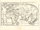
Este é um dos dois mapas-múndi “modernos” incluídos no atlas ptolomaico de Fries e um dos poucos mapas-múndi do início do século XVI disponíveis para colecionadores. É uma versão reduzida do famoso Mapa do Almirante, de Waldseemuller, concentrando-se no Velho Mundo, mas mostrando partes da América no lado esquerdo. Mostra o mundo numa combinação de equívocos clássicos com algumas das descobertas mais recentes, como um pouco da costa da América do Sul ao longo da borda esquerda. A Gronelândia é desenhada como uma península alongada ligada a uma Escandinávia ainda de forma primitiva. A adaptação de Fries apresenta as montanhas de uma maneira estilizada diferente e não tem as linhas direcionais da placa de Waldseemuler. Foram adicionados elementos decorativos, incluindo um elefante ao largo da costa da Groenlândia e retratos de cinco reis: Rússia, Egito, Etiópia, Toprobana e Mursuli. Ela oferece uma visão fascinante do que se sabia e não se sabia sobre o mundo no início da Era dos Descobrimentos. O canto superior direito da borda está faltando, como é o caso das edições de 1525 a 1541.

Mapping: ein Überblick

Este é um dos dois mapas-múndi “modernos” incluídos no atlas ptolomaico de Fries e um dos poucos mapas-múndi do início do século XVI disponíveis para colecionadores. É uma versão reduzida do famoso Mapa do Almirante, de Waldseemuller, concentrando-se no Velho Mundo, mas mostrando partes da América no lado esquerdo. Mostra o mundo numa combinação de equívocos clássicos com algumas das descobertas mais recentes, como um pouco da costa da América do Sul ao longo da borda esquerda. A Gronelândia é desenhada como uma península alongada ligada a uma Escandinávia ainda de forma primitiva. A adaptação de Fries apresenta as montanhas de uma maneira estilizada diferente e não tem as linhas direcionais da placa de Waldseemuler. Foram adicionados elementos decorativos, incluindo um elefante ao largo da costa da Groenlândia e retratos de cinco reis: Rússia, Egito, Etiópia, Toprobana e Mursuli. Ela oferece uma visão fascinante do que se sabia e não se sabia sobre o mundo no início da Era dos Descobrimentos. O canto superior direito da borda está faltando, como é o caso das edições de 1525 a 1541.

Mapeamento: uma visão geral

Word Map from 1702

Encuestas nacionales y atlas modernos: evolución cartográfica

Word Map from 1702

Nationale Erhebungen und moderne Atlanten: eine Analyse

Word Map from 1702

Enquêtes nationales et atlas modernes : un aperçu

Word Map from 1702

National Surveys and Modern Atlases: Key Developments

Word Map from 1702

Levantamentos nacionais e atlas modernos: uma análise

The Atlantic Ocean by Governor Pownall, 1787

Fortschritte in der Kartografie und Vermessung im Großbritannien des 18. Jahrhunderts

The Atlantic Ocean by Governor Pownall, 1787

Avanços britânicos no século XVIII em cartografia e levantamento topográfico

The Atlantic Ocean by Governor Pownall, 1787

Eighteenth-Century British Advances in Cartography and Surveying

The Atlantic Ocean by Governor Pownall, 1787

Progrès britanniques en cartographie et en arpentage au XVIIIe siècle

The Atlantic Ocean by Governor Pownall, 1787

Avances británicos en cartografía y topografía en el siglo XVIII
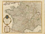
Carte de France Dressee pour l'Usage du Roy, 1765

La reforma de la cartografía en Francia en el siglo XVII

Carte de France Dressee pour l'Usage du Roy, 1765

Die Reformation der Kartografie in Frankreich im 17. Jahrhundert

Carte de France Dressee pour l'Usage du Roy, 1765

Réforme de la cartographie en France - Aperçu historique

Carte de France Dressee pour l'Usage du Roy, 1765

Reformation of Cartography in France - A Historical Overview

Carte de France Dressee pour l'Usage du Roy, 1765

Reforma da cartografia na França - Uma visão histórica
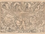
Margarita Philosophica 1583

Topografía en los siglos XV y XVI: Nuevas Mapas

Margarita Philosophica 1583

Les levés topographiques aux XVe et XVIe siècles

Margarita Philosophica 1583

Levantamento topográfico nos séculos XV e XVI
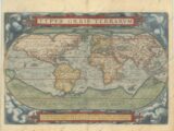
This is the first (of three) world maps that was included in Ortelius' famous atlas. It is a simplified reduction of Mercator's influential map of 1569 presented on an oval projection rather than the projection for which Mercator is now famous. From surviving correspondence, it is known that Mercator encouraged Ortelius and provided him with information, particularly with coordinates of places in the Americas. Placed on a cloud background, the map shows North America as much too wide and South America retains the unusual bulged southwestern coastline. At the poles, a prominent Northwest Passage snakes its way south of the four islands making up the arctic regions, and a huge Terra Australis Nondum Cognita makes up the imaginary southern continent. A notation next to New Guinea notes that it is unknown if this large island is a part of the southern continent. The title is in a strapwork banner at top, which is balanced with a quotation from Cicero at bottom. This superb map was engraved by Frans Hogenberg with his signature at bottom. The plate was used for the first 16 editions of the Theatrum. A crack developed in the lower left corner from 1570 onward.

Cartografía de los Grandes Descubrimientos: Navegación y Cartografía

This is the first (of three) world maps that was included in Ortelius' famous atlas. It is a simplified reduction of Mercator's influential map of 1569 presented on an oval projection rather than the projection for which Mercator is now famous. From surviving correspondence, it is known that Mercator encouraged Ortelius and provided him with information, particularly with coordinates of places in the Americas. Placed on a cloud background, the map shows North America as much too wide and South America retains the unusual bulged southwestern coastline. At the poles, a prominent Northwest Passage snakes its way south of the four islands making up the arctic regions, and a huge Terra Australis Nondum Cognita makes up the imaginary southern continent. A notation next to New Guinea notes that it is unknown if this large island is a part of the southern continent. The title is in a strapwork banner at top, which is balanced with a quotation from Cicero at bottom. This superb map was engraved by Frans Hogenberg with his signature at bottom. The plate was used for the first 16 editions of the Theatrum. A crack developed in the lower left corner from 1570 onward.

Kartografie der großen Entdeckungen: Navigation und Kartografie

This is the first (of three) world maps that was included in Ortelius' famous atlas. It is a simplified reduction of Mercator's influential map of 1569 presented on an oval projection rather than the projection for which Mercator is now famous. From surviving correspondence, it is known that Mercator encouraged Ortelius and provided him with information, particularly with coordinates of places in the Americas. Placed on a cloud background, the map shows North America as much too wide and South America retains the unusual bulged southwestern coastline. At the poles, a prominent Northwest Passage snakes its way south of the four islands making up the arctic regions, and a huge Terra Australis Nondum Cognita makes up the imaginary southern continent. A notation next to New Guinea notes that it is unknown if this large island is a part of the southern continent. The title is in a strapwork banner at top, which is balanced with a quotation from Cicero at bottom. This superb map was engraved by Frans Hogenberg with his signature at bottom. The plate was used for the first 16 editions of the Theatrum. A crack developed in the lower left corner from 1570 onward.

Cartographie des grandes découvertes : navigation et cartographie

This is the first (of three) world maps that was included in Ortelius' famous atlas. It is a simplified reduction of Mercator's influential map of 1569 presented on an oval projection rather than the projection for which Mercator is now famous. From surviving correspondence, it is known that Mercator encouraged Ortelius and provided him with information, particularly with coordinates of places in the Americas. Placed on a cloud background, the map shows North America as much too wide and South America retains the unusual bulged southwestern coastline. At the poles, a prominent Northwest Passage snakes its way south of the four islands making up the arctic regions, and a huge Terra Australis Nondum Cognita makes up the imaginary southern continent. A notation next to New Guinea notes that it is unknown if this large island is a part of the southern continent. The title is in a strapwork banner at top, which is balanced with a quotation from Cicero at bottom. This superb map was engraved by Frans Hogenberg with his signature at bottom. The plate was used for the first 16 editions of the Theatrum. A crack developed in the lower left corner from 1570 onward.

Cartography of the Great Discoveries: Navigation and Mapping

This is the first (of three) world maps that was included in Ortelius' famous atlas. It is a simplified reduction of Mercator's influential map of 1569 presented on an oval projection rather than the projection for which Mercator is now famous. From surviving correspondence, it is known that Mercator encouraged Ortelius and provided him with information, particularly with coordinates of places in the Americas. Placed on a cloud background, the map shows North America as much too wide and South America retains the unusual bulged southwestern coastline. At the poles, a prominent Northwest Passage snakes its way south of the four islands making up the arctic regions, and a huge Terra Australis Nondum Cognita makes up the imaginary southern continent. A notation next to New Guinea notes that it is unknown if this large island is a part of the southern continent. The title is in a strapwork banner at top, which is balanced with a quotation from Cicero at bottom. This superb map was engraved by Frans Hogenberg with his signature at bottom. The plate was used for the first 16 editions of the Theatrum. A crack developed in the lower left corner from 1570 onward.

Cartografia das Grandes Descobertas: Navegação e Mapeamento
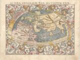
Sebastian Munster (1489 - 1552) was one of the three most renowned cartographers of the sixteenth century, along with Mercator and Ortelius. Munster's Geographia and Cosmographia Universalis were two of the most widely read and influential books of the period. His editions of Ptolemy's Geographia, published between 1540 and 1552, were illustrated with 48 woodcut maps, the standard 27 Ptolemaic maps supplemented by 21 new maps. These new maps included a separate map of each of the known continents and marked the development of regional cartography in Central Europe. The antique geography was a prelude to Munster's major work, the Cosmographia, which was published in nearly 30 editions in six languages between 1544 and 1578 and then was revised and reissued by Sebastian Petri from 1588 to 1628. The Cosmographia was a geographical as well as historical and ethnographic description of the world. It contained the maps from the Geographia plus additional regional maps and city views with nearly 500 illustrations which made it one of the most popular pictorial encyclopedias of the sixteen century. Clouds and twelve named wind heads surround Munster’s woodblock world map. It displays the prevailing conception of the world geography prior to the discovery of the New World and according to Claudius Ptolemy. The continents are oddly shaped and all connected by a great southern continent Terra Incognita Secundum Ptolemaeum. There is a very large Taprobana (modern day Sri Lanka) in the enclosed Indian Ocean, and the Indian subcontinent is severely truncated. Only the northern part of Africa is shown with the Nile originating from a series of lakes in a large mountain range. There is a fine vertical crack line across the right-hand part of the map, which is present in nearly all editions.

Die Wiederbelebung von Ptolemäus' Geographie im 15. Jahrhundert

Sebastian Munster (1489 - 1552) was one of the three most renowned cartographers of the sixteenth century, along with Mercator and Ortelius. Munster's Geographia and Cosmographia Universalis were two of the most widely read and influential books of the period. His editions of Ptolemy's Geographia, published between 1540 and 1552, were illustrated with 48 woodcut maps, the standard 27 Ptolemaic maps supplemented by 21 new maps. These new maps included a separate map of each of the known continents and marked the development of regional cartography in Central Europe. The antique geography was a prelude to Munster's major work, the Cosmographia, which was published in nearly 30 editions in six languages between 1544 and 1578 and then was revised and reissued by Sebastian Petri from 1588 to 1628. The Cosmographia was a geographical as well as historical and ethnographic description of the world. It contained the maps from the Geographia plus additional regional maps and city views with nearly 500 illustrations which made it one of the most popular pictorial encyclopedias of the sixteen century. Clouds and twelve named wind heads surround Munster’s woodblock world map. It displays the prevailing conception of the world geography prior to the discovery of the New World and according to Claudius Ptolemy. The continents are oddly shaped and all connected by a great southern continent Terra Incognita Secundum Ptolemaeum. There is a very large Taprobana (modern day Sri Lanka) in the enclosed Indian Ocean, and the Indian subcontinent is severely truncated. Only the northern part of Africa is shown with the Nile originating from a series of lakes in a large mountain range. There is a fine vertical crack line across the right-hand part of the map, which is present in nearly all editions.

O renascimento da Geografia de Ptolomeu no século XV

Sebastian Munster (1489 - 1552) was one of the three most renowned cartographers of the sixteenth century, along with Mercator and Ortelius. Munster's Geographia and Cosmographia Universalis were two of the most widely read and influential books of the period. His editions of Ptolemy's Geographia, published between 1540 and 1552, were illustrated with 48 woodcut maps, the standard 27 Ptolemaic maps supplemented by 21 new maps. These new maps included a separate map of each of the known continents and marked the development of regional cartography in Central Europe. The antique geography was a prelude to Munster's major work, the Cosmographia, which was published in nearly 30 editions in six languages between 1544 and 1578 and then was revised and reissued by Sebastian Petri from 1588 to 1628. The Cosmographia was a geographical as well as historical and ethnographic description of the world. It contained the maps from the Geographia plus additional regional maps and city views with nearly 500 illustrations which made it one of the most popular pictorial encyclopedias of the sixteen century. Clouds and twelve named wind heads surround Munster’s woodblock world map. It displays the prevailing conception of the world geography prior to the discovery of the New World and according to Claudius Ptolemy. The continents are oddly shaped and all connected by a great southern continent Terra Incognita Secundum Ptolemaeum. There is a very large Taprobana (modern day Sri Lanka) in the enclosed Indian Ocean, and the Indian subcontinent is severely truncated. Only the northern part of Africa is shown with the Nile originating from a series of lakes in a large mountain range. There is a fine vertical crack line across the right-hand part of the map, which is present in nearly all editions.

The revival of Ptolemy's Geography in the 15th century

Sebastian Munster (1489 - 1552) was one of the three most renowned cartographers of the sixteenth century, along with Mercator and Ortelius. Munster's Geographia and Cosmographia Universalis were two of the most widely read and influential books of the period. His editions of Ptolemy's Geographia, published between 1540 and 1552, were illustrated with 48 woodcut maps, the standard 27 Ptolemaic maps supplemented by 21 new maps. These new maps included a separate map of each of the known continents and marked the development of regional cartography in Central Europe. The antique geography was a prelude to Munster's major work, the Cosmographia, which was published in nearly 30 editions in six languages between 1544 and 1578 and then was revised and reissued by Sebastian Petri from 1588 to 1628. The Cosmographia was a geographical as well as historical and ethnographic description of the world. It contained the maps from the Geographia plus additional regional maps and city views with nearly 500 illustrations which made it one of the most popular pictorial encyclopedias of the sixteen century. Clouds and twelve named wind heads surround Munster’s woodblock world map. It displays the prevailing conception of the world geography prior to the discovery of the New World and according to Claudius Ptolemy. The continents are oddly shaped and all connected by a great southern continent Terra Incognita Secundum Ptolemaeum. There is a very large Taprobana (modern day Sri Lanka) in the enclosed Indian Ocean, and the Indian subcontinent is severely truncated. Only the northern part of Africa is shown with the Nile originating from a series of lakes in a large mountain range. There is a fine vertical crack line across the right-hand part of the map, which is present in nearly all editions.

La renaissance de la géographie de Ptolémée au XVe siècle

Sebastian Munster (1489 - 1552) was one of the three most renowned cartographers of the sixteenth century, along with Mercator and Ortelius. Munster's Geographia and Cosmographia Universalis were two of the most widely read and influential books of the period. His editions of Ptolemy's Geographia, published between 1540 and 1552, were illustrated with 48 woodcut maps, the standard 27 Ptolemaic maps supplemented by 21 new maps. These new maps included a separate map of each of the known continents and marked the development of regional cartography in Central Europe. The antique geography was a prelude to Munster's major work, the Cosmographia, which was published in nearly 30 editions in six languages between 1544 and 1578 and then was revised and reissued by Sebastian Petri from 1588 to 1628. The Cosmographia was a geographical as well as historical and ethnographic description of the world. It contained the maps from the Geographia plus additional regional maps and city views with nearly 500 illustrations which made it one of the most popular pictorial encyclopedias of the sixteen century. Clouds and twelve named wind heads surround Munster’s woodblock world map. It displays the prevailing conception of the world geography prior to the discovery of the New World and according to Claudius Ptolemy. The continents are oddly shaped and all connected by a great southern continent Terra Incognita Secundum Ptolemaeum. There is a very large Taprobana (modern day Sri Lanka) in the enclosed Indian Ocean, and the Indian subcontinent is severely truncated. Only the northern part of Africa is shown with the Nile originating from a series of lakes in a large mountain range. There is a fine vertical crack line across the right-hand part of the map, which is present in nearly all editions.

El renacimiento de la Geografía de Ptolomeo en el siglo XV
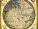
Fra Mauro - Mappa Mundi 1450

Cartografía del siglo XV: Fra Mauro y Martin Behaim

Fra Mauro - Mappa Mundi 1450

Kartografie des 15. Jahrhunderts – Fra Mauro und Martin Behaim

Fra Mauro - Mappa Mundi 1450

Cartographie du XVe siècle — Fra Mauro et Martin Behaim

Fra Mauro - Mappa Mundi 1450

Fifteenth‑Century World Maps: Fra Mauro and Martin Behaim

Fra Mauro - Mappa Mundi 1450

Cartografia do século XV — Fra Mauro e Martin Behaim
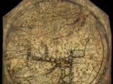
mapa de Hereford

Cartografía: desde la Antigüedad hasta los avances medievales