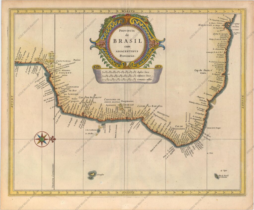
Map of Brazil from 1630 – Nieuwe Wereldt ofte Beschrijvinghe
“Provincia de Brasil cum Adiacentibus Provinciis”, Gerritsz/De Laet
This fine map was a collaborative effort between Hessel Gerritsz, the official cartographer to the Dutch East India Company, and Johannes de Laet, the director of the newly formed Dutch West India Company.
Their maps of South America laid the foundation for many other cartographers.
Detail is confined to the coastlines and includes the Capitanias.
The interior is filled with a large title cartouche and distance scales, and the map is further embellished with a compass rose, orienting north to the right of the chart.
References: Shirley (BL Atlases) G.LAET-1b #12.
Map of Brazil from 1630 – Historical Map
Publicações Relacionadas
Reis Magos Fort Engraving from 1690 - Engravings Stories
All Saints Bay Map of 1644 - Historical Map
Map of Southern South America, 1656 - Historical Map
Map of Brazil from 1850 - Historical Map of Brazil
1671 Map of Jamaica
1620 Map of Portugal and Spain - Historical Map
Map of Cabo Santo Agostinho from 1645 - Historical Map of Brazil
1823 Map of Brazil - Historical Map
1631 Map of the Western Hemisphere - Historical Map
Map of South America and Brazil 1624 - Historical Map
Map of Rio de Janeiro, 1840 - Historical Map
Map of All Saints Bay 1769 - Historical Maps
1592 Map of the Western Hemisphere - Historical Map
1587 Map of the Western Hemisphere - Historical Map
1587 Map of the Western Hemisphere - Historical Map
Map of Brazil 1554 - Historical Maps of Brazil
Map of Olinda in Pernambuco from 1640 - Historical Map
Map of Brazil from 1652
This post is also on:
![]() Português
Português ![]() English
English ![]() Deutsch
Deutsch ![]() Español
Español ![]() Français
Français


