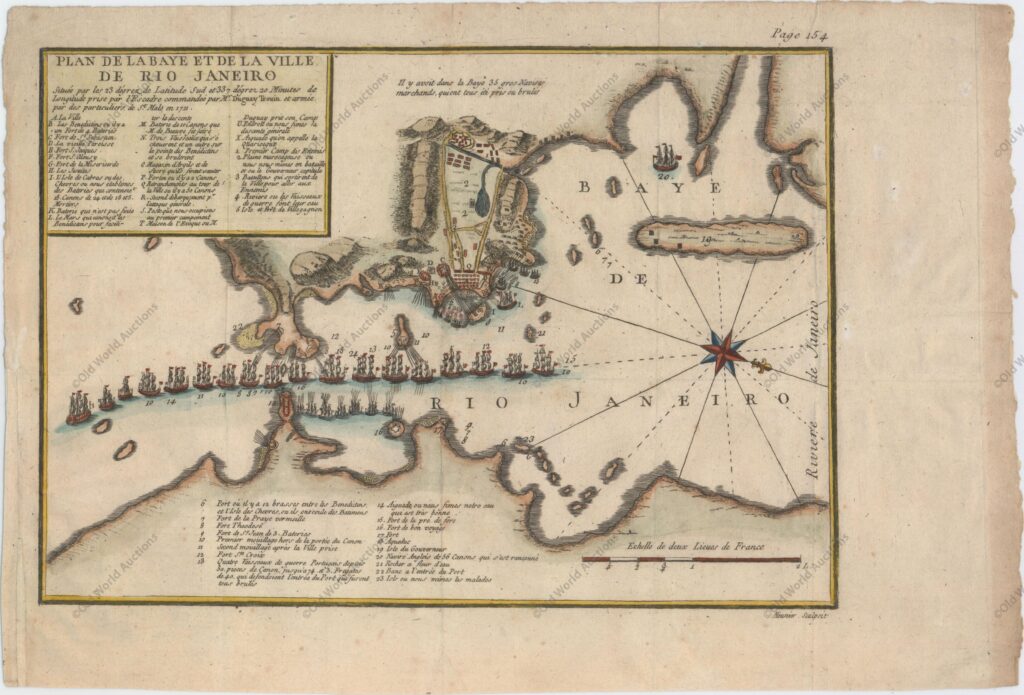
Map of Rio de Janeiro of 1750
“Plan de la Baye et de la Ville de Rio Janeiro…”
This beautiful panoramic plan of Rio de Janeiro and Guanabara Bay was created to illustrate the French siege of 1711.
A large compass rose points north to right. Numbered and lettered legends identify various ships and important sites, including islands, forts, warehouses and batteries. Engraved by Meunier.
This map was first published in Memoires de Monsieur du Guay-Trouin in 1740, with two later editions of the map published in 1785. René Duguay-Trouin was a French pirate from Saint-Malo who later became a lieutenant general in the French Royal Navy.
In 1711, during the War of the Spanish Succession, Duguay-Trouin led seventeen ships and 6,000 men into Guanabara Bay to capture Rio de Janeiro.
The French defeated the Portuguese and took the city. After occupying the city for two months, the French received news that Portuguese reinforcements were being sent under the command of António de Albuquerque.
Duguay-Trouin decided to return to France, first securing a booty of around 4 million pounds of the city’s gold. All editions of this map are very rare.
Map of Rio de Janeiro from 1750 – Historical Map


