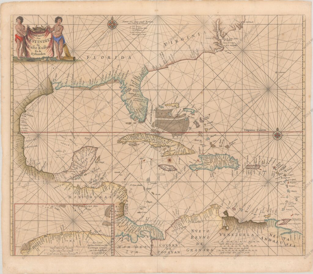
Map of the Gulf of Mexico and the Caribbean from 1666 – De Zee-Atlas, ofte Water-Weereld
Scarce sea chart with an interesting depiction of the coastline of the USA, “Pascaerte van Westindien de Vaste Kusten en de Eylanden”, Goos, Pieter
Goos’s scarce map of the Gulf of Mexico and the Caribbean was based on Hessel Gerritsz’s map of the region published around 1631, which influenced many derivatives.
Goos included updates of other derivatives, including the cartography of the Gulf of Mexico by Joannes van Loon, c.1661, and the gently sloping coastline of the south-eastern USA by Hendrick Doncker, c.1659.
However, Goos’s map was the first derivative to include Gerritsz’s insertion of the northern coast of Cuba, which fills the lower left-hand corner. Goos also introduced some improvements, such as the depiction of the Outer Banks.
The map is decorated with two compass roses and the title appears on a cowhide held aloft by two cherubs.
References: Burden #389.
Publicações Relacionadas
1620 Map of Portugal and Spain - Historical Map
Painting of the Three Kings Fort in Natal from 1647
Map of the Brazilian coast from the Paraíba River to Cabo de Santo Agostinho
Map of Salvador de Bahia from 1748
1581 Map of the Western Hemisphere - Historical Map
Map of the Gulf of Mexico and the Caribbean, 1594
Map of Africa 1593 - Historical Map
1697 Map of the Western Hemisphere - Historical Map
Map of Cabo Santo Agostinho from 1645 - Historical Map of Brazil
Map of the Bay of All Saints and Pernambuco, 1700
1694 Map of South America - Historical Map
Map of All Saints Bay 1769 - Historical Maps
Map of the Captaincy of Espirito Santo and Porto Seguro from 1698
1592 Map of the Western Hemisphere - Historical Map
Map of Brazil from 1606 - Historical Map
Map of Rio de Janeiro of 1764 - Historical Map
Engraving of Vila de Olinda in 1671 - Historical Engraving
Map of Brazil from 1798
This post is also on:
![]() Português
Português ![]() English
English ![]() Deutsch
Deutsch ![]() Español
Español ![]() Français
Français


