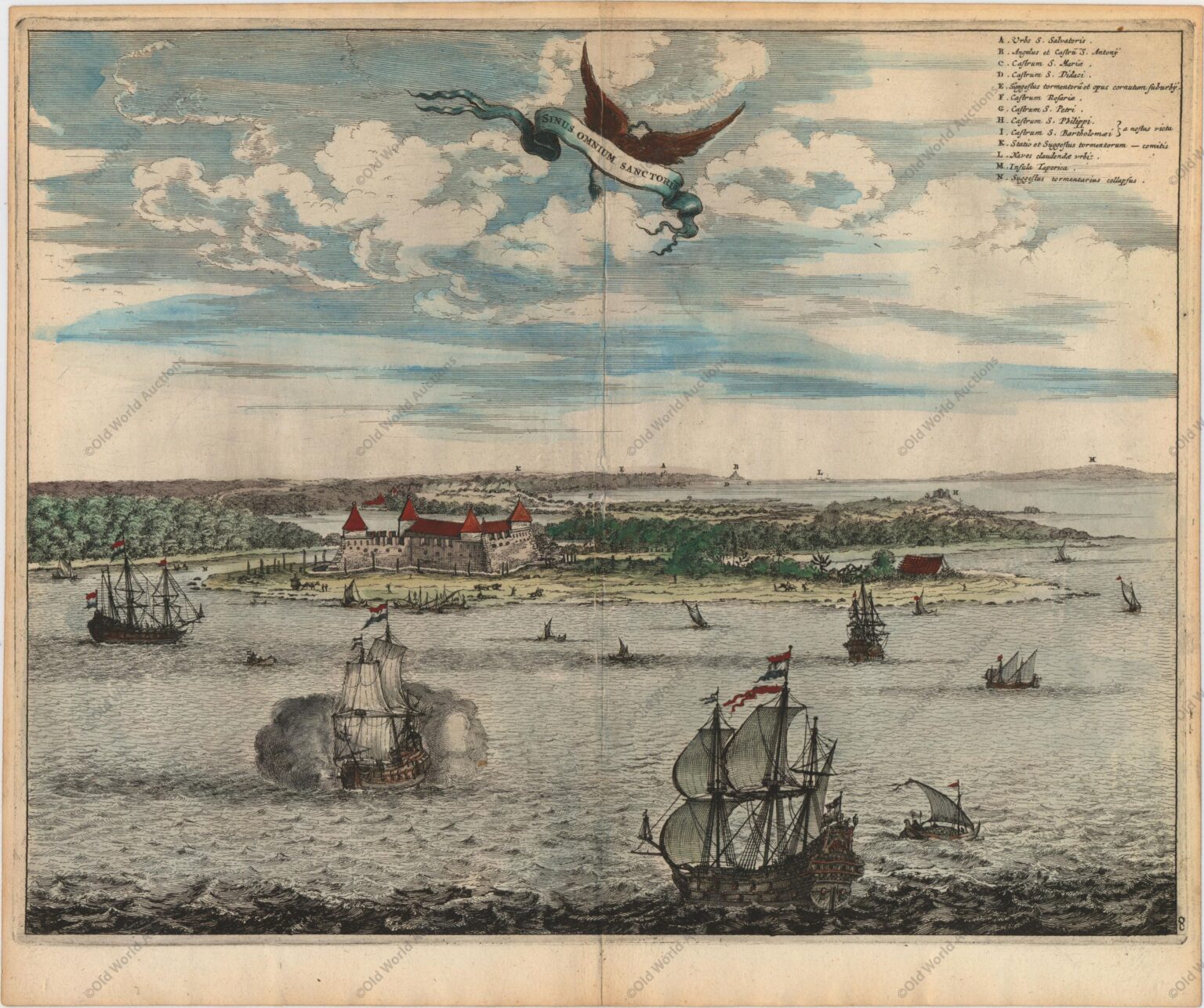
Engraving of the Baia de Todos os Santos from 1671 – Brazil – De Nieuwe en Onbekende Weereld
“Sinus Omnium Sanctoru”, Montanus, Arnoldus
Montanus’ work was perhaps the greatest illustrated book on the New World produced in the seventeenth century.
It contained over one hundred beautifully engraved plates, views, and maps of North and South America. The plates vividly depict forts, festivals, occupations, Dutch fleets, battles, religious rites, and customs of the native inhabitants.
This important work was translated into German by Olivier Dapper, and into English by John Ogilby. Several of the plates were later acquired by Pierre Vander Aa.
This is a superb view of Todos os Santos Bay (All Saints Bay) with Salvador da Bahia in the background.
The engraving illustrates the region when the Dutch were attempting to gain control of the Portuguese colonies in Brazil and her lucrative sugar trade. In 1624 the Dutch captured and sacked the Salvador da Bahia, and held it along with other northeast ports until it was retaken by a Spanish-Portuguese fleet.
The city then played a strategically vital role in the Portuguese-Brazilian resistance against the Dutch in the 1630s.
This view was taken from the work of Frans Post. His works are some of the earliest European paintings of Brazil and were eagerly reproduced in print by Dutch engravers.
Engraving of the Baia de Todos os Santos from 1671 – Brazil – Historical Map
Publicações Relacionadas
1679 Map of Recife - Historical Map
Map of the Gulf of Mexico and the Caribbean, 1675
1587 Map of the Western Hemisphere - Historical Map
Map of South America 1601 - Historical Map
Map of Brazil from 1606 - Historical Map
1730 Map of Northern South America - Historical Map
Map of Brazil from 1798
Map of Brazil divided into fourteen hereditary captainships from 1657 onwards
Painting of the Three Kings Fort in Natal from 1647
Map of the Gulf of Mexico, the Caribbean and the Southern United States, 1682
1677 Map of the Western Hemisphere - Historical Map
Map of Mexico and Central America, 1671 - Historical Map
Map of the Province of Paraíba from 1698
1671 Map of Jamaica
Engraving of the town of Olinda in 1633 - Historical Engraving
Map of Brazil 1698 - Historical Maps of Brazil
Map of Panama 1699 - Historical Map
1719 Map of the Western Hemisphere - Historical Map
This post is also on:
Português
English
Deutsch
Español
Français


