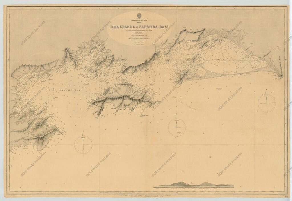
Maritime chart of the east coast of Brazil Ilha Grande and Sapetiba Bay 1884

Carta marítima Costa Leste do Brasil Ilha Grande e Baías de Sapetiba 1884
Beautiful large-format marine chart of the region west of Rio de Janeiro. Complete with soundings, anchorages and navigational hazards. In the background is a view of Ilha Grande and the East Passage. The chart was first drawn by Captain Mouchez of the Imperial French Navy in 1868-69 and published by the British Admiralty in 1870. This chart was updated for 1884.

Marine Map of the East Coast of Brazil Ilha Grande and Sapetiba Bay 1884

Beautiful large scale chart of the region west of Rio de Janeiro. Complete with soundings, anchorages and navigational hazards.

In the background is a view of Ilha Grande and the East Passage. The chart was first drawn by Captain Mouchez of the Imperial French Navy in 1868-69 and published by the British Admiralty in 1870.

This chart has been updated for 1884.

This post is also on: Português English Deutsch Español Français