Expansão Marítima de Portugal – Exploração da costa ocidental da África

Publicado em · Atualizado em

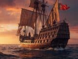
A exploração da costa ocidental africana foi um marco na expansão marítima portuguesa nos séculos XV e XVI, impulsionada por motivações econômicas, estratégicas e científicas.

A iniciativa de Dom Henrique e as expedições de navegadores como Gil Eanes, Diogo Cão e Bartolomeu Dias abriram novas rotas e estabeleceram feitorias.

Essas viagens prepararam o caminho para a ligação marítima com a Índia e alteraram profundamente as redes comerciais e geopolíticas da época, consolidando a presença portuguesa ao longo da costa africana e influenciando os rumos das navegações ultramarinas.

Expansão Marítima de Portugal - Exploração da costa ocidental da África

Expansão Marítima de Portugal - Exploração da costa ocidental da África

Exploração da costa ocidental da África

1. Início das navegações — Dom Henrique (1434)

Dom Henrique deu início à exploração da costa ocidental da África ao ordenar que seu auxiliar Gil Eanes dobrasse o Cabo Bojador (1434).

A seguir, gradativamente, seus capitães atingiram o Cabo Branco, a foz do rio Senegal, o Cabo Verde, a Gâmbia, Serra Leoa e o Cabo das Palmas.

2. Continuidade e dificuldades — Dom Afonso V (meados do século XV)

Após a morte do Infante, os descobrimentos prosseguiram até a Guiné e ilhas próximas, ainda no reinado de Dom Afonso V.

No entanto, em consequência de uma guerra com Castela, Leão e Aragão, esse rei foi obrigado a reconhecer a soberania espanhola sobre as Canárias.

3. Novo impulso e descobertas — Dom João II (final do século XV)

Dom João II, filho e sucessor, deu novo e grande impulso à exploração do que faltava conhecer na costa oeste da África. Começou por ordenar a fundação, por Diogo de Azambuja, da feitoria e fortaleza de São Jorge da Mina.

Seus capitães Diogo Cão e Bartolomeu Dias alcançaram, respectivamente, pontos além do Congo e do Cabo das Tormentas.

Este último, atingido em 1488, passou a chamar‑se Cabo da Boa Esperança, já que a mudança de direção do litoral sul‑africano tornava plausível o descobrimento de um caminho marítimo para a Índia.

Map of Europe from 1644 (circa) This classic map of Europe is presented in the carte-de-figures style with vignettes on three sides. The upper frieze has nine bird's-eye views of Amsterdam, Prague, Constantinople, Venice, Rome, Paris, London, Toledo and Lisbon. The side borders contain the costumes of the noblemen and women of ten European nations. The map is embellished with sailing ships, sea monsters, bears and Neptune riding a dolphin and holding his trident. A beautiful map produced at the height of the Golden Age of Dutch mapmaking; it was included in the first volume of Blaeu's magnificent atlas. Latin text on verso, published between 1644-55. Publication: Theatrum Orbis Terrarum - Blaeu's Carte-a-Figures Map of Europe - "Europa Recens Descripta", Blaeu, Willem
Mapa da Europa de 1644 (aproximadamente) – Este mapa clássico da Europa é apresentado no estilo carte-de-figures, com vinhetas em três lados. O friso superior tem nove vistas aéreas de Amsterdã, Praga, Constantinopla, Veneza, Roma, Paris, Londres, Toledo e Lisboa.
As bordas laterais contêm os trajes dos nobres e nobres de dez nações europeias. O mapa é embelezado com navios à vela, monstros marinhos, ursos e Netuno montado em um golfinho e segurando seu tridente.
Um belo mapa produzido no auge da Idade de Ouro da cartografia holandesa; foi incluído no primeiro volume do magnífico atlas de Blaeu. Texto em latim no verso, publicado entre 1644-55.
Publicação: Theatrum Orbis Terrarum – Mapa Carte-a-Figures da Europa de Blaeu – “Europa Recens Descripta”, Blaeu, Willem
Willy Sievert

Escrito por Willy Sievert

Editor do Bahia.ws desde sua fundação em 2009. Morador de Salvador, viaja com frequência pelo Nordeste e por todo o Brasil para manter os guias atualizados. Conheça mais sobre Willy Sievert →

Publicações Relacionadas

nau portuguesa do século XV–XVI

Nau portuguesa e caravela: diferenças e tipos de navios
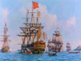
A nau portuguesa era um tipo de embarcação utilizada principalmente durante os séculos XV e XVI, época das Grandes Navegações. Caracterizava-se por seu casco robusto e grande capacidade de carga, sendo ideal para longas viagens oceânicas. As naus eram dotadas de vela latina e, posteriormente, de velas redondas, permitindo melhor navegação em diferentes ventos. Essas embarcações foram fundamentais para o comércio e a exploração marítima portuguesa, transportando mercadorias, pessoas e, em muitos casos, também escravizados.

Expansão Marítima de Portugal - A navegação nos séculos XV e XVI
Portugueses chegando na America do Norte em 1497

Expansão Marítima de Portugal - Os Portugueses na América do Norte
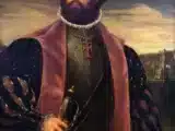
Vasco da Gama

Expansão Marítima de Portugal - O descobrimento do caminho marítimo para a Índia
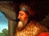
Afonso V de Portugal

Expansion maritime du Portugal - Exploration de la côte occidentale de l'Afrique

Afonso V de Portugal

Portugal's Maritime Expansion - Exploration of the West Coast of Africa

Afonso V de Portugal

Die maritime Expansion Portugals – Erkundung der Westküste Afrikas
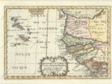
Map of West Africa and the Cape Verde Islands, 1699 - Map of the important Cape Verde Islands and the opposite African coast from Cap Blanc to Sierra Leone. There is a lot of detail along the African coastline, with numerous cities, capes, rivers, and more identified. A fancy decorative title cartouche adorns the bottom of the map. Sanson's small maps from his L'Afrique en Plusieurs Cartes..., first published in 1656 and engraved by A. Peyrounin, were copied several times by various map publishers. Johann David Zunners made copies of Sanson's maps for his German translation of Die Gantze Erd-Kugel in 1679. Johannes Ribbius and Simon de Vries published copies in 1682 and 1683, with new maps engraved by Antoine d'Winter. The plates were later sold to Francois Halma, who used them in 1699 and then again in 1705 with the titles re-engraved in Dutch. The titles on the d'Winter plates were re-engraved back into French, and then used by Nicholas Chemereau in 1715 and by Henri du Sauzet in 1738. "Isles du Cap Verd Coste, et Pays des Negres aux Environs du Cap Verd...", Sanson, Nicolas

Expansion maritime du Portugal - Découverte des îles de l'Atlantique

Map of West Africa and the Cape Verde Islands, 1699 - Map of the important Cape Verde Islands and the opposite African coast from Cap Blanc to Sierra Leone. There is a lot of detail along the African coastline, with numerous cities, capes, rivers, and more identified. A fancy decorative title cartouche adorns the bottom of the map. Sanson's small maps from his L'Afrique en Plusieurs Cartes..., first published in 1656 and engraved by A. Peyrounin, were copied several times by various map publishers. Johann David Zunners made copies of Sanson's maps for his German translation of Die Gantze Erd-Kugel in 1679. Johannes Ribbius and Simon de Vries published copies in 1682 and 1683, with new maps engraved by Antoine d'Winter. The plates were later sold to Francois Halma, who used them in 1699 and then again in 1705 with the titles re-engraved in Dutch. The titles on the d'Winter plates were re-engraved back into French, and then used by Nicholas Chemereau in 1715 and by Henri du Sauzet in 1738. "Isles du Cap Verd Coste, et Pays des Negres aux Environs du Cap Verd...", Sanson, Nicolas

Expansión marítima de Portugal: descubrimiento de las islas del Atlántico

Map of West Africa and the Cape Verde Islands, 1699 - Map of the important Cape Verde Islands and the opposite African coast from Cap Blanc to Sierra Leone. There is a lot of detail along the African coastline, with numerous cities, capes, rivers, and more identified. A fancy decorative title cartouche adorns the bottom of the map. Sanson's small maps from his L'Afrique en Plusieurs Cartes..., first published in 1656 and engraved by A. Peyrounin, were copied several times by various map publishers. Johann David Zunners made copies of Sanson's maps for his German translation of Die Gantze Erd-Kugel in 1679. Johannes Ribbius and Simon de Vries published copies in 1682 and 1683, with new maps engraved by Antoine d'Winter. The plates were later sold to Francois Halma, who used them in 1699 and then again in 1705 with the titles re-engraved in Dutch. The titles on the d'Winter plates were re-engraved back into French, and then used by Nicholas Chemereau in 1715 and by Henri du Sauzet in 1738. "Isles du Cap Verd Coste, et Pays des Negres aux Environs du Cap Verd...", Sanson, Nicolas

Portugal's Maritime Expansion - Discovery of the Atlantic Islands

Map of West Africa and the Cape Verde Islands, 1699 - Map of the important Cape Verde Islands and the opposite African coast from Cap Blanc to Sierra Leone. There is a lot of detail along the African coastline, with numerous cities, capes, rivers, and more identified. A fancy decorative title cartouche adorns the bottom of the map. Sanson's small maps from his L'Afrique en Plusieurs Cartes..., first published in 1656 and engraved by A. Peyrounin, were copied several times by various map publishers. Johann David Zunners made copies of Sanson's maps for his German translation of Die Gantze Erd-Kugel in 1679. Johannes Ribbius and Simon de Vries published copies in 1682 and 1683, with new maps engraved by Antoine d'Winter. The plates were later sold to Francois Halma, who used them in 1699 and then again in 1705 with the titles re-engraved in Dutch. The titles on the d'Winter plates were re-engraved back into French, and then used by Nicholas Chemereau in 1715 and by Henri du Sauzet in 1738. "Isles du Cap Verd Coste, et Pays des Negres aux Environs du Cap Verd...", Sanson, Nicolas

Die maritime Expansion Portugals – Entdeckung der Atlantikinseln

Map of West Africa and the Cape Verde Islands, 1699 - Map of the important Cape Verde Islands and the opposite African coast from Cap Blanc to Sierra Leone. There is a lot of detail along the African coastline, with numerous cities, capes, rivers, and more identified. A fancy decorative title cartouche adorns the bottom of the map. Sanson's small maps from his L'Afrique en Plusieurs Cartes..., first published in 1656 and engraved by A. Peyrounin, were copied several times by various map publishers. Johann David Zunners made copies of Sanson's maps for his German translation of Die Gantze Erd-Kugel in 1679. Johannes Ribbius and Simon de Vries published copies in 1682 and 1683, with new maps engraved by Antoine d'Winter. The plates were later sold to Francois Halma, who used them in 1699 and then again in 1705 with the titles re-engraved in Dutch. The titles on the d'Winter plates were re-engraved back into French, and then used by Nicholas Chemereau in 1715 and by Henri du Sauzet in 1738. "Isles du Cap Verd Coste, et Pays des Negres aux Environs du Cap Verd...", Sanson, Nicolas

Expansão Marítima de Portugal - Descobrimento das Ilhas do Atlântico
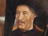
Infante Dom Henrique, o “Navegador”

Expansión marítima de Portugal - Infante Dom Henrique, el «Navegante»

Infante Dom Henrique, o “Navegador”

Die maritime Expansion Portugals – Infante Dom Henrique, der „Seefahrer“

Infante Dom Henrique, o “Navegador”

Portugal's Maritime Expansion - Prince Henry the Navigator

Infante Dom Henrique, o “Navegador”

Expansion maritime du Portugal - Infante Dom Henrique, le Navigateur

Infante Dom Henrique, o “Navegador”

Expansão Marítima de Portugal - Infante Dom Henrique, o “Navegador”
Caravela Portuguesa

Die maritime Expansion Portugals – Seefahrt vor den Entdeckungen

Caravela Portuguesa

Expansion maritime du Portugal - La navigation avant les découvertes

Caravela Portuguesa

Portugal's Maritime Expansion - Navigation before the Discoveries

Caravela Portuguesa

Expansión marítima de Portugal: la navegación antes de los descubrimientos

Caravela Portuguesa

Expansão Marítima de Portugal - Navegação antes dos Descobrimentos
caravela portuguesa

Portugal's Maritime Expansion - First Naval Operations

caravela portuguesa

Expansion Maritime du Portugal - Premières Opérations Navales

caravela portuguesa

Die maritime Expansion Portugals – Erste Seefahrtsoperationen

caravela portuguesa

Expansión marítima de Portugal: primeras operaciones navales

caravela portuguesa

Expansão Marítima de Portugal - Primeiras Operações Navais
expansão marítima de portugal

Expansion maritime du Portugal - La pêche comme origine

expansão marítima de portugal

Die maritime Expansion Portugals – Die Fischerei als Ursprung

expansão marítima de portugal

Expansión marítima de Portugal: la pesca como origen

expansão marítima de portugal

Portugal's Maritime Expansion - Fishing as the Origin

expansão marítima de portugal

Expansão Marítima de Portugal - Pesca como Origem

Hide picture