Expansão Marítima de Portugal – Infante Dom Henrique, o “Navegador”

Publicado em · Atualizado em

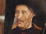
Infante Dom Henrique, conhecido como o “Navegador”, foi figura central nos primórdios dos descobrimentos portugueses: nascido em 1394, participou da expedição a Ceuta e, como mestre da Ordem de Cristo e 1.º Duque de Viseu, fundou na região do Cabo de São Vicente um centro de estudos náuticos — a chamada Escola de Sagres.

Ali, apoiado por papas e pela família real, reuniu cientistas e navegadores para aperfeiçoar técnicas de navegação e promover a exploração gradual da costa e do interior da África, com objetivos religiosos e comerciais, deixando um legado duradouro mesmo sem completar todos os seus planos até sua morte em 1460.

Expansão Marítima de Portugal - Infante Dom Henrique, o “Navegador”

Expansão Marítima de Portugal - Infante Dom Henrique, o “Navegador”

Influência do Infante Dom Henrique na Expansão Marítima de Portugal

1. Origem e títulos

Infante Dom Henrique nasceu em 1394, participante da expedição de Ceuta, mestre da Ordem de Nosso Senhor Jesus Cristo e 1.º Duque de Viseu, o Infante Dom Henrique, filho de Dom João I e da rainha Dom Filipa de Lencastre, teve papel de grande relevância na história dos descobrimentos marítimos portugueses.

2. Instalação no sudoeste e a Escola de Sagres

De volta daquela primeira jornada à África, estabeleceu‑se no extremo sudoeste do continente europeu, próximo ao Cabo de São Vicente, e aí, fiel à sua divisa — Talent de bien faire — criou o centro de estudos e experiências náuticas que se convencionou chamar Escola de Sagres, por ficar perto do promontório desse nome.

3. Colaboradores e navegações

Atraiu à sua companhia um cartógrafo e construtor de instrumentos náuticos — Mestre Jácome de Maiorca — e navegadores como o veneziano Cadamosto, entre outros.

4. Ciência e aperfeiçoamento da marinharia

Dedicado à matemática e à astronomia, aplicou‑as no aperfeiçoamento da marinharia de seu tempo, de modo a pôr em execução o plano que consistia no descobrimento gradual da costa e do interior da África, visando simultaneamente a conversão à fé cristã dos seus naturais e o estabelecimento de relações comerciais úteis aos portugueses.

5. Apoio papal e financiamento

Autorizado por bulas dos papas Eugénio IV, Nicolau V e Calisto III, aplicou, com esse objetivo, tanto as rendas da Ordem de Cristo como outras que lhe doaram o irmão D. Duarte e o sobrinho D. Afonso V.

6. Legado do Infante Dom Henrique

Ao perecer, em 1460, embora não tivesse realizado toda a obra projetada, deixou‑a bem encaminhada — razão pela qual ficou com justiça cognominado o Navegador.

Infante Dom Henrique, o “Navegador”
Willy Sievert

Escrito por Willy Sievert

Editor do Bahia.ws desde sua fundação em 2009. Morador de Salvador, viaja com frequência pelo Nordeste e por todo o Brasil para manter os guias atualizados. Conheça mais sobre Willy Sievert →

Publicações Relacionadas

nau portuguesa do século XV–XVI

Nau portuguesa e caravela: diferenças e tipos de navios
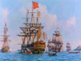
A nau portuguesa era um tipo de embarcação utilizada principalmente durante os séculos XV e XVI, época das Grandes Navegações. Caracterizava-se por seu casco robusto e grande capacidade de carga, sendo ideal para longas viagens oceânicas. As naus eram dotadas de vela latina e, posteriormente, de velas redondas, permitindo melhor navegação em diferentes ventos. Essas embarcações foram fundamentais para o comércio e a exploração marítima portuguesa, transportando mercadorias, pessoas e, em muitos casos, também escravizados.

Expansão Marítima de Portugal - A navegação nos séculos XV e XVI
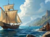
Portugueses chegando na America do Norte em 1497

Expansão Marítima de Portugal - Os Portugueses na América do Norte
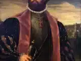
Vasco da Gama

Expansão Marítima de Portugal - O descobrimento do caminho marítimo para a Índia
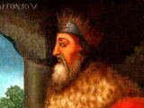
Afonso V de Portugal

Expansion maritime du Portugal - Exploration de la côte occidentale de l'Afrique

Afonso V de Portugal

Portugal's Maritime Expansion - Exploration of the West Coast of Africa

Afonso V de Portugal

Expansão Marítima de Portugal - Exploração da costa ocidental da África

Afonso V de Portugal

Die maritime Expansion Portugals – Erkundung der Westküste Afrikas
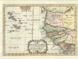
Map of West Africa and the Cape Verde Islands, 1699 - Map of the important Cape Verde Islands and the opposite African coast from Cap Blanc to Sierra Leone. There is a lot of detail along the African coastline, with numerous cities, capes, rivers, and more identified. A fancy decorative title cartouche adorns the bottom of the map. Sanson's small maps from his L'Afrique en Plusieurs Cartes..., first published in 1656 and engraved by A. Peyrounin, were copied several times by various map publishers. Johann David Zunners made copies of Sanson's maps for his German translation of Die Gantze Erd-Kugel in 1679. Johannes Ribbius and Simon de Vries published copies in 1682 and 1683, with new maps engraved by Antoine d'Winter. The plates were later sold to Francois Halma, who used them in 1699 and then again in 1705 with the titles re-engraved in Dutch. The titles on the d'Winter plates were re-engraved back into French, and then used by Nicholas Chemereau in 1715 and by Henri du Sauzet in 1738. "Isles du Cap Verd Coste, et Pays des Negres aux Environs du Cap Verd...", Sanson, Nicolas

Expansion maritime du Portugal - Découverte des îles de l'Atlantique

Map of West Africa and the Cape Verde Islands, 1699 - Map of the important Cape Verde Islands and the opposite African coast from Cap Blanc to Sierra Leone. There is a lot of detail along the African coastline, with numerous cities, capes, rivers, and more identified. A fancy decorative title cartouche adorns the bottom of the map. Sanson's small maps from his L'Afrique en Plusieurs Cartes..., first published in 1656 and engraved by A. Peyrounin, were copied several times by various map publishers. Johann David Zunners made copies of Sanson's maps for his German translation of Die Gantze Erd-Kugel in 1679. Johannes Ribbius and Simon de Vries published copies in 1682 and 1683, with new maps engraved by Antoine d'Winter. The plates were later sold to Francois Halma, who used them in 1699 and then again in 1705 with the titles re-engraved in Dutch. The titles on the d'Winter plates were re-engraved back into French, and then used by Nicholas Chemereau in 1715 and by Henri du Sauzet in 1738. "Isles du Cap Verd Coste, et Pays des Negres aux Environs du Cap Verd...", Sanson, Nicolas

Expansión marítima de Portugal: descubrimiento de las islas del Atlántico

Map of West Africa and the Cape Verde Islands, 1699 - Map of the important Cape Verde Islands and the opposite African coast from Cap Blanc to Sierra Leone. There is a lot of detail along the African coastline, with numerous cities, capes, rivers, and more identified. A fancy decorative title cartouche adorns the bottom of the map. Sanson's small maps from his L'Afrique en Plusieurs Cartes..., first published in 1656 and engraved by A. Peyrounin, were copied several times by various map publishers. Johann David Zunners made copies of Sanson's maps for his German translation of Die Gantze Erd-Kugel in 1679. Johannes Ribbius and Simon de Vries published copies in 1682 and 1683, with new maps engraved by Antoine d'Winter. The plates were later sold to Francois Halma, who used them in 1699 and then again in 1705 with the titles re-engraved in Dutch. The titles on the d'Winter plates were re-engraved back into French, and then used by Nicholas Chemereau in 1715 and by Henri du Sauzet in 1738. "Isles du Cap Verd Coste, et Pays des Negres aux Environs du Cap Verd...", Sanson, Nicolas

Portugal's Maritime Expansion - Discovery of the Atlantic Islands

Map of West Africa and the Cape Verde Islands, 1699 - Map of the important Cape Verde Islands and the opposite African coast from Cap Blanc to Sierra Leone. There is a lot of detail along the African coastline, with numerous cities, capes, rivers, and more identified. A fancy decorative title cartouche adorns the bottom of the map. Sanson's small maps from his L'Afrique en Plusieurs Cartes..., first published in 1656 and engraved by A. Peyrounin, were copied several times by various map publishers. Johann David Zunners made copies of Sanson's maps for his German translation of Die Gantze Erd-Kugel in 1679. Johannes Ribbius and Simon de Vries published copies in 1682 and 1683, with new maps engraved by Antoine d'Winter. The plates were later sold to Francois Halma, who used them in 1699 and then again in 1705 with the titles re-engraved in Dutch. The titles on the d'Winter plates were re-engraved back into French, and then used by Nicholas Chemereau in 1715 and by Henri du Sauzet in 1738. "Isles du Cap Verd Coste, et Pays des Negres aux Environs du Cap Verd...", Sanson, Nicolas

Die maritime Expansion Portugals – Entdeckung der Atlantikinseln

Map of West Africa and the Cape Verde Islands, 1699 - Map of the important Cape Verde Islands and the opposite African coast from Cap Blanc to Sierra Leone. There is a lot of detail along the African coastline, with numerous cities, capes, rivers, and more identified. A fancy decorative title cartouche adorns the bottom of the map. Sanson's small maps from his L'Afrique en Plusieurs Cartes..., first published in 1656 and engraved by A. Peyrounin, were copied several times by various map publishers. Johann David Zunners made copies of Sanson's maps for his German translation of Die Gantze Erd-Kugel in 1679. Johannes Ribbius and Simon de Vries published copies in 1682 and 1683, with new maps engraved by Antoine d'Winter. The plates were later sold to Francois Halma, who used them in 1699 and then again in 1705 with the titles re-engraved in Dutch. The titles on the d'Winter plates were re-engraved back into French, and then used by Nicholas Chemereau in 1715 and by Henri du Sauzet in 1738. "Isles du Cap Verd Coste, et Pays des Negres aux Environs du Cap Verd...", Sanson, Nicolas

Expansão Marítima de Portugal - Descobrimento das Ilhas do Atlântico
Infante Dom Henrique, o “Navegador”

Expansión marítima de Portugal - Infante Dom Henrique, el «Navegante»

Infante Dom Henrique, o “Navegador”

Die maritime Expansion Portugals – Infante Dom Henrique, der „Seefahrer“

Infante Dom Henrique, o “Navegador”

Portugal's Maritime Expansion - Prince Henry the Navigator

Infante Dom Henrique, o “Navegador”

Expansion maritime du Portugal - Infante Dom Henrique, le Navigateur
Caravela Portuguesa

Die maritime Expansion Portugals – Seefahrt vor den Entdeckungen

Caravela Portuguesa

Expansion maritime du Portugal - La navigation avant les découvertes

Caravela Portuguesa

Portugal's Maritime Expansion - Navigation before the Discoveries

Caravela Portuguesa

Expansión marítima de Portugal: la navegación antes de los descubrimientos

Caravela Portuguesa

Expansão Marítima de Portugal - Navegação antes dos Descobrimentos
caravela portuguesa

Portugal's Maritime Expansion - First Naval Operations

caravela portuguesa

Expansion Maritime du Portugal - Premières Opérations Navales

caravela portuguesa

Die maritime Expansion Portugals – Erste Seefahrtsoperationen

caravela portuguesa

Expansión marítima de Portugal: primeras operaciones navales

caravela portuguesa

Expansão Marítima de Portugal - Primeiras Operações Navais
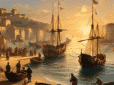
expansão marítima de portugal

Expansion maritime du Portugal - La pêche comme origine

expansão marítima de portugal

Die maritime Expansion Portugals – Die Fischerei als Ursprung

expansão marítima de portugal

Expansión marítima de Portugal: la pesca como origen

expansão marítima de portugal

Portugal's Maritime Expansion - Fishing as the Origin

expansão marítima de portugal

Expansão Marítima de Portugal - Pesca como Origem

Hide picture