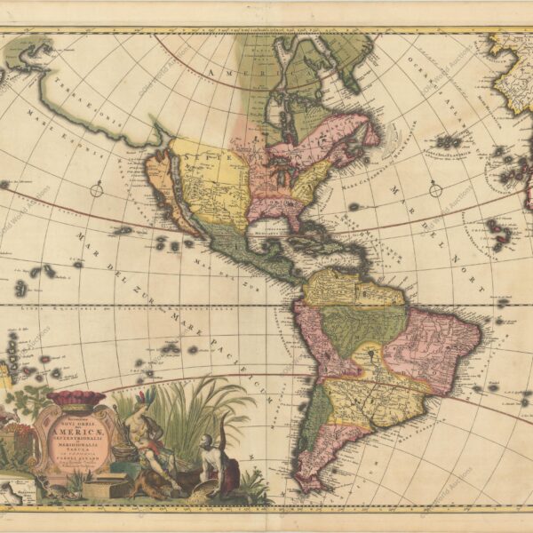
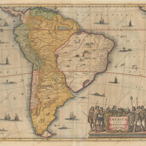
Map of the Western Hemisphere, 1700 This sumptuous map of the Americas features a dramatically decorative title cartouche depicting an Amazon queen surrounded by riches, a sugar cane field and exotic animals. Inserted in the cartouche is a small map of the coast of New Zealand. The cartography of North […]
Tag: Mapa Histórico
1719 Map of the Western Hemisphere – Historical Map
Map of the Western Hemisphere, 1719 This spectacular wall map is richly engraved in the tradition of Dutch cartography. Although the main focus of the map is the Americas, it also covers the entire Pacific, including the East Indies and Japan, and the entire Atlantic, including much of Western Europe […]
1730 Map of the Western Hemisphere – Historical Map
Map of the Western Hemisphere, 1730 This attractive map is a revision of old Homann’s 1710 map of America. After his death in 1724, his son (Johann Christoph Homann) re-engraved the plate to correct the west coast of North America, which here extends far to the west and north, with […]
1740 Map of the Western Hemisphere – Historical Map
Map of the Western Hemisphere, 1740 This impressive map of the Americas shows a prominent island of California, based on the second Sanson model, with two jagged bays on its north coast. Just above the island is the Strait of Fretum Anian and the coastline of Terra Esonis incognito, obscured […]
1638 Map of South America – Historical Map
Map of South America from 1638 This is an important decorative map of the continent and an essential piece for any South American collection. The coastlines are well detailed, but the interior is full of misinformation. Several rivers (including the Amazon and the Paraguay) flow into the Lago de los […]
1694 Map of South America – Historical Map
Map of South America from 1694 This beautiful map of the continent is decorated with elaborate title and mileage cartouches, which balance the lower part of the map with images of Native Americans, flora and fauna. One cartouche contains the title of the map, while the other shows eight different […]
1730 Map of Northern South America – Historical Map
Map of Northern South America from 1730 This beautiful and important map of the northern part of South America is full of information and annotations speculating on the indigenous tribes and the tributaries of the Amazon. The captains are shown along the coast of Brazil. An annotation in Guyana records […]