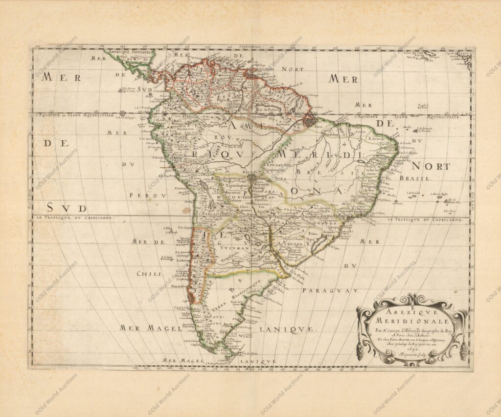
Map of South America from 1650
“Amerique Meridionale”, Sanson/Mariette
This attractive map presents the continent with Sanson’s characteristic attention to detail.
The relatively unknown Amazon region is left with little speculation.
The mythical Lac de Parime still appears with the legendary Manoa del Dora (city of gold) on its western shore; although the lake is diminished in size from earlier depictions.
There is considerable detail of towns and cities and the capitaineries are delineated in Brazil. Decorated with a strapwork title cartouche. Engraved by A. Peyrounin.
Map of South America from 1650 – Historical Map
Publicações Relacionadas
1639 Map of Paraíba - Historical Map of Brazil
Map of Brazil from 1750 - Historical Map of Brazil
1677 Map of the Western Hemisphere - Historical Map
Map of Rio de Janeiro of 1810 - Historical Map
Engraving of Sirinhaém from 1671
1714 Map of the Western Hemisphere - Historical Map
1620 Map of Portugal and Spain - Historical Map
Map of Salvador de Bahia from 1748
1592 Map of the Western Hemisphere - Historical Map
Engraving of the town of Olinda in 1633 - Historical Engraving
Map of Brazil from 1798
1823 Map of Brazil - Historical Map
Map of Mexico and Central America, 1671 - Historical Map
Map of the Province of Paraíba from 1698
Map of Brazil from 1630
1660 Map of the Western Hemisphere - Historical Map
Map of the Brazilian coast from the Paraíba River to Cabo de Santo Agostinho
Engraving of Fort Nassau in Pernambuco, 1671
This post is also on:
![]() Português
Português ![]() English
English ![]() Deutsch
Deutsch ![]() Español
Español ![]() Français
Français


