In the early days of the exploitation of the gold region, at the end of the 17th century, a long road connected the mining settlements with the port of Paraty, crossing the Mantiqueira mountain range.
The journey took three months.
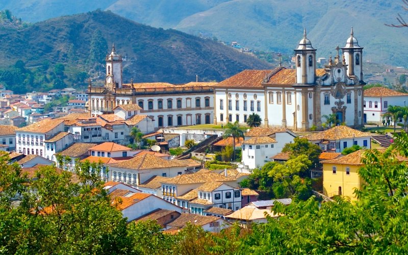
In 1698 the bandeirante Garcia Rodrigues received authorisation to open a new route, from Vila Rica (now Ouro Preto) towards Rio de Janeiro, passing through what is now Juiz de Fora – the so-called Caminho Novo, as it became known.

The Portuguese Crown tightly controlled the flow of metal from its colony, and both the New and the Old Roads could only be travelled under its control; opening new roads was a crime of lese majesty.
With the exhaustion of the mines at the turn of the 19th century, the Estrada Real lost its solemnity.
It was only after Brazil’s Independence (1822) that the old Royal Roads became open to traffic. They were joined by ordinary roads, some sections of which fell into disuse and disappearance, swallowed up by time and the forests.
Other stretches became mere roads, the beds of motorways and railways.
As a result, the history of the Estrada Real somehow“faded away”; many travelled along it, unaware that these roads were the scene of so many stories. These stories only began to be revived at the end of the 20th century, with the resurgence of the Estrada Real, now as a tourist product.
The official routes were thus given the generic name of Estrada Real.
The two old roads – and their subsequent extensions, between Ouro Preto and Diamantina – are now being reconstructed by the Estrada Real Institute, in partnership with the Government of Minas Gerais, with the aim of boosting tourism in the region.
The project includes 177 towns along 1,400 kilometres, in a route that crosses mountains, valleys, plateaus, plains, forests and savannas.
Within the Estrada Real there are regional, circuits and routes – the Trilha dos Inconfidentes, which brings together sixteen towns around Tiradentes, for example, or the Circuito das Vilas e Fazendas, a selection of places for rural accommodation around Congonhas.
Many of the towns that make up the Estrada Real are in the process of developing and improving their tourist infrastructure; small towns, hitherto alien to conventional tourism, are mobilising to offer support and good services to new visitors.

They compensate for the shortcomings of their incipient professionalisation with the richness of their old buildings, the beauty of their surrounding landscape and the moving authenticity of their cultural manifestations.
Video about the Diamond Route of the Royal Road

A rota do ouro e do diamante parte 117:45

Caminho dos Diamantes parte 216:36

Caminhos do Diamante parte 317:05
Ways to discover the tourist attractions of the Royal Road
1. The Old Way
Also known as the Gold Route, it was the first route created by the Portuguese Crown and connects Ouro Preto with Paraty.
Some of the towns and districts that are part of the Old Way: Aiuruoca, Baependi, Bananal, Cachoeira Paulista, Carrancas, Caxambu, Delfim Moreira, Itamonte, Lambari, Lavras, Ouro Preto, Paraty, Queluz, São Luiz do Paraitinga, Tiradentes and Três Corações.
2. New route
Built to serve as a safer route to the port of Rio de Janeiro, mainly because cargo was subject to pirate attacks on the sea route between Paraty and Rio.
Some of the towns and districts that are part of the Caminho Novo: Antônio Carlos, Barbacena, Conceição de Ibitipoca, Inconfidência, Itatiaia, Juiz de Fora, Lima Duarte, Ouro Preto, Petrópolis, Rio de Janeiro and Santa Rita de Ibitipoca.
3. Sabarabuçu Way
This district of Ouro Preto is surrounded by gorgeous mountain scenery and legends that permeate the popular imagination.
Some of the towns and districts that are part of the Sabarabuçu Way: Brumadinho, Caeté, Cocais, Morro Vermelho, Nova Lima, Ouro Preto and Sabará.
4. Diamond Trail
Created to connect the captaincy seat, Ouro Preto, with the main diamond mining town, Diamantina.

Some of the cities and boroughs that are part of the Diamond Route: Alvinópolis, Conceição do Mato Dentro, Diamantina, Ipoema, Mariana, Milho Verde, Ouro Preto, Santa Bárbara, Santana do Riacho and Serra do Cipó.
History of the Royal Road Route
The Royal Road Route, 1400 kilometres long, includes more than 200 municipalities, divided into three Brazilian states: Rio de Janeiro, São Paulo and Minas Gerais.

The Royal Road Route fuelled the country’s economy for more than 150 years.
Along these routes, gold and precious stones were brought to the court in Rio de Janeiro.
During this period, Brazil’s economic centre was in Minas Gerais, a region that remained uninhabited by “Christians” until the end of the 17th century.
It was the discovery of gold and diamonds that was decisive in attracting people from all walks of life to the region, with the aim of easily enriching themselves with minimal investment.
After the period of the occupation of the Brazilian coast, the expeditions of the bandeirantes and sertanistas, in the last decades of the 17th century, the discovery of gold and the establishment of the first settlements and population centres began.
Large numbers of people from different parts of the colony and Europe began to populate the region.
In 1705, the Portuguese Crown tried to prevent outsiders from entering the gold zone.
The search for gold in Minas Gerais reached its peak in the colonial period until the middle of the 18th century.
Gold mining began on the banks of streams and rivers and then moved to higher ground on the slopes of the mountains.
The search for gold and precious stones led to the emergence of many paths leading to the mines, extending the entradas left by the bandeirantes and the paths marked out by the indigenous people.
Many roads were built from Rio de Janeiro to Minas, passing through São Paulo.
Due to the variety of routes, detours and changes that have occurred over time, three routes have been delineated on the maps:
- Caminho Velho
- General Hinterland Way
- New Way
The Old Road is the longest of the Royal Roads.
The Caminho Geral do Sertão, as the Old Road of São Paulo became known, was the result of the efforts of the bandeirante Fernão Dias Paes on his last expedition (1674-1681).
This route established communication between São Paulo de Piratininga and the cities of the Paraíba Valley – Mogi, Jacareí, Taubaté, Pindamonhangaba and Guaratinguetá, crossing the Mantiqueira Mountain Range and crossing the Rio Grande on its eastern stretch towards the Rio das Velhas.
On the Old Road, the journey from São Paulo to Ouro Preto or the Rio das Velhas region took about 74 days. From Rio de Janeiro, via Paraty, the journey took about 73 days, comprising “35 days of travelling and 38 stops”.
Despite the difficulties, this route was not widely used until the arrival of the Caminho Novo, which allowed quick and easy access to the mines.
The Caminho Novo is considered the first official Brazilian road.
Its construction was strongly supported by Governor Artur de Sá e Meneses, who, impressed by the difficulties encountered on the first trip to the gold mines, quickly commissioned another road from the emerald hunter’s son Garcia Rodrigues Paes, who completed it in 1707.
From the beginning of the 18th century until the middle of the 19th century, the Caminho Novo was the main gold route among all the colonial, roads and 19th century highways.
The route went from Rio de Janeiro to the mines. This new route was travelled in 10 to 12 days, with its 80 leagues or 494 km.
The Diamond Route, also known as the Sabarabuçu Route, is a regional route within the captaincy of Minas Gerais.
The discovery of gold veins in the Serro Frio (Serro) and Tijuco (Diamantina) regions led to the creation of this route.
The access to it became very popular. The valued gems of the Diamantino District were brought by this route from Vila Rica (Ouro Preto).
Few of the original routes of the Gold Roads to the Mines have remained intact.
From Rio de Janeiro and São Paulo, sections were converted, mainly into railways, as the sites for such projects were provided by the numerous gorges in the Serra do Mar and Serra da Mantiqueira, through which these routes passed.
Other routes were converted into new roads in the 19th century, giving way to motorways in the 20th century.
Publicações Relacionadas
Diamantina - Tourist Attractions, History and Architecture
Little Church of Pampulha MG: history, architecture and religious importance
Tourist Attractions and History of the Caraça Sanctuary MG
Church of St Francis of Assisi - Ouro Preto: History, architecture and art
São João del Rei MG - Attractions, History and Architecture
Ouro Preto: Historic City of Tourist and Cultural Interest
Tourist Attractions and History of Serro in Minas Gerais
History and Monuments of Tiradentes MG
Sabará: A Journey Through Its Rich History
Sanctuary of Bom Jesus de Matozinhos - History and Architecture
Mariana: A journey through time to colonial Brazil
Baroque of Minas Gerais in Focus: History, Techniques and Works
Catas Altas MG - History and Monuments
Aleijadinho: Biography and works that shaped the Brazilian Baroque
Pico do Itacolomi - Attractions, history and itineraries
Tourist attractions and routes in Serra do Cipó MG
Summary of the history of Minas Gerais
This post is also on:
![]() Português
Português ![]() English
English ![]() Deutsch
Deutsch ![]() Español
Español ![]() Français
Français


