Fernando de Noronha Archipelago: Geography and Tourist Attractions
The Fernando de Noronha Archipelago is one of Brazil’s most important natural heritage sites, recognised both for its biodiversity and its potential for sustainable tourism.
Located in the middle of the Atlantic Ocean, it is part of the state of Pernambuco and is a protected area and World Heritage Site, declared by UNESCO in 2001.
Fernando de Noronha is an example of sustainable tourism in Brazil, with controlled access and strict environmental policies.
1. Geographical location and physical aspects
Fernando de Noronha is located about 545 kilometres from the capital of Pernambuco, Recife, and about 350 kilometres from the coast of Rio Grande do Norte.
The archipelago is of volcanic origin and is made up of 21 islands, islets and rocks, with a total area of about 26 km², of which 17 km² correspond to the main island, which is the only one inhabited.
The highest point is Morro do Pico, with an altitude of 321 metres.
The main island is home to Vila dos Remédios, the urban centre where the administrative, historical and commercial functions of the city are concentrated.
2. Climate and vegetation
Fernando de Noronha has a tropical climate with two well-defined seasons: a rainy one (from March to July) and a dry one (from August to February).
The average annual temperature is about 26°C.
The vegetation consists mainly of species adapted to the semi-arid and coastal climate, including grasses, shrubs and areas of dry forest.
3. Environmental aspects and conservation
Most of the archipelago is protected by two nature reserves:
- Fernando de Noronha Environmental Protection Area (APA) – covers urbanised areas and allows sustainable economic activities.
- Fernando de Noronha National Marine Park – managed by ICMBio, restricts access to areas of integral conservation.
Since 2001, the archipelago has been recognised by UNESCO as a World Natural Heritage Site, together with Atol das Rocas.
4. Tourist Attractions
4.1 Beaches
- Baía do Sancho: voted the most beautiful beach in the world several times, it has controlled access and is part of the National Marine Park.
- Baía dos Porcos: Famous for its natural pools between volcanic rocks, with views of the “Two Brothers”.
- Praia do Leão: One of the wildest of the island, it is a nesting place for sea turtles.
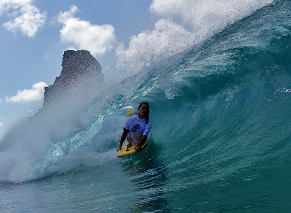
- Cacimba do Padre: popular with surfers for its quality waves.
4.2 Trails and ecotourism
Fernando de Noronha’s trails are regulated and some require reservations:
- Atalaia Trail: leads to a natural pool rich in biodiversity.
- Capim-Açu Trail: longer and more challenging, offering unique views and landscapes.
- Abreus and Pontinha-Caieira Trails: pass through areas of great environmental sensitivity.
4.3 Diving and marine life
The island is one of Brazil’s most important diving destinations, offering
- Scuba diving: at sites such as Pedras Secas and Naufrágio do Porto.
- Snorkelling: In Sueste, Porcos and Sancho bays.
- Dolphin watching: especially in Dolphin Bay.
Projects such as the Tamar Project and the Spinner Dolphin Project work to conserve marine life.
5. Infrastructure and access
5.1 Transportation
Access to the archipelago is by air, with regular flights from Recife and Natal. Internally, tourists use buggies, vans, taxis or footpaths.
5.2 Accommodation and food
Accommodation ranges from cosy inns to sophisticated resorts. The local cuisine favours seafood and regional ingredients, with renowned restaurants such as Zé Maria and Varanda.
6. Environmental legislation and fees
- Environment Conservation Fee (TPA): Compulsory and charged per day of stay.
- National Marine Park Entrance Fee: required to access trails and beaches within the park.
Both fees can be paid in advance through the official websites of the Pernambuco government and ICMBio.