Map of Santa Catarina Island from 1777
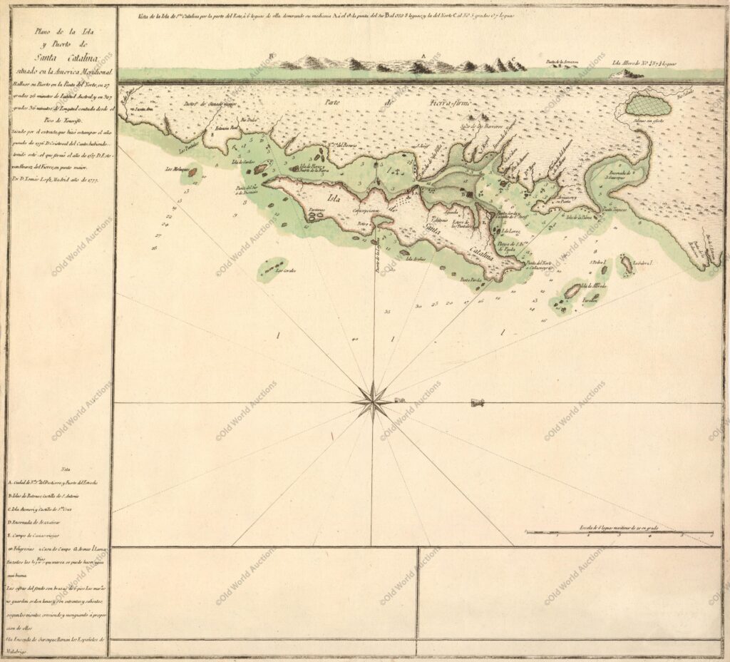
“Plano de la Isla y Puerto de Santa Catalina situado en la America Meridional”, Lopez, D. Tomas
This is a rare Spanish map of Santa Catalina island, now the city of Florianopolis and an important tourist destination. The pristine island is shown here with a few small villages and several protected anchorages.
A coastal approach view is provided at top.
Map of Santa Catarina Island from 1777 – Historical Map
Publicações Relacionadas
Reis Magos Fort Engraving from 1690 - Engravings Stories
1623 Map of the Western Hemisphere - Historical Map
1631 Map of the Western Hemisphere - Historical Map
Map of Brazil from 1750 - Historical Map of Brazil
Map of eastern Brazil 1664 - Historical Map of Brazil
1620 Map of Portugal and Spain - Historical Map
Map of All Saints Bay 1769 - Historical Maps
1587 Map of the Western Hemisphere - Historical Map
Map of the Bay of All Saints and Pernambuco, 1700
1679 Map of Recife - Historical Map
1697 Map of the Western Hemisphere - Historical Map
Engraving of Salvador de Bahia from 1770 - Historical Maps
1714 Map of the Western Hemisphere - Historical Map
Map of South America from 1740
Map of Brazil from 1757
Map of Brazil from 1850
Map of Rio de Janeiro of 1764 - Historical Map
1727 Map of the Western Hemisphere - Historical Map
This post is also on:
![]() Português
Português ![]() English
English ![]() Deutsch
Deutsch ![]() Español
Español ![]() Français
Français


