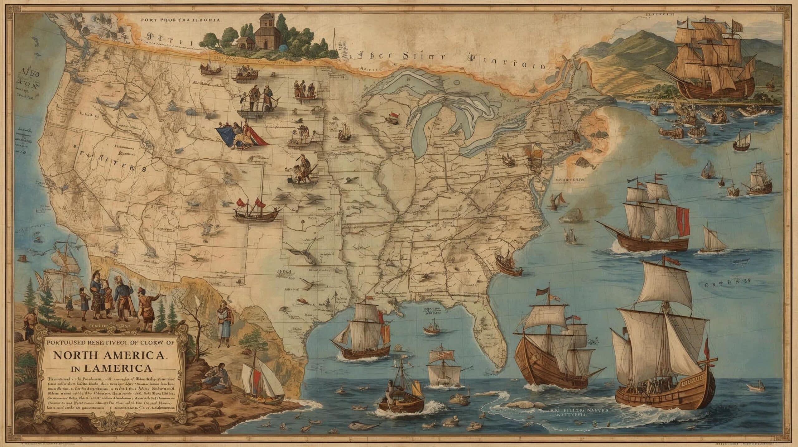
Les Portugais en Amérique du Nord
La présence portugaise en Amérique du Nord remonte aux XVe et XVIe siècles, une période marquée par d’intenses explorations maritimes.
Motivés par la recherche de nouvelles routes commerciales et par le désir d’élargir leurs connaissances géographiques, les navigateurs portugais ont été des pionniers dans plusieurs régions du continent.
Dans ce texte, nous explorons les principales expéditions menées par les Portugais dans la région, en soulignant leurs exploits et leurs contributions significatives à l’histoire de l’exploration maritime.
Portugal's Maritime Expansion - The Portuguese in North America
1. Premières explorations
Les explorations maritimes portugaises ont également atteint l’Amérique du Nord.
En 1474, João Vaz Côrte-Real et Álvaro Martins Homem ont été récompensés pour leurs voyages à Terra do Bacalhau, qui correspond à l’île de Terre-Neuve, probablement accompagnés de navigateurs danois.
Aujourd’hui, l’île de Terre-Neuve est connue sous le nom d’île de Newfoundland, qui fait partie de la province de Terre-Neuve-et-Labrador, au Canada.
2. Voyages avant Christophe Colomb
Au début de l’année 1492, avant Christophe Colomb, l’Açorien João Fernandes, connu sous le nom de Lavrador, et Pedro de Barcelos partirent pour un voyage de trois ans qui les conduisit au Groenland.
3. Chronologie des explorations portugaises
- 1474 : João Vaz Côrte-Real et Álvaro Martins Homem sont récompensés pour leurs voyages à Terra do Bacalhau, l’île de Terre-Neuve, c’est-à-dire l’île de Newfoundland.
- 1492 : João Fernandes et Pedro de Barcelos partent pour un voyage qui les mène au Groenland.
- 1497 : João Caboto mène son expédition au service de l’Angleterre et atteint les côtes de Terre-Neuve.
- 1500 : Gaspar Côrte-Real, autorisé par D. Manuel I, explore la région de Terre-Neuve et du Labrador.
- 1502 : Gaspar Côrte-Real reprend ses explorations, mais ni lui ni son frère Miguel ne reviennent.
- 1520 : João Álvares Fagundes explore les terres du Canada.
- 1525 : Estêvão Gomes visite les côtes du nord-est des États-Unis actuels.
- 1542 : João Rodrigues Cabrilho découvre les côtes de Californie, au service de l’Espagne.
4. Gaspar Côrte-Real et ses explorations
En 1500, autorisé par D. Manuel I, Gaspar Côrte-Real explore la même région, revenant l’année suivante et atteignant ce que nous connaissons aujourd’hui sous le nom de Terre-Neuve.
Les explorations reprennent en 1502, mais ni Gaspar ni son frère Miguel ne reviennent.
5. Autres explorations portugaises
Plus tard, d’autres navigateurs portugais ont également laissé leur empreinte en Amérique du Nord.
João Álvares Fagundes explora les terres du Canada ; Estêvão Gomes visita les côtes du nord-est des États-Unis actuels ; et João Rodrigues Cabrilho, un Portugais au service de l’Espagne, découvrit les côtes de la Californie, dans l’océan Pacifique.
Cette série d’expéditions a non seulement élargi les connaissances géographiques de l’époque, mais a également établi des liens durables entre le Portugal et les terres du Nouveau Monde.


Este post também está disponível em:
![]() Português
Português ![]() English
English ![]() Deutsch
Deutsch ![]() Español
Español ![]() Français
Français