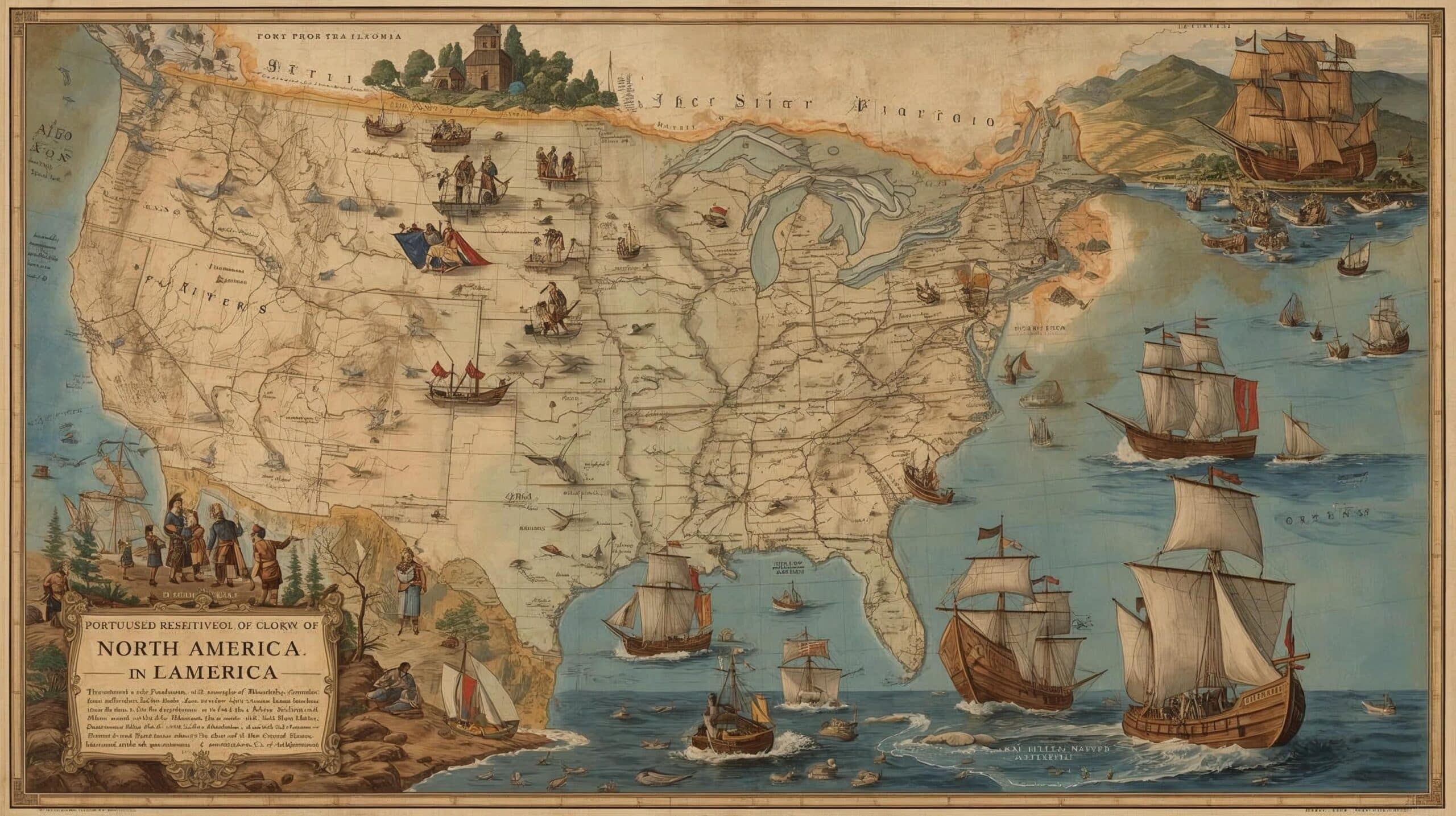
Die Portugiesen in Nordamerika
Die portugiesische Präsenz in Nordamerika reicht bis ins 15. und 16. Jahrhundert zurück, eine Zeit, die von intensiven Seefahrten geprägt war.
Motiviert durch die Suche nach neuen Handelswegen und den Wunsch, geografische Kenntnisse zu erweitern, waren portugiesische Seefahrer Pioniere in verschiedenen Gebieten des Kontinents.
In diesem Text untersuchen wir die wichtigsten Expeditionen der Portugiesen in dieser Region und heben ihre Leistungen und bedeutenden Beiträge zur Geschichte der Seefahrt hervor.
Portugal's Maritime Expansion - The Portuguese in North America
1. Erste Erkundungen
Die portugiesischen Seefahrten erreichten auch Nordamerika.
Im Jahr 1474 wurden João Vaz Côrte-Real und Álvaro Martins Homem für ihre Reisen nach Terra do Bacalhau, das der Insel Neufundland entspricht, belohnt, wahrscheinlich in Begleitung dänischer Seefahrer.
Heute ist die Insel Neufundland als Newfoundland bekannt und gehört zur Provinz Neufundland und Labrador in Kanada.
2. Reisen vor Kolumbus
Anfang 1492, noch vor Christoph Kolumbus, brachen der Azorer João Fernandes, bekannt als Lavrador, und Pedro de Barcelos zu einer dreijährigen Reise auf, die sie nach Grönland führte.
3. Chronologie der portugiesischen Entdeckungsreisen
- 1474: João Vaz Côrte-Real und Álvaro Martins Homem werden für ihre Reisen nach Terra do Bacalhau, der Insel Terra Nova, also der Insel Neufundland, belohnt.
- 1492: João Fernandes und Pedro de Barcelos brechen zu einer Reise auf, die sie nach Grönland führt.
- 1497: João Caboto unternimmt seine Expedition im Auftrag Englands und erreicht die Küste Neufundlands.
- 1500: Gaspar Côrte-Real erkundet mit Genehmigung von König Manuel I. die Region Neufundland und Labrador.
- 1502: Gaspar Côrte-Real nimmt seine Erkundungen wieder auf, aber weder er noch sein Bruder Miguel kehren zurück.
- 1520: João Álvares Fagundes erkundet Gebiete Kanadas.
- 1525: Estêvão Gomes besucht die Nordostküste der heutigen Vereinigten Staaten.
- 1542: João Rodrigues Cabrilho entdeckt im Auftrag Spaniens die Küste Kaliforniens.
4. Gaspar Côrte-Real und seine Erkundungen
Im Jahr 1500 erkundete Gaspar Côrte-Real mit Genehmigung von König Manuel I. dieselbe Region, kehrte im folgenden Jahr zurück und erreichte das Gebiet, das wir heute als Neufundland kennen.
Die Erkundungen wurden 1502 wieder aufgenommen, aber weder Gaspar noch sein Bruder Miguel kehrten zurück.
5. Weitere portugiesische Erkundungen
Später hinterließen auch andere portugiesische Seefahrer ihre Spuren in Nordamerika.
João Álvares Fagundes erkundete Gebiete in Kanada, Estêvão Gomes besuchte die Nordostküste der heutigen Vereinigten Staaten und João Rodrigues Cabrilho, ein Portugiese im Dienste Spaniens, entdeckte die Pazifikküste Kaliforniens.
Diese Reihe von Expeditionen erweiterte nicht nur das geografische Wissen der damaligen Zeit, sondern knüpfte auch dauerhafte Verbindungen zwischen Portugal und den Ländern der Neuen Welt.


Este post também está disponível em:
![]() Português
Português ![]() English
English ![]() Deutsch
Deutsch ![]() Español
Español ![]() Français
Français