Karte des Golfs von Mexiko, der Karibik und der südlichen Vereinigten Staaten von 1682

Veröffentlicht am · Aktualisiert am

Mapa do Golfo do México, Caraíbas e Sul dos Estados Unidos de 1682 - Atlas Minor"Insulae Americanae in Oceano Septentrionali ac Regiones Adiacentes, a C. de May Usque ad Lineam Aequinoctialem", Visscher, Nicolas Este bonito mapa mostra as Índias Ocidentais e abrange a região desde Chesapeake até ao Golfo do México, com a América Central e a parte norte da América do Sul. Duas encantadoras cartelas com querubins e sereias decoram os cantos opostos. Oito navios navegam pelos mares e três canoas nativas são representadas na costa da América do Norte. O mapa apresenta uma série de mitos cartográficos interessantes. Estes incluem dois grandes lagos inexistentes na região da Geórgia ocidental e uma cadeia de montanhas inexistente que se estende dos Piemontes ao longo do continente norte-americano. Na América do Sul, o arquétipo do mito cartográfico, Manoa o' El Dorado (a cidade dourada), está localizado nas margens do Lacus Parime vel Roponowini, na Guiana. Este é o segundo estado com a adição do privilégio na cartela.
Karte des Golfs von Mexiko, der Karibik und der südlichen Vereinigten Staaten von 1682 – Atlas Minor „Insulae Americanae in Oceano Septentrionali ac Regiones Adiacentes, a C. de May Usque ad Lineam Aequinoctialem“, Visscher, Nicolas Diese schöne Karte zeigt die Westindischen Inseln und umfasst das Gebiet vom Chesapeake bis zum Golf von Mexiko, mit Mittelamerika und dem nördlichen Teil Südamerikas. Zwei bezaubernde Karten mit Cherubinen und Meerjungfrauen schmücken die gegenüberliegenden Ecken. Acht Schiffe befahren die Meere und drei Eingeborenenkanus sind an der Küste Nordamerikas dargestellt. Die Karte enthält eine Reihe interessanter kartographischer Mythen. Dazu gehören zwei nicht existierende große Seen in der Region Westgeorgien und eine nicht existierende Gebirgskette, die sich von den Pazifischen Bergen quer über den nordamerikanischen Kontinent erstreckt. In Südamerika liegt der Archetyp des kartographischen Mythos, Manoa o‘ El Dorado (die goldene Stadt), am Ufer des Lacus Parime vel Roponowini in Guyana. Dies ist der zweite Staat, in dem das Privileg auf der Kartusche vermerkt ist.

Karte des Golfs von Mexiko, der Karibik und der südlichen Vereinigten Staaten von 1682 – Atlas Minor

„Insulae Americanae in Oceano Septentrionali ac Regiones Adiacentes, a C. de May Usque ad Lineam Aequinoctialem“, Visscher, Nicolas

Diese schöne Karte zeigt die Westindischen Inseln und umfasst das Gebiet vom Chesapeake bis zum Golf von Mexiko, mit Mittelamerika und dem nördlichen Teil Südamerikas.

Zwei charmante Karten mit Putten und Meerjungfrauen zieren die gegenüberliegenden Ecken.

Acht Schiffe befahren die Meere und drei Eingeborenenkanus sind an der Küste Nordamerikas dargestellt.

Die Karte enthält eine Reihe interessanter kartographischer Mythen. Dazu gehören zwei nicht existierende große Seen in der Region Westgeorgien und eine nicht existierende Gebirgskette, die sich von den Pazifischen Bergen quer über den nordamerikanischen Kontinent erstreckt.

In Südamerika liegt der Archetyp des kartographischen Mythos, Manoa o‘ El Dorado (die goldene Stadt), an den Ufern des Lacus Parime vel Roponowini in Guyana. Guyana ist der zweite Staat, der dieses Privileg in seine Kartusche aufgenommen hat.

Willy Sievert

Geschrieben von Willy Sievert

Redakteur von Bahia.ws seit der Gründung im Jahr 2009. Wohnhaft in Salvador, reist er häufig durch den Nordosten und ganz Brasilien, um die Reiseführer aktuell zu halten. Mehr über Willy Sievert erfahren →

Publicações Relacionadas

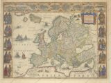
Map of Europe from 1644 (circa) This classic map of Europe is presented in the carte-de-figures style with vignettes on three sides. The upper frieze has nine bird's-eye views of Amsterdam, Prague, Constantinople, Venice, Rome, Paris, London, Toledo and Lisbon. The side borders contain the costumes of the noblemen and women of ten European nations. The map is embellished with sailing ships, sea monsters, bears and Neptune riding a dolphin and holding his trident. A beautiful map produced at the height of the Golden Age of Dutch mapmaking; it was included in the first volume of Blaeu's magnificent atlas. Latin text on verso, published between 1644-55. Publication: Theatrum Orbis Terrarum - Blaeu's Carte-a-Figures Map of Europe - "Europa Recens Descripta", Blaeu, Willem

Karte von Europa aus dem Jahr 1644: Geschichte erforschen
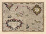
Map of the Azores from 1584 - Map of the Azores based on the cartography of Luis Teixeira. The islands are shown in good detail and the map is richly embellished with three large ornate cartouches, a title banner, sailing ships and a sea monster. "Acores Insulae", Ortelius, Abraham. Publication: Theatrum Orbis

Karte der Azoren aus dem Jahr 1584

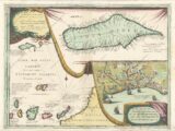
Map of Madeira and the Canary Islands, c. 1692 - Map details the Canary Island group on the left side of the map. The map is filled with rhumblines, fleur-de-lis and many notations and includes a portion of the African coastline. With two large inset charts filling the right half resting on a tasseled drapery background. The upper inset is a detailed chart of the island of Madeira, a volcanic archipelago in the North Atlantic north of the Canary Islands. The town of Madera (Fanchal) is shown below in a birds eye view that includes several ships in the harbor with the fortified town at the shore. The map is very decorative and beautifully engraved in Coronelli's characteristic style. Dedicated to Alvise da Mosto, "Procr di S. M. Sauio Grande." Blank verso. Vincenzo Coronelli was a Franciscan priest and renowned mathematician and cartographer. He was appointed official Cosmographer to the Venetian Republic in 1685 and founded the world's earliest geographic society, L'Accademia Cosmografica degli Argonauti. "Isole Canarie Possedutte da S.M. Cattolica...", Coronelli, Vincenzo Maria. - Publication: Atlante Veneto

Karte von Madeira und den Kanarischen Inseln aus dem Jahr 1692
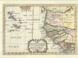
Map of West Africa and the Cape Verde Islands, 1699 - Map of the important Cape Verde Islands and the opposite African coast from Cap Blanc to Sierra Leone. There is a lot of detail along the African coastline, with numerous cities, capes, rivers, and more identified. A fancy decorative title cartouche adorns the bottom of the map. Sanson's small maps from his L'Afrique en Plusieurs Cartes..., first published in 1656 and engraved by A. Peyrounin, were copied several times by various map publishers. Johann David Zunners made copies of Sanson's maps for his German translation of Die Gantze Erd-Kugel in 1679. Johannes Ribbius and Simon de Vries published copies in 1682 and 1683, with new maps engraved by Antoine d'Winter. The plates were later sold to Francois Halma, who used them in 1699 and then again in 1705 with the titles re-engraved in Dutch. The titles on the d'Winter plates were re-engraved back into French, and then used by Nicholas Chemereau in 1715 and by Henri du Sauzet in 1738. "Isles du Cap Verd Coste, et Pays des Negres aux Environs du Cap Verd...", Sanson, Nicolas

Mapa da África Ocidental e das Ilhas de Cabo Verde de 1699
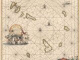
Map of the Cape Verde Islands, 1697 - A large copper engraved sea chart of the Cape Verde Islands. A beautiful decorative title cartouche with a sea shell surrounds the title that rests above a scene of Poseidon, mermaids and horses. The chart is further adorned with two sailing ships and a distance scale at bottom right featuring sea-boys and fish. Publication: De Nieuwe Groote Lichtende Zee-Fakkel "Nieuwe Paskaart van de Zoute Eylanden...", Keulen, Johannes van

Karte der Kapverdischen Inseln von 1697
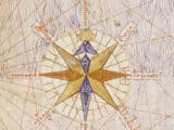
Atlas Catalão, a primeira rosa dos ventos representada em um mapa

Der katalanische Atlas: Neuzeichnung der mittelalterlichen Welt und Asiens
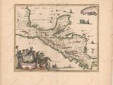
1671 Karte von Mexiko und Mittelamerika - Historische Karte
1671 Karte von Mexiko und Mittelamerika - Historische Karte

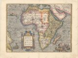
Historische Karte Afrikas von 1570
Historische Karte Afrikas von 1570

Karte von Brasilien von 1730 - Historische Karte
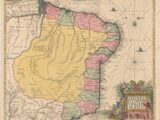
Karte von Brasilien von 1730 - Historische Karte

1620 Karte von Portugal und Spanien - Historische Karte
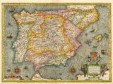
1620 Karte von Portugal und Spanien - Historische Karte

Karte von Südamerika von 1601 - Historische Karte
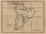
Karte von Südamerika von 1601 - Historische Karte

1584 Weltkarte - Historische Karte
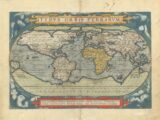
1584 Weltkarte - Historische Karte

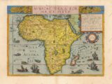
Karte von Afrika von 1593 - Historische Karte
Karte von Afrika von 1593 - Historische Karte

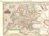
1575 Karte Europas - Historische Karte
1575 Karte Europas - Historische Karte

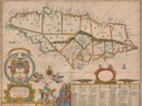
1671 Karte von Jamaika - Historische Karte
1671 Karte von Jamaika - Historische Karte

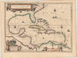
1638 Karte des Golfs von Mexiko und der Karibik - Historische Karte
1638 Karte des Golfs von Mexiko und der Karibik - Historische Karte

Karte von Panama von 1699 - Historische Karte
Karte von Panama von 1699 - Historische Karte

Karte Brasiliens von 1606 - Historische Karte
Karte Brasiliens von 1606 - Historische Karte

Karte des Golfs von Mexiko und der Karibik von 1681
Karte des Golfs von Mexiko und der Karibik von 1681

Karte von Südamerika und der Karibik von 1596 - Historische Karte
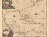
Karte von Südamerika und der Karibik von 1596 - Historische Karte

Karte des Golfs von Mexiko und der Karibik von 1675 - Historische Karte
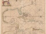
Karte des Golfs von Mexiko und der Karibik von 1675 - Historische Karte

1666 Karte des Golfs von Mexiko und der Karibik - Historische Karte
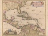
1666 Karte des Golfs von Mexiko und der Karibik - Historische Karte

Karte des Golfs von Mexiko und der Karibik von 1650-80
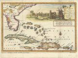
Karte des Golfs von Mexiko und der Karibik von 1650-80

Südost-Kolonialkarte der Vereinigten Staaten, der Bahamas und der Großen Antillen von 1706
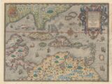
Südost-Kolonialkarte der Vereinigten Staaten, der Bahamas und der Großen Antillen von 1706

Karte des Golfs von Mexiko und der Karibik von 1594
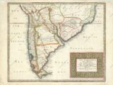
Karte des Golfs von Mexiko und der Karibik von 1594

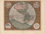
Karte des südlichen Amerikas von 1656 - Historische Karte
Karte des südlichen Amerikas von 1656 - Historische Karte

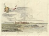
Gemälde der Festung der Heiligen Drei Könige in Natal aus dem Jahr 1647
Gemälde der Festung der Heiligen Drei Könige in Natal aus dem Jahr 1647

1607 Karte der westlichen Hemisphäre - Historische Karte
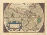
1607 Karte der westlichen Hemisphäre - Historische Karte

1579 Karte der westlichen Hemisphäre - Amerika - Historische Karte
1579 Karte der westlichen Hemisphäre - Amerika - Historische Karte

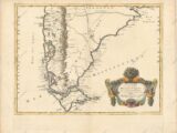
Karte des südlichen Amerikas von 1668 - Historische Karte
Karte des südlichen Amerikas von 1668 - Historische Karte

Karte von Rio de Janeiro von 1794 - Historische Karte
Karte von Rio de Janeiro von 1794 - Historische Karte

Karte von Brasilien von 1698 - Historische Karte
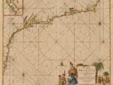
Karte von Brasilien von 1698 - Historische Karte

Karte von Rio de Janeiro von 1682 - Historische Karte
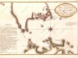
Karte von Rio de Janeiro von 1682 - Historische Karte

Karte von Rio de Janeiro von 1810 - Historische Karte
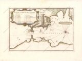
Karte von Rio de Janeiro von 1810 - Historische Karte

Karte von Rio de Janeiro von 1764 - Historische Karte
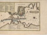
Karte von Rio de Janeiro von 1764 - Historische Karte

Karte von Rio de Janeiro von 1750 - Historische Karte

Karte von Rio de Janeiro von 1750 - Historische Karte